Day 167, Mile 2660.1 – Oh Canada!!!

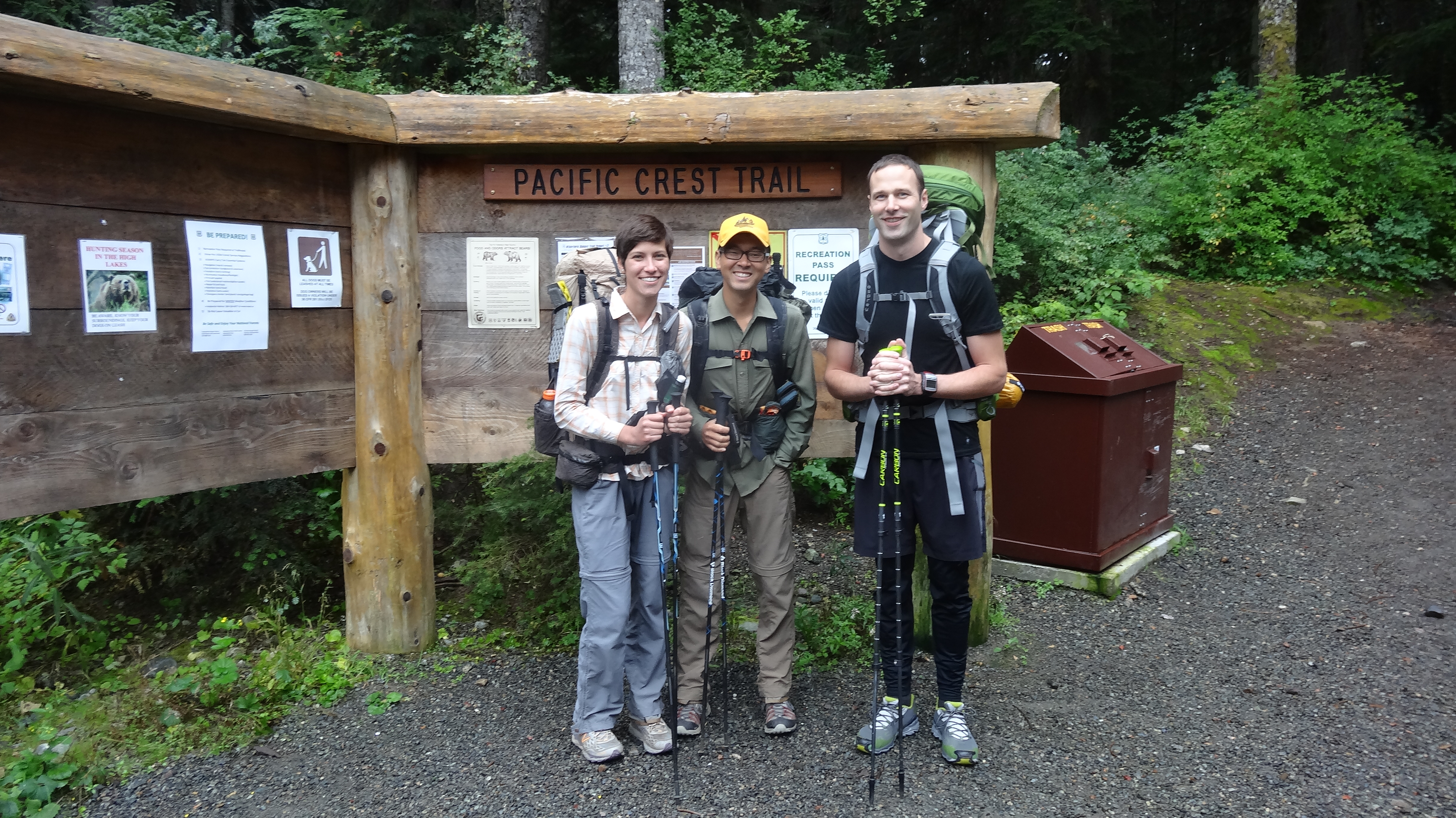
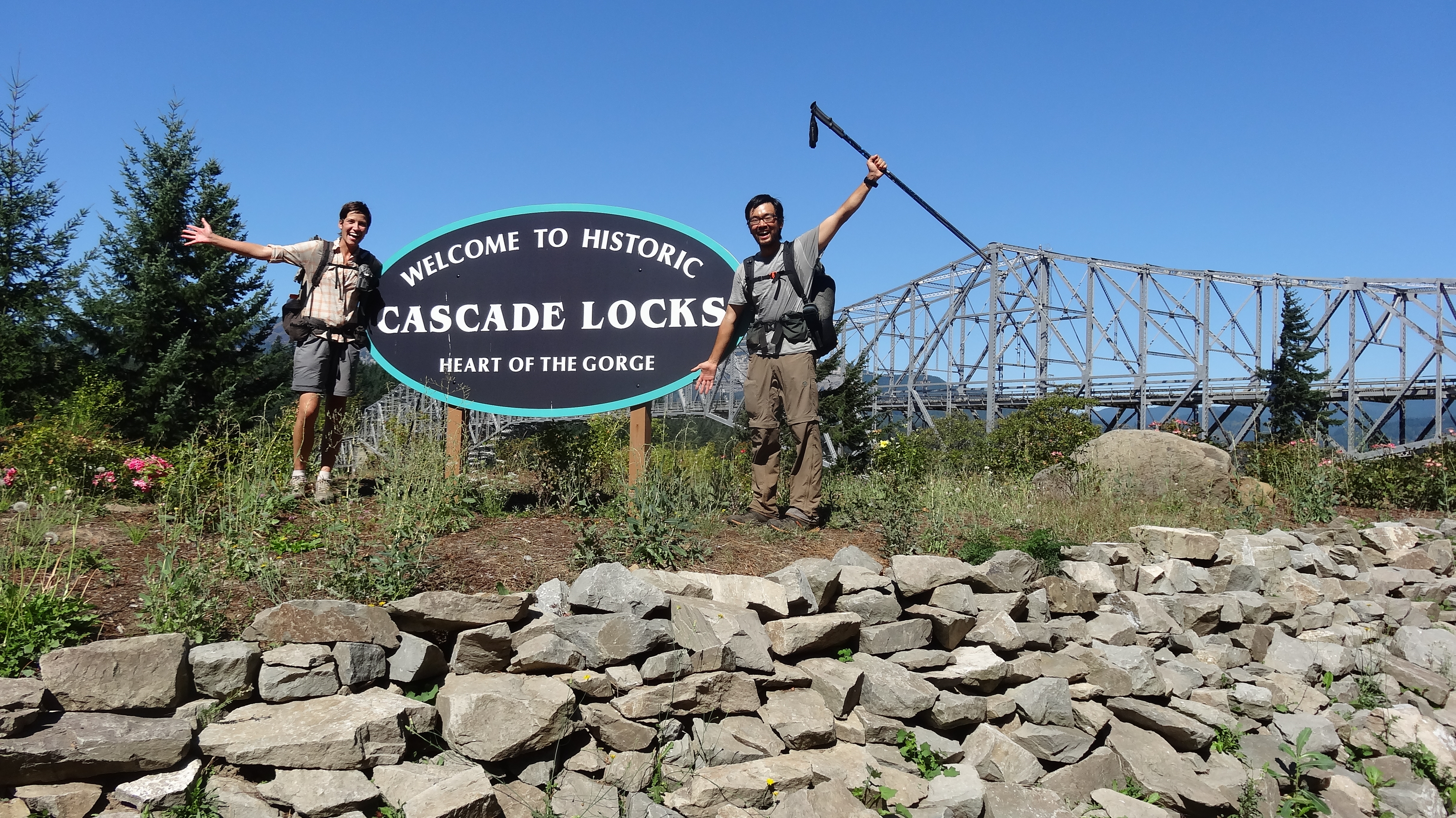
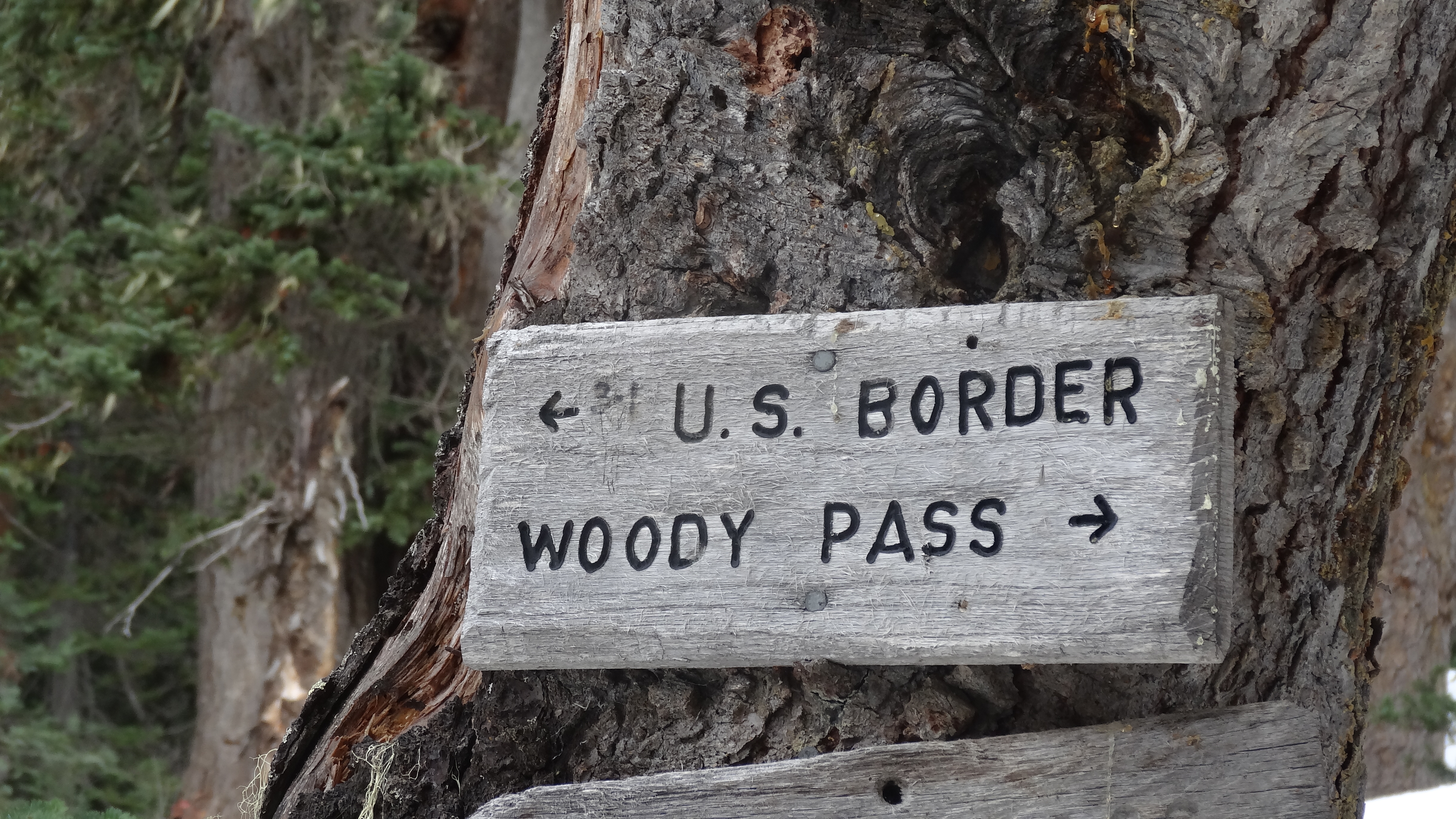
First of all: WE MADE IT!!!!! We made it to Canada. But getting there was truly an adventure – and an emotional roller coaster, to say the least. Just 4 days before we made it to the border, we were in a bar with tears in our eyes, coming to terms with the fact that our hike was most likely over. So let me fill in the gaps, and spare no detail.

We finally left Stevens Pass after taking 3 zeros to allow the worst of the rain/snow storm to pass. We were dropped off by Ashe’s brother, where we found Japanese hiker Goku sitting by the trailhead. He doesn’t speak much English but managed to explain that after hiking 30 miles out from Stevens Pass, he had turned back. He just kept repeating the phrase “many snow” over and over again… and with that as our only update on trail conditions, we headed out. We soon learned that many hikers had been forced to zero in their tents during the storm, and that there was a lot of snow on the passes. Over the next day and a half, we passed 7 thru hikers who had turned around and were heading the other way, all of whom had weathered the storm on trail and said they didn’t feel safe continuing on. Not the best way to start our section.

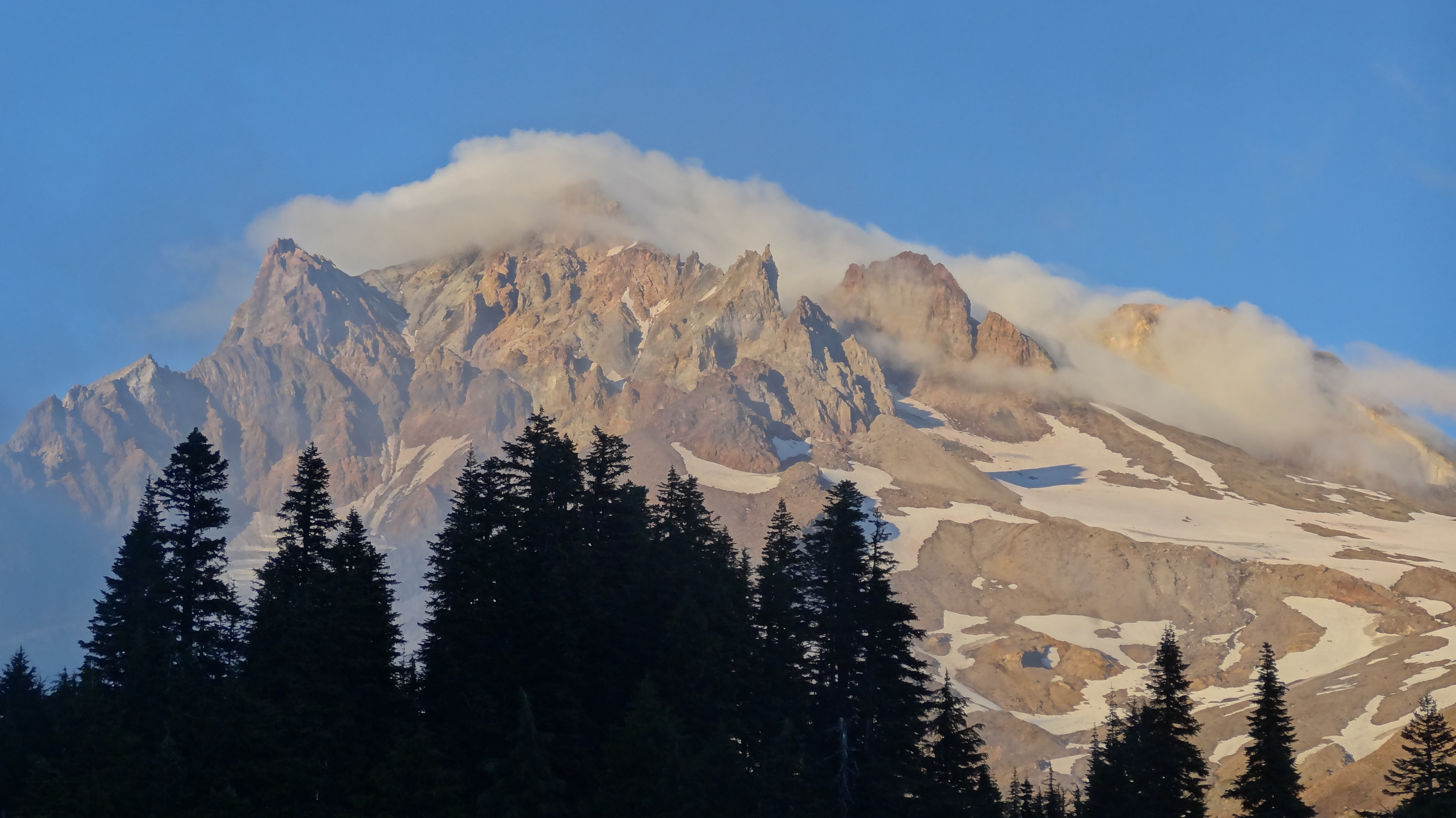
On the second day out, we met back up with long-time hiking buddy Shedder, who caught up to us from Stevens. We hiked on over rolling alpine meadows, with a few breaks here and there in the drizzling rain. The first snow we encountered was on Red Pass, where many of the hikers had turned back or hunkered down in their tents. Fortunately, by the time we went over the pass, there had been at least 20 hikers in front of us, packing down the snow and blazing the trail. It was slick at some points, and I sure wouldn’t want to cross it in blizzard-like conditions, but we went right over it with little trouble.

After Red Pass, the trail became very overgrown and was covered in large blowdowns (fallen trees). We made our way through the foliage and over, under, and around all the trees, but it was slow going. It added an extra layer of challenge to a section that was already extremely difficult due to the cold, constant drizzle and a severe elevation profile. We were trying to cover big miles and push into Stehekin by midday on day 5. So on the third day, we hiked 25 miles, covering 8000 feet of elevation gain and 8500 of elevation loss, including an hour in the dark, during which we overshot our campsite by half a mile and had to backtrack (making for a grand total of 26 miles). It rained and snowed on us lightly that day. My legs were burning.

On our last night and day into Stehekin, it began to rain harder. And for the last 10 miles in particular, it poured. By this point, we were physically and mentally exhausted, all our gear was wet from rain and/or condensation, our clothes were wet, and our feet were constantly freezing. I would have thoughts like, “I wonder how long it takes to get Trench Foot.” But at long last, we made it to Stehekin.

Stehekin is a small, small town in North Cascades National Park, located on the north end of Lake Chelan. There are no roads connecting it to the outside world; it can only be reached by boat, float plane, or by foot. The Park Service operates a shuttle that takes people from the trailhead to various places around the town, including an amazing bakery and the lodge where we were staying. After standing in the pouring rain for 30 minutes waiting for the shuttle to arrive, we joyfully got on the bus (our first shelter from the rain in 5 days), stocked up on baked goods at the bakery, and then arrived at the lodge, where we immediately checked into our room, took hot, hot showers, and spread out all our gear to dry.

There were a number of other hikers at the lodge in Stehekin, and they told us that lots of people were calling it quits and getting on the boat to Chelan. “Winter is here,” they said. “It’s over.” The storm had dropped tons of snow on the trail north of us. And there was another system moving in the next day, which was expected to drop a lot more snow – and at lower elevations. We were too physically and mentally exhausted to deal with this news at the moment, so we decided to zero in Stehekin and take some time to think about our next move. We caught the Washington/Arizona football game on TV in the common room, drank a beer, and slept deeply. The next day (after watching an amazing Seahawks game vs. the Texans), we made a plan. We would hike the 19 miles to the aptly-named Rainy Pass, which we knew would be mostly snow free due to its elevation. From there, we would hitch down Highway 20 into the town of Winthrop, where we knew that at least a dozen hikers were holed up and trying to figure out their next move.
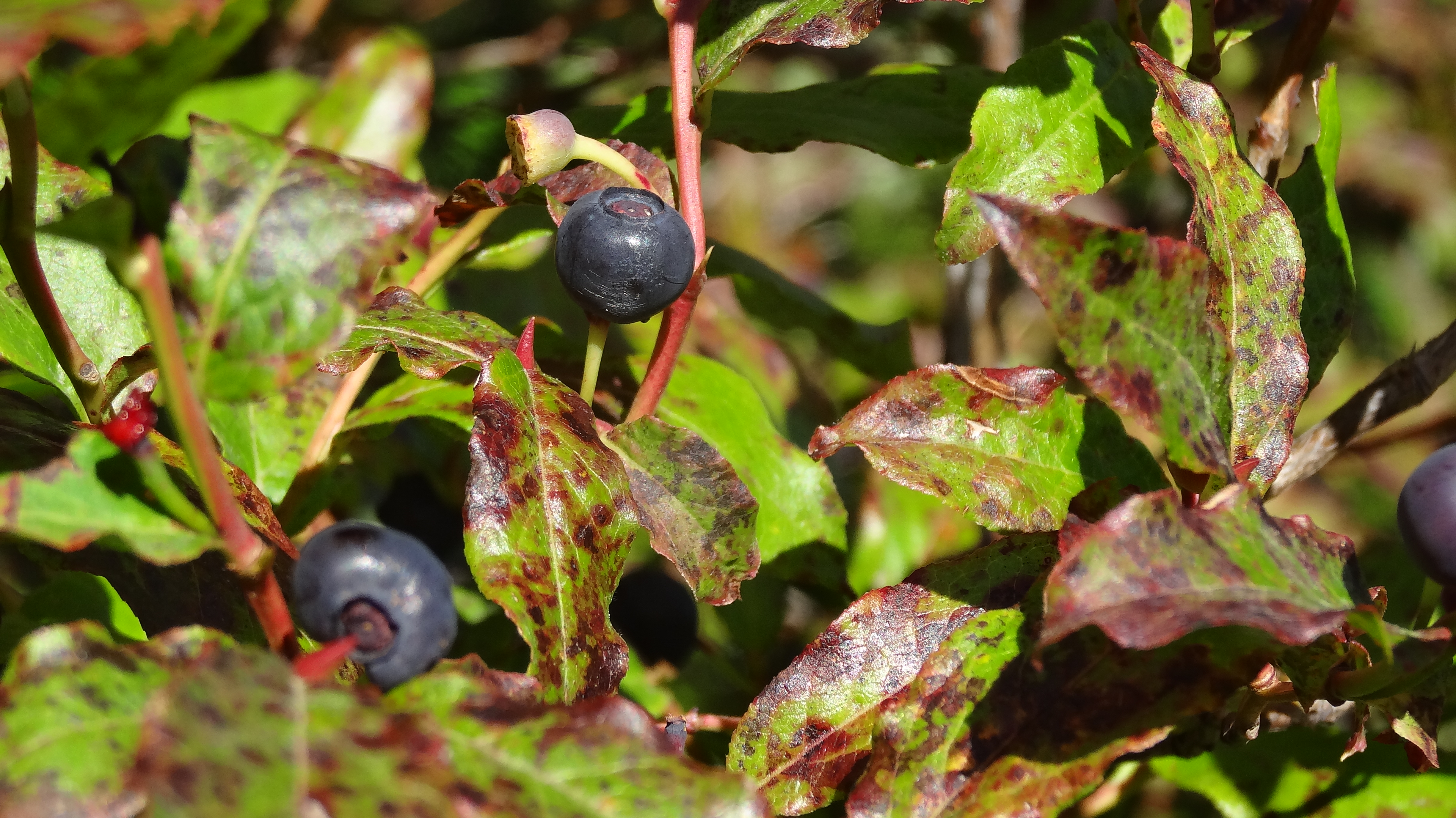
DSC03275

Wild blueberries

DSC03285

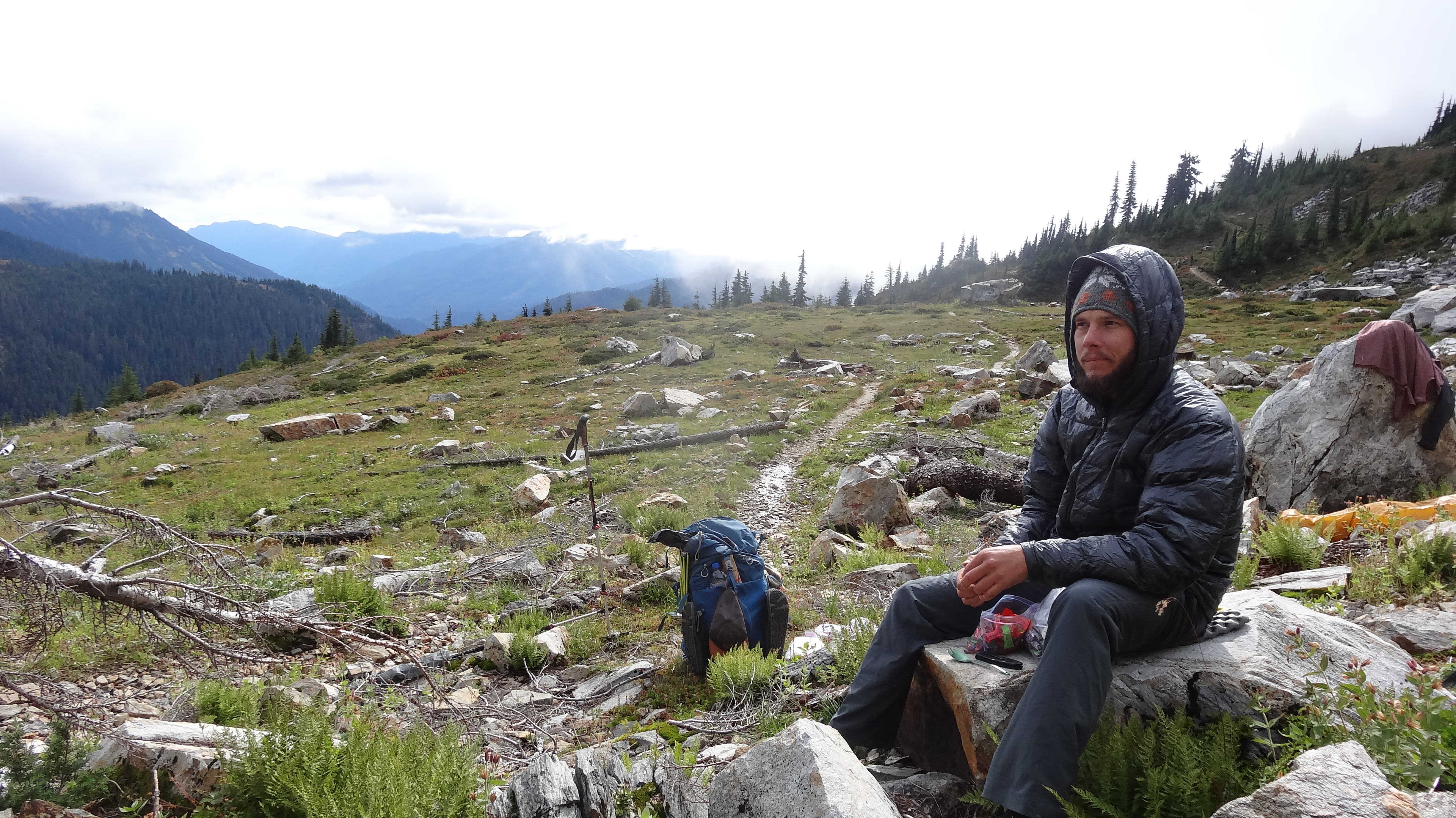
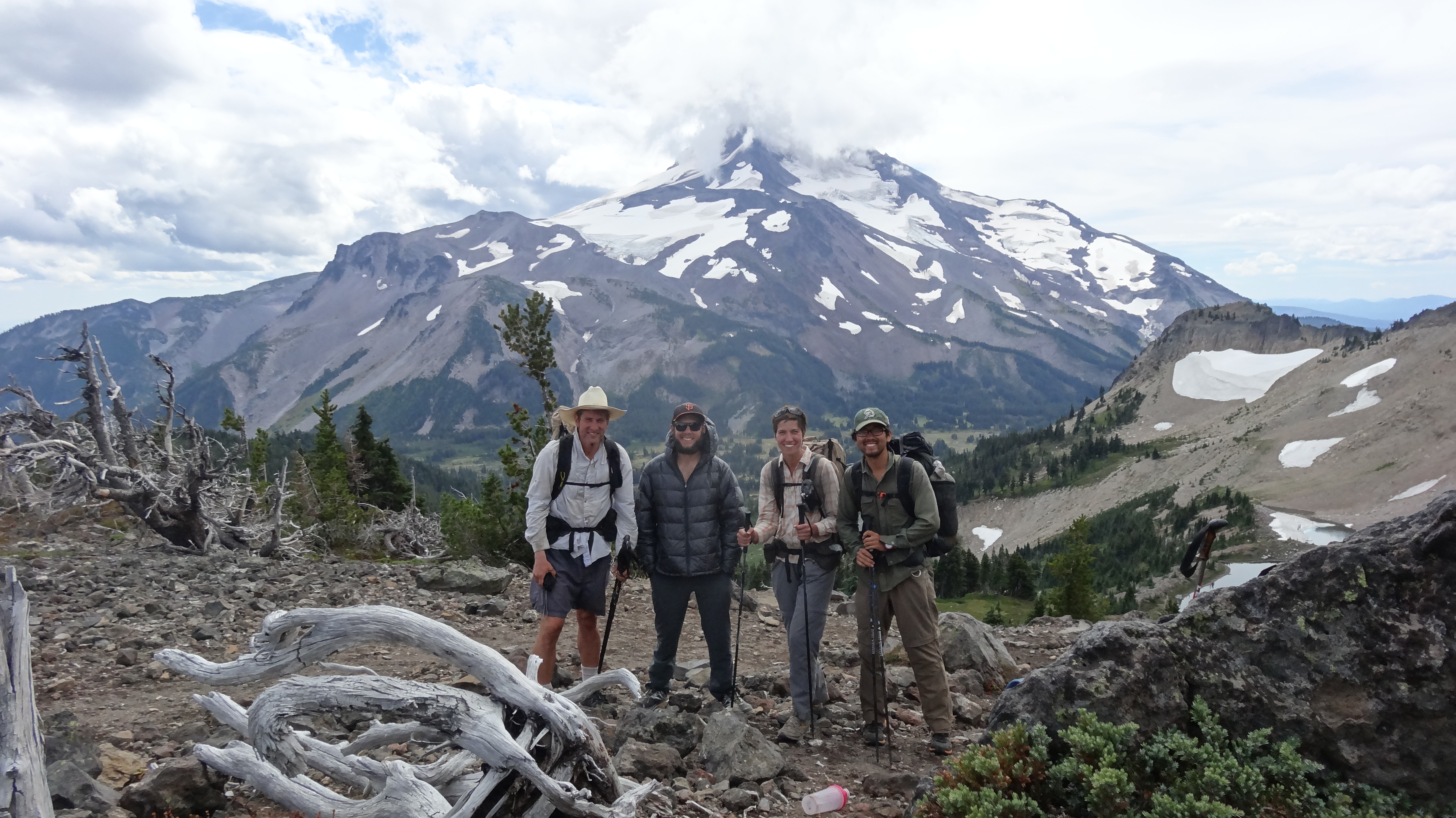
Lunch with Shedder during a break in the weather

DSC03286

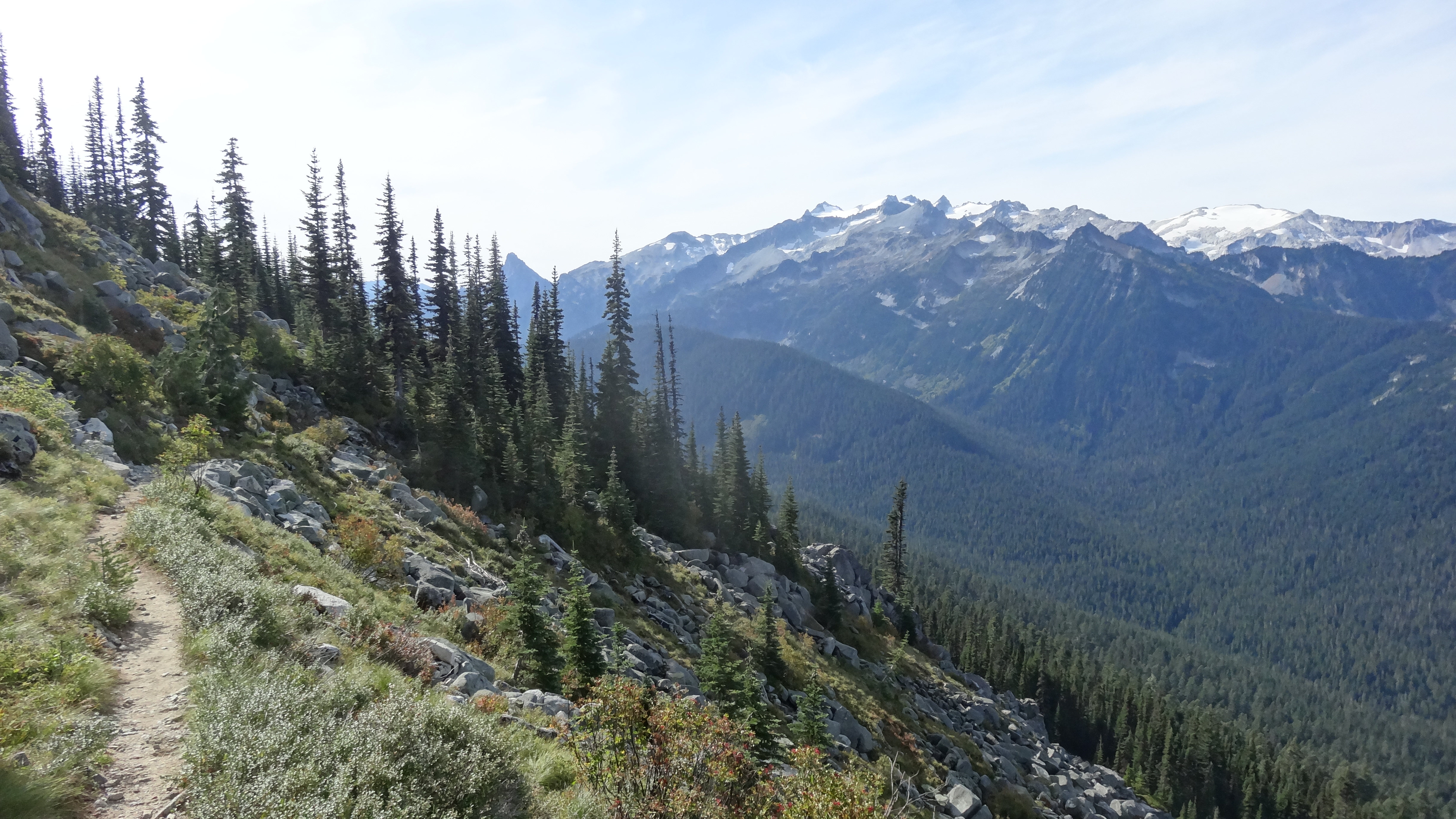
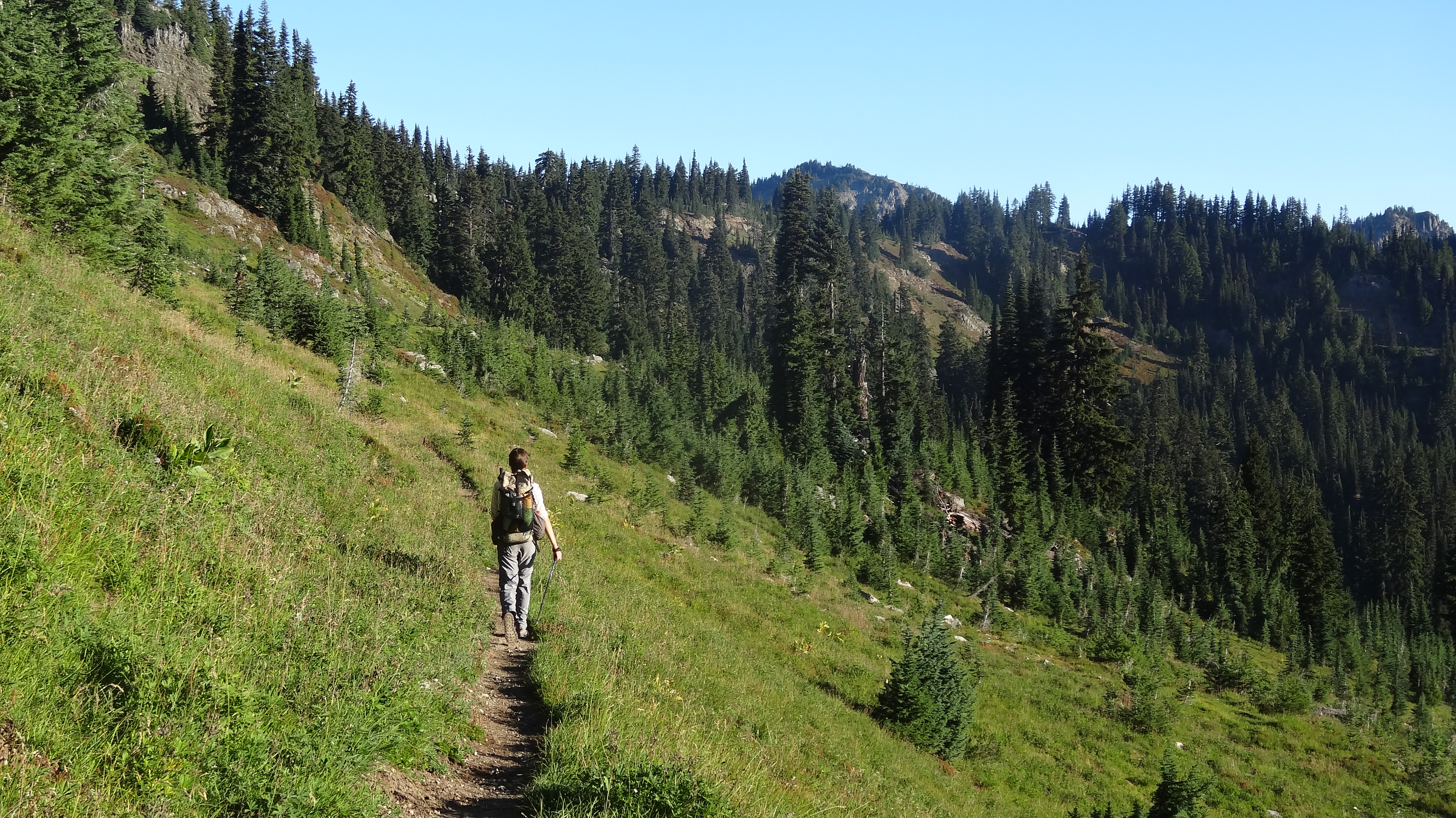
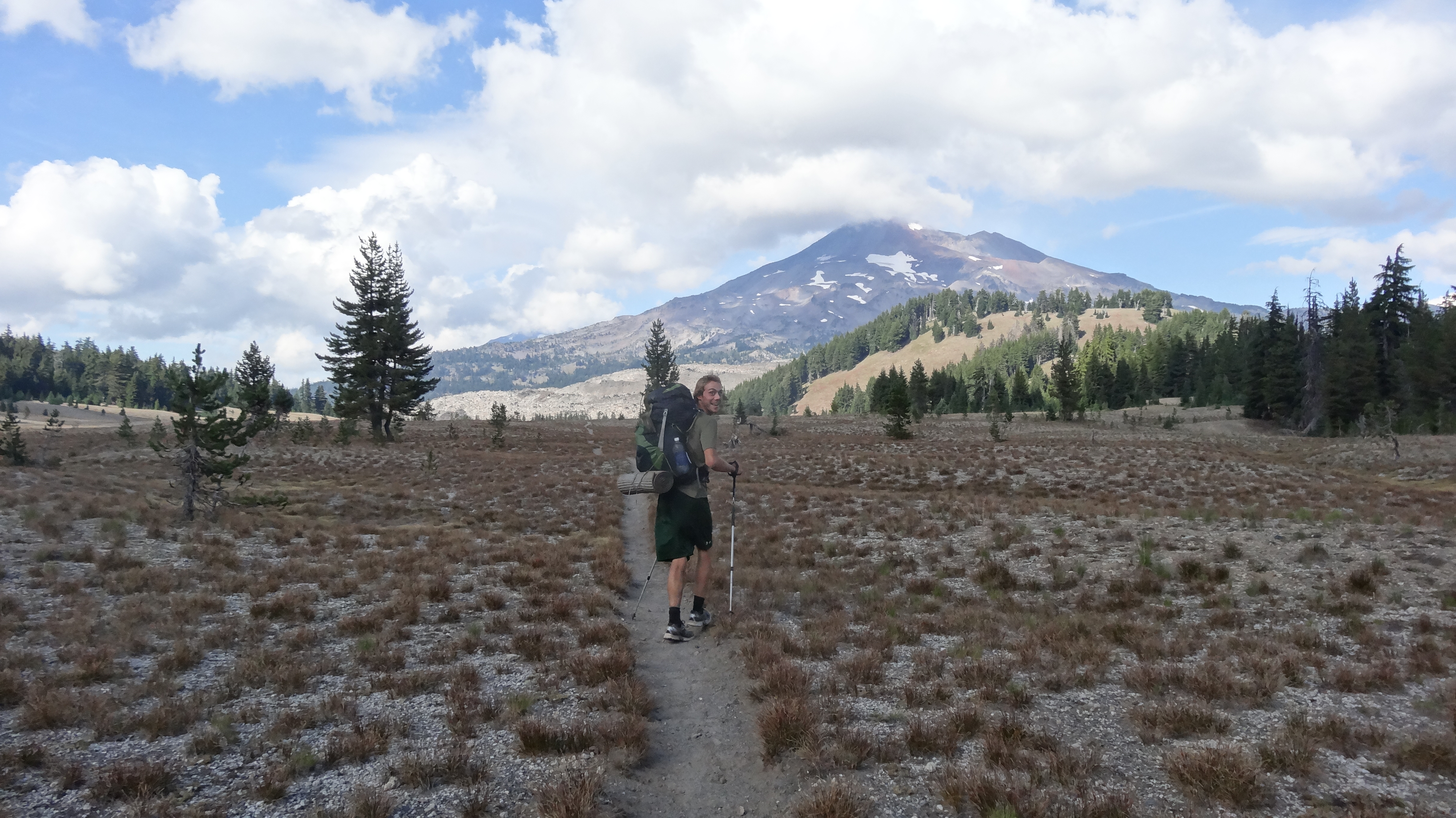
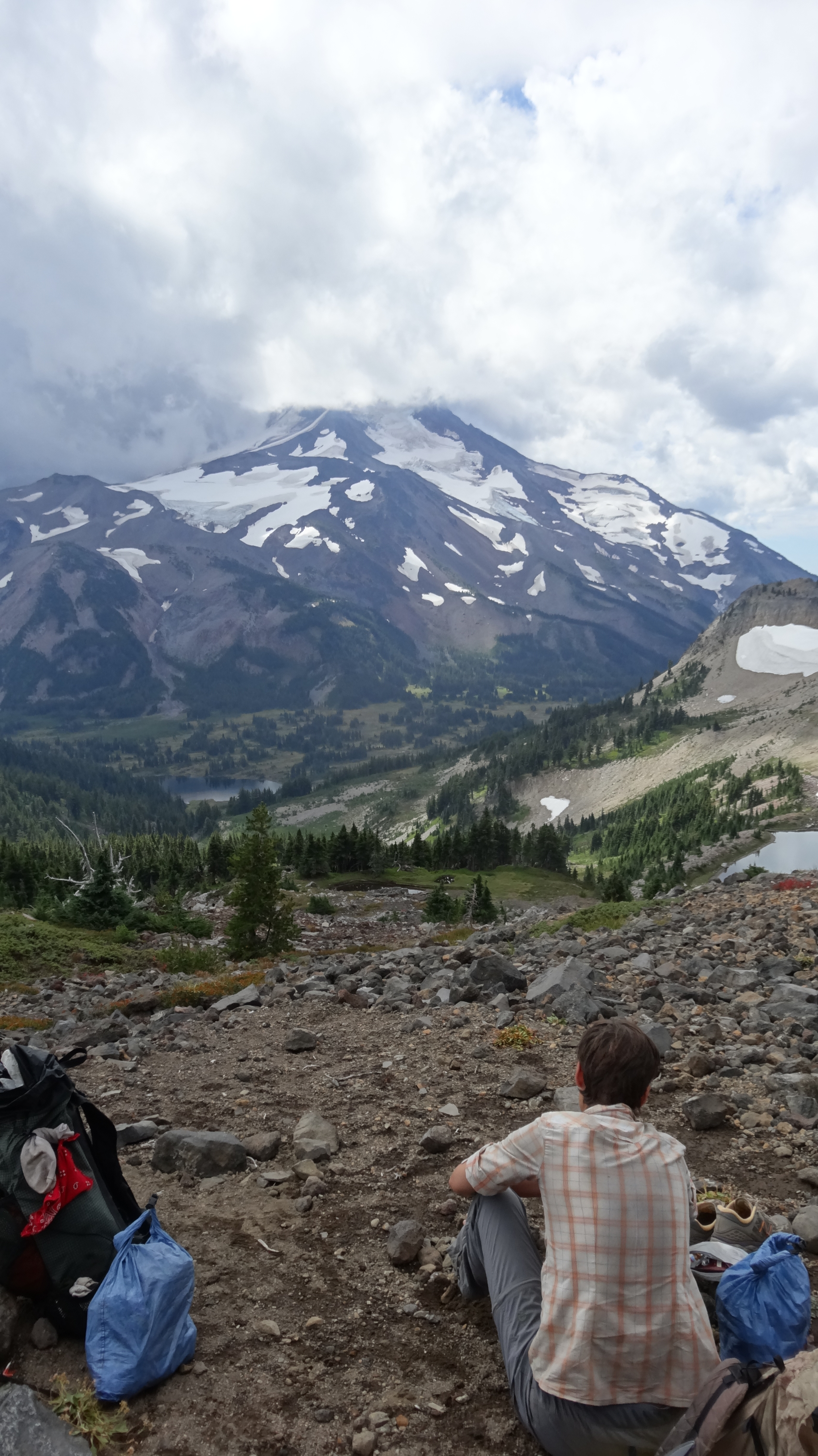
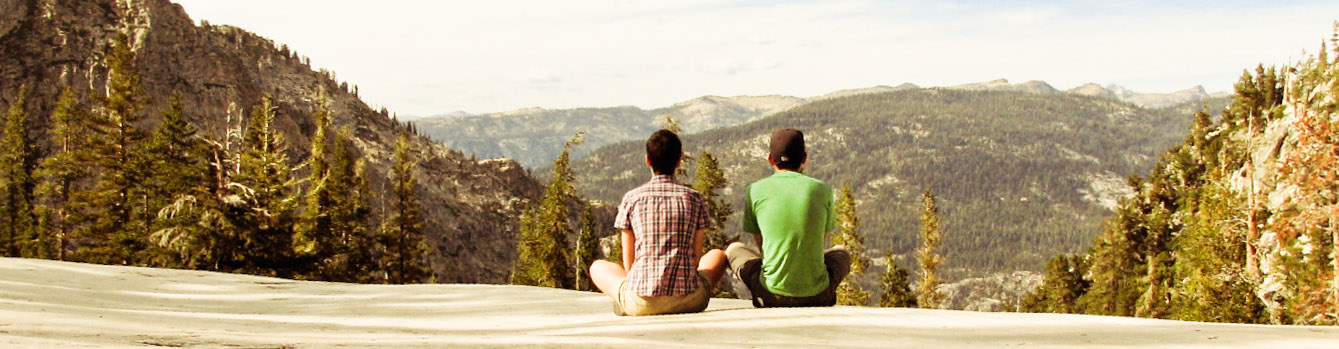
Hiking along alpine meadows

DSC03300

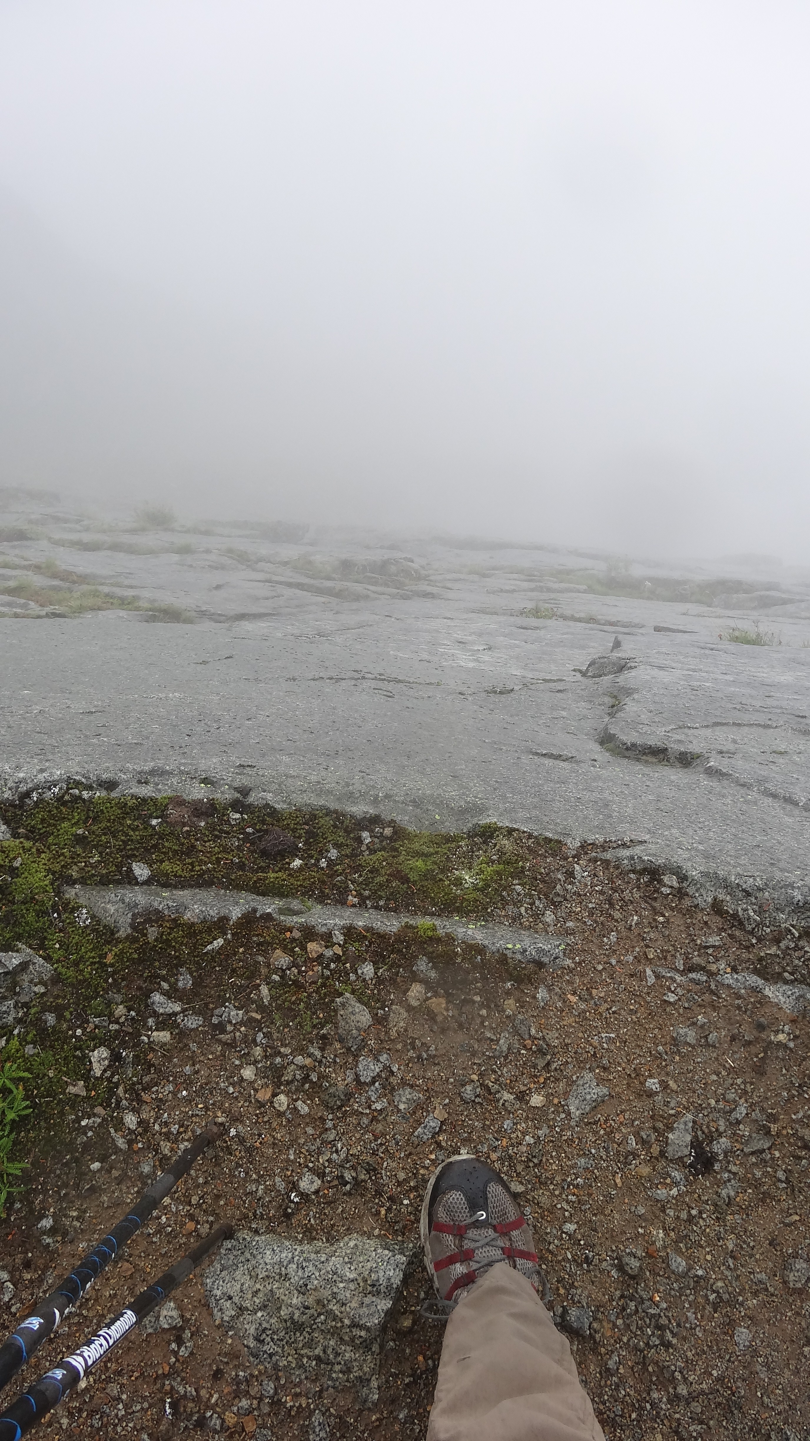
Grey clouds preparing to rain on our parade

DSC03308

This little guy was on top of Red Pass.

DSC03309

This little guy was also on top of Red Pass.

DSC03315

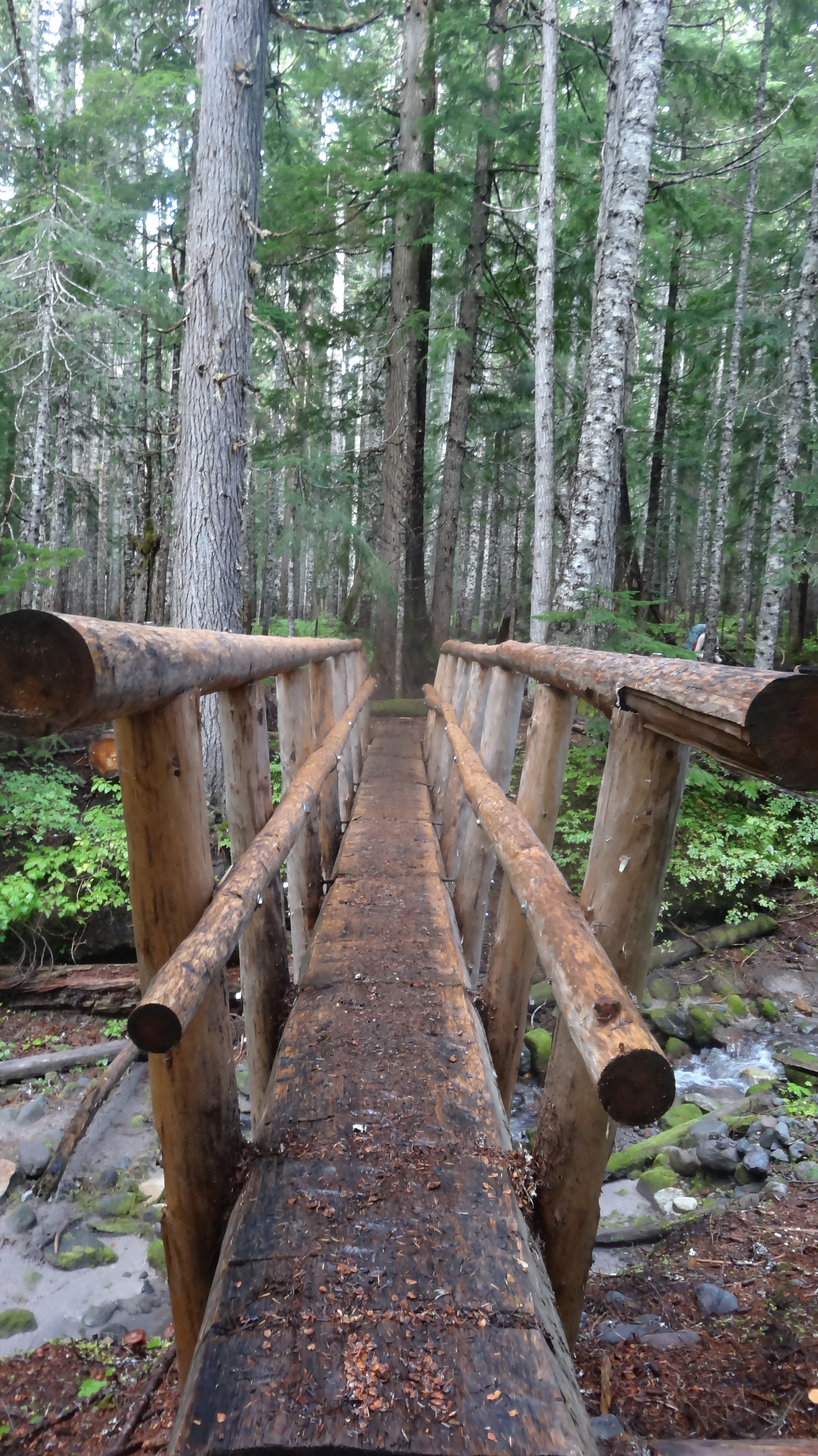
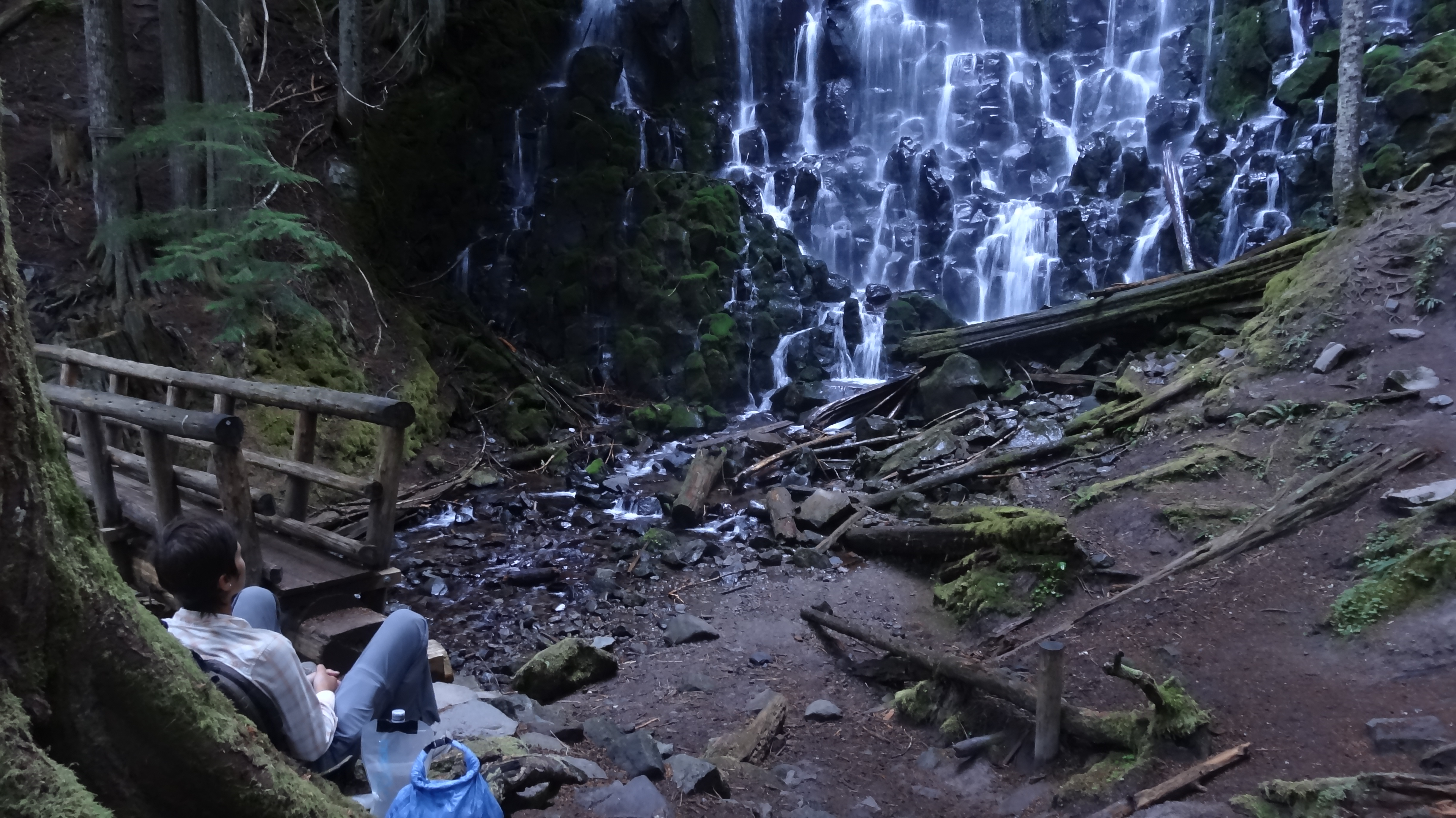
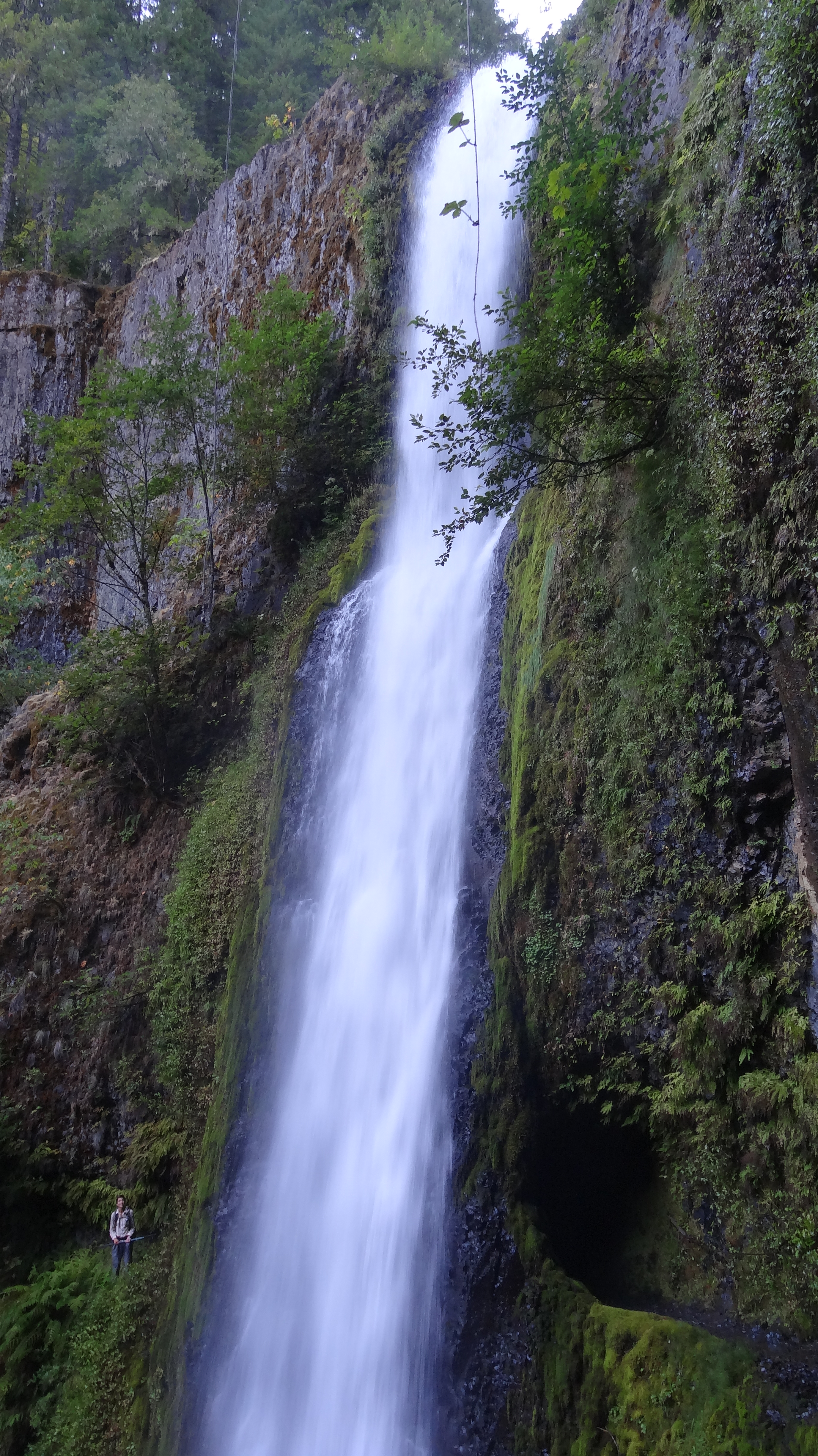
One of the few bridges in this section that wasn’t collapsed or washed away

DSC03336

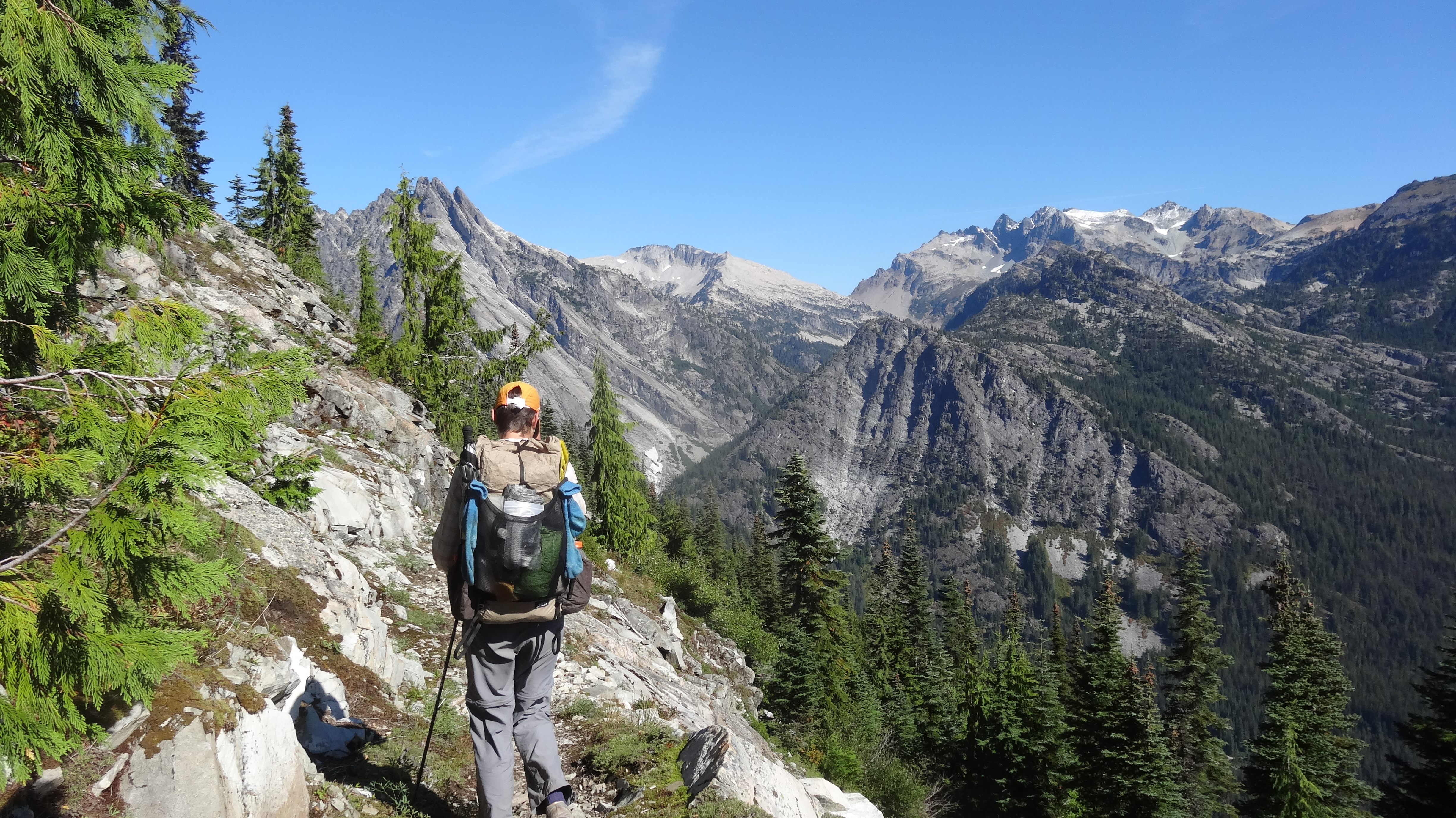
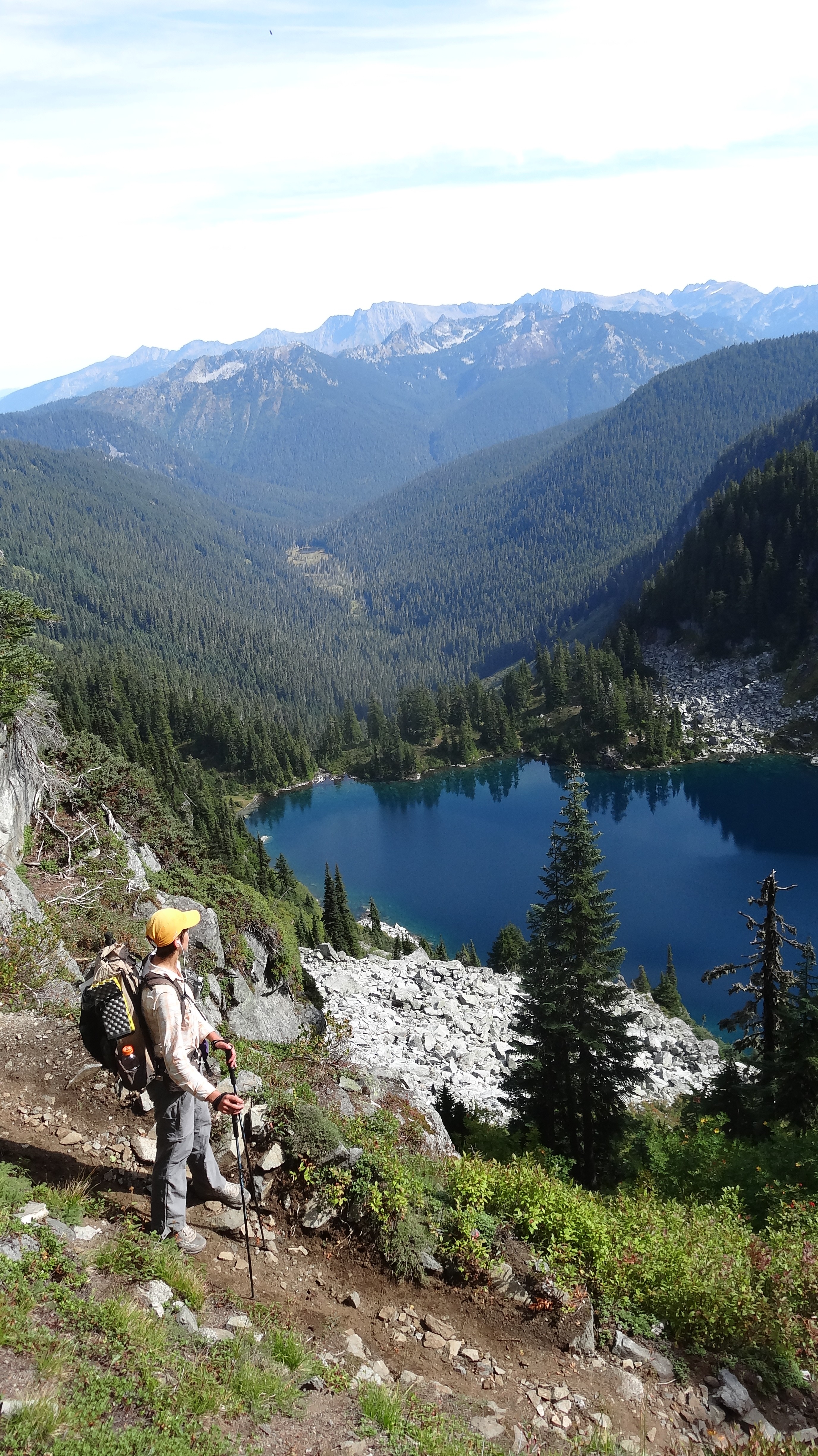
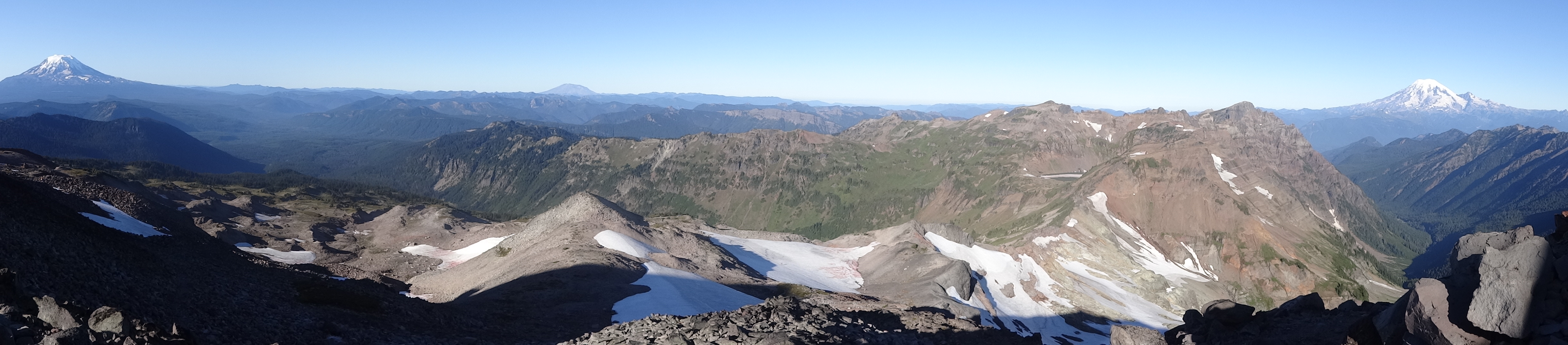
The view from the top of one of our climbs

DSC03348

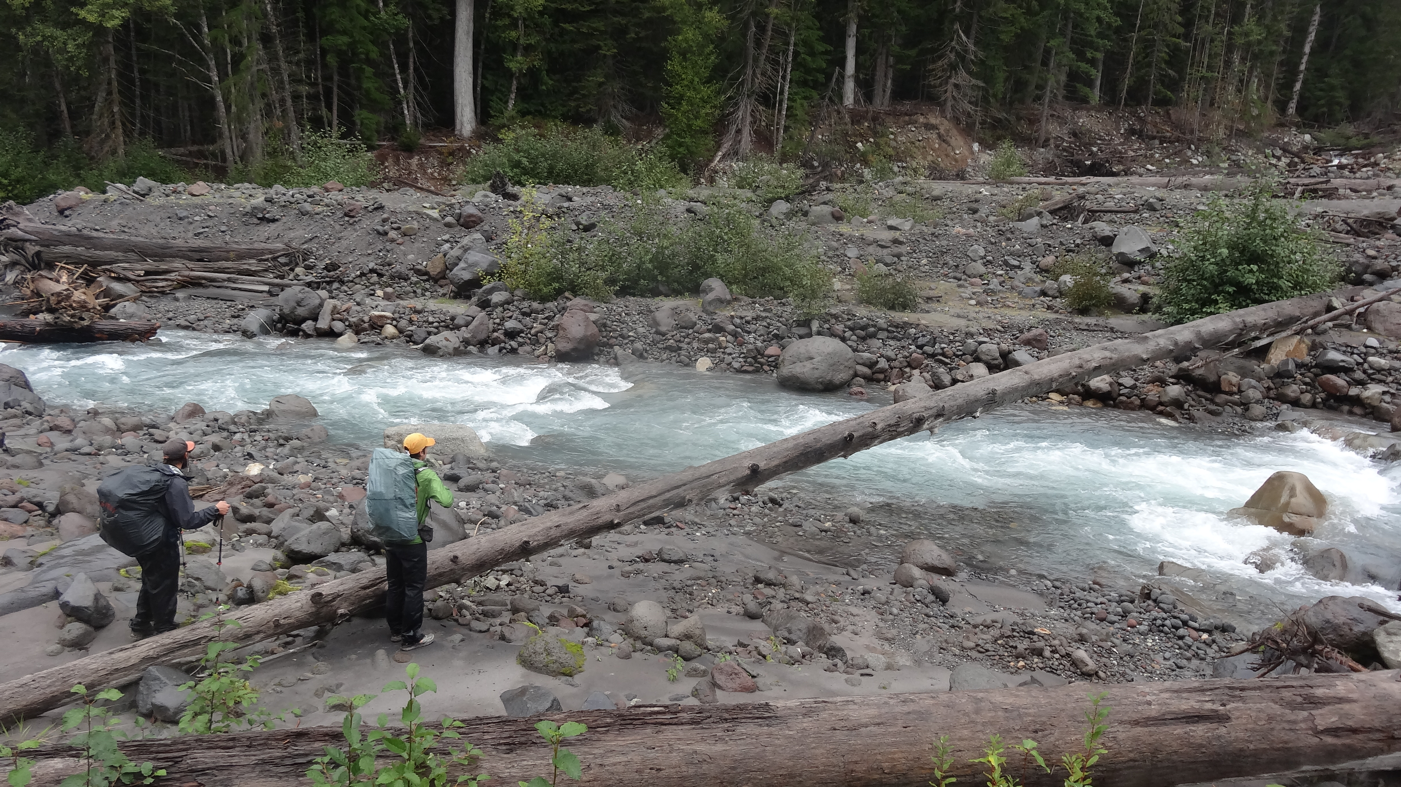
Goldilocks and Shedder contemplate crossing the Suiattle River on this log. This river crossing is notorious among thru hikers, although I believe we found a different log than the one frequently photographed in years past.

DSC03350

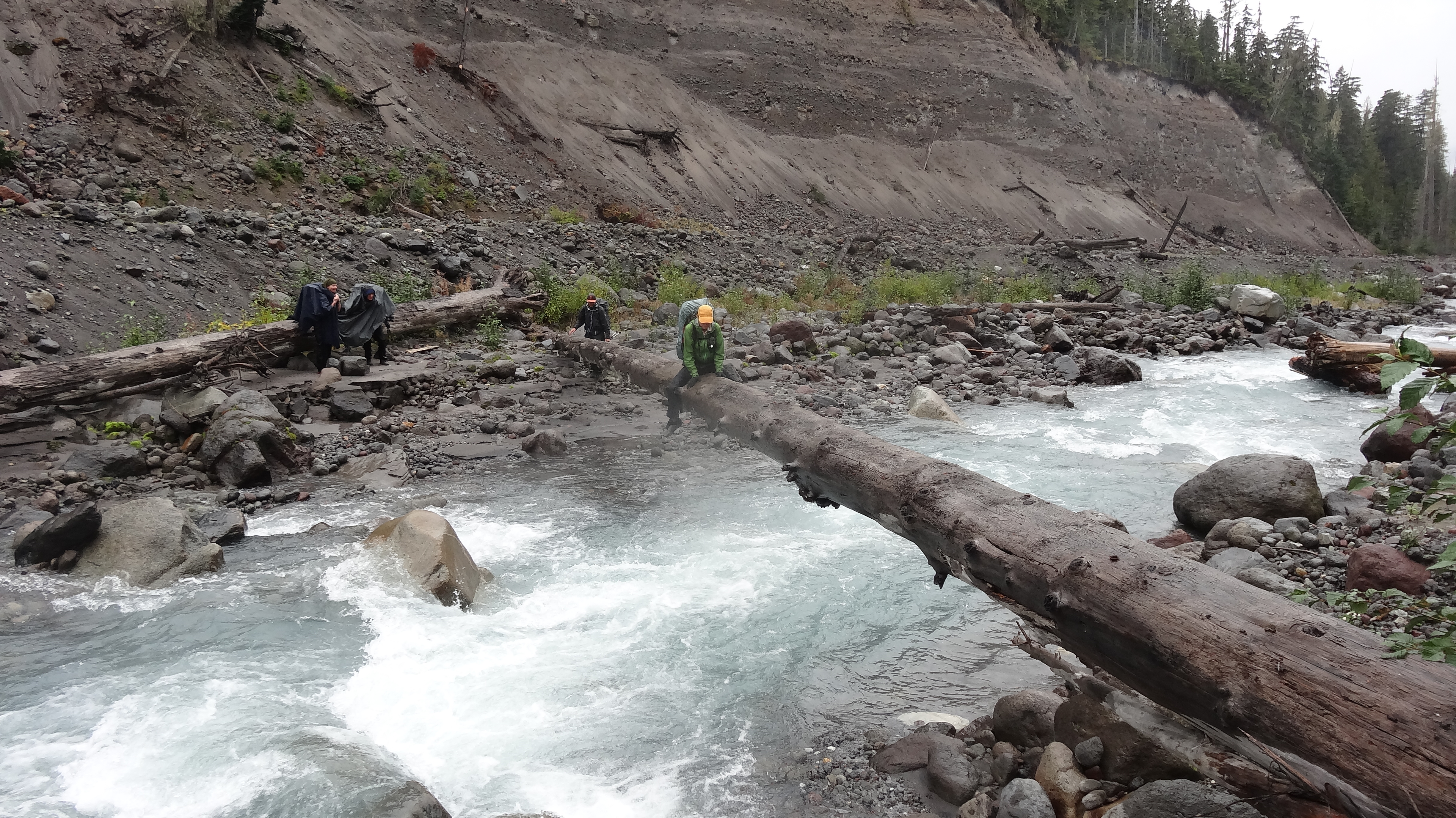
Crossing the Suiattle… I walked across, but everyone else opted to scoot.

DSC03359

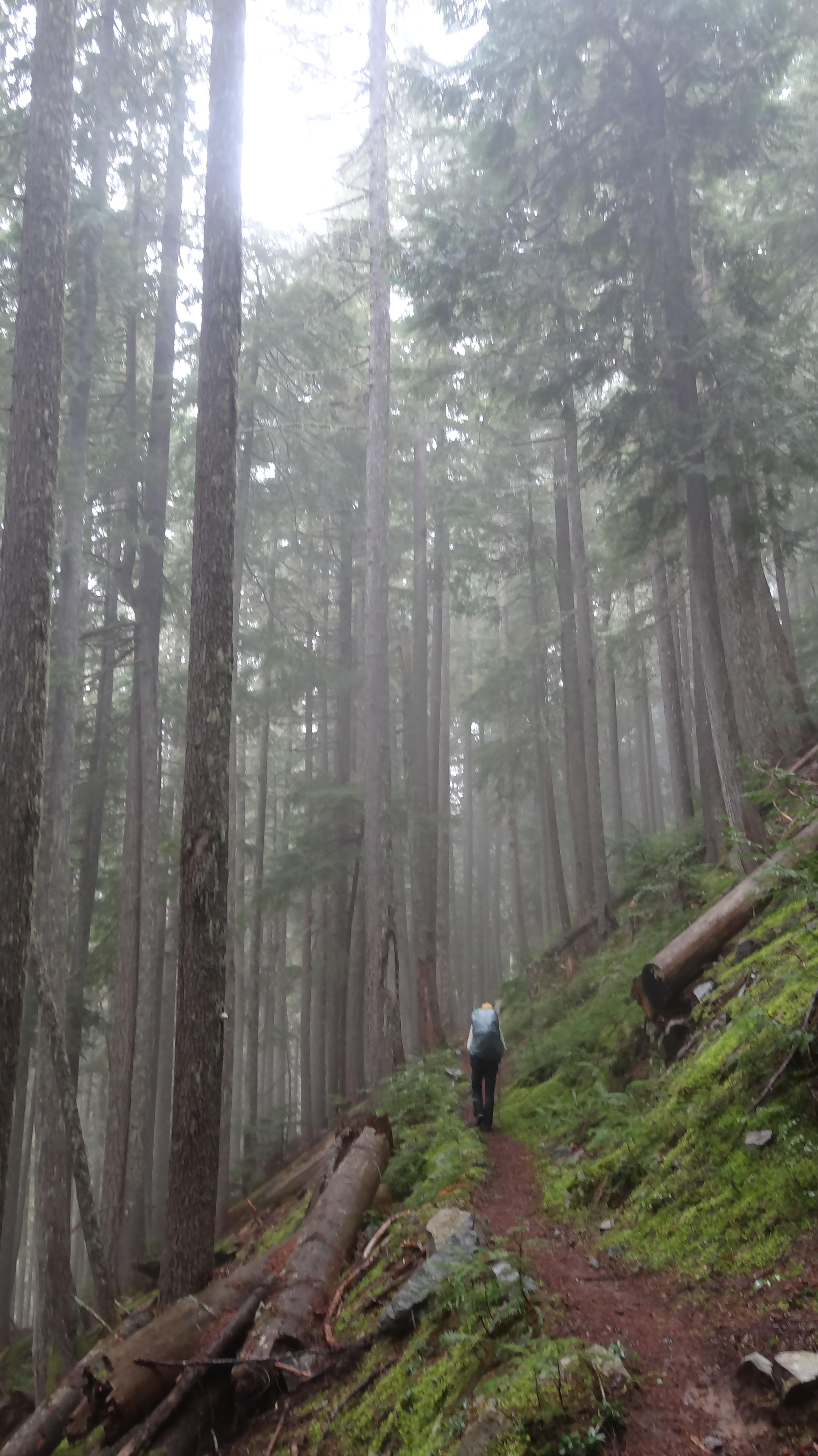
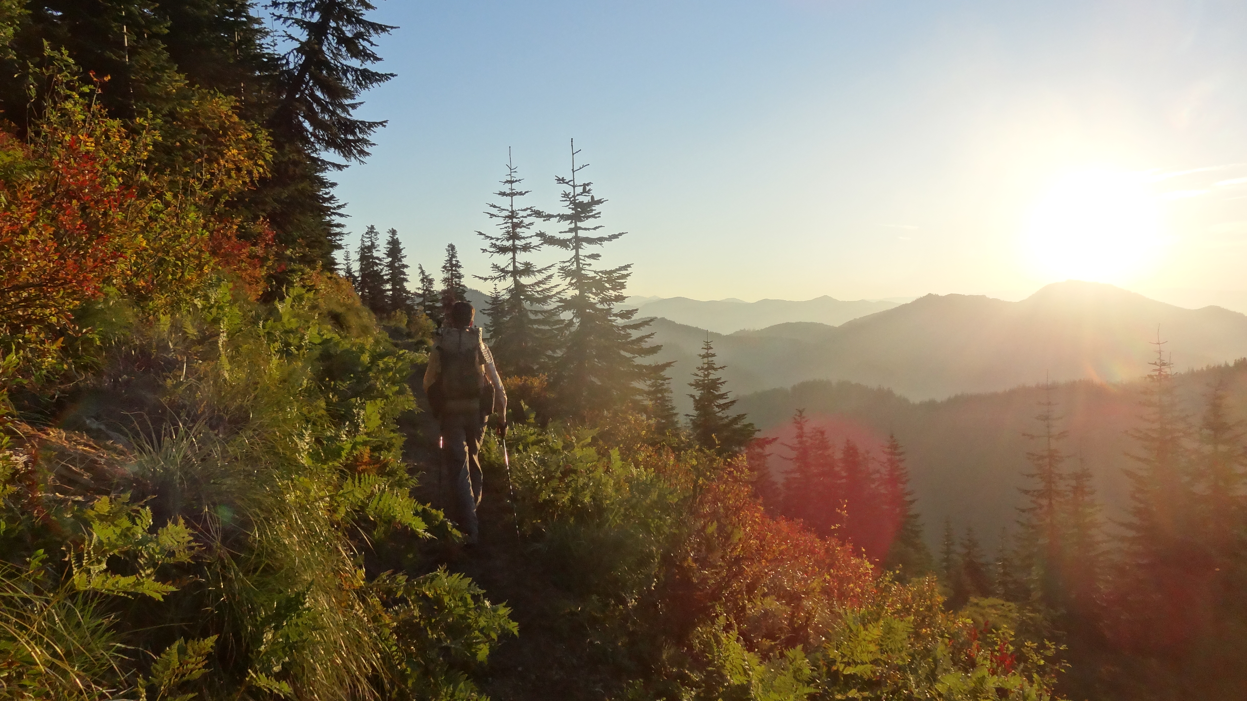
A pleasant walk in the woods
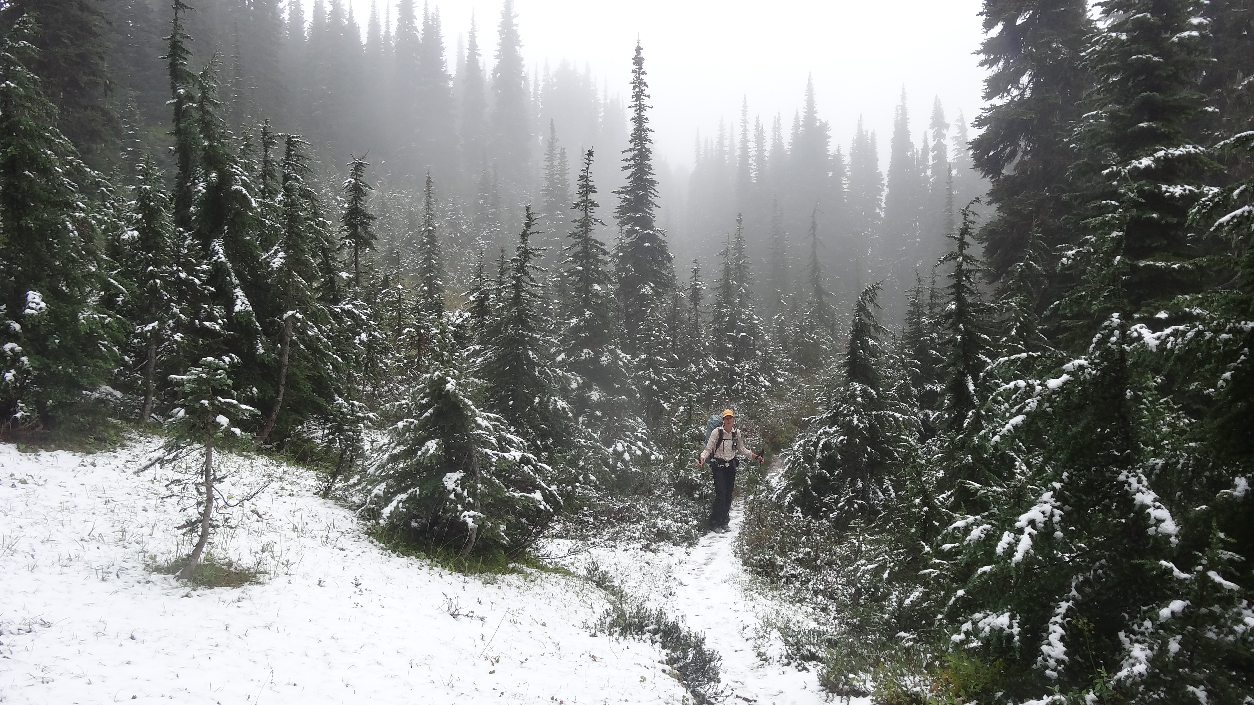
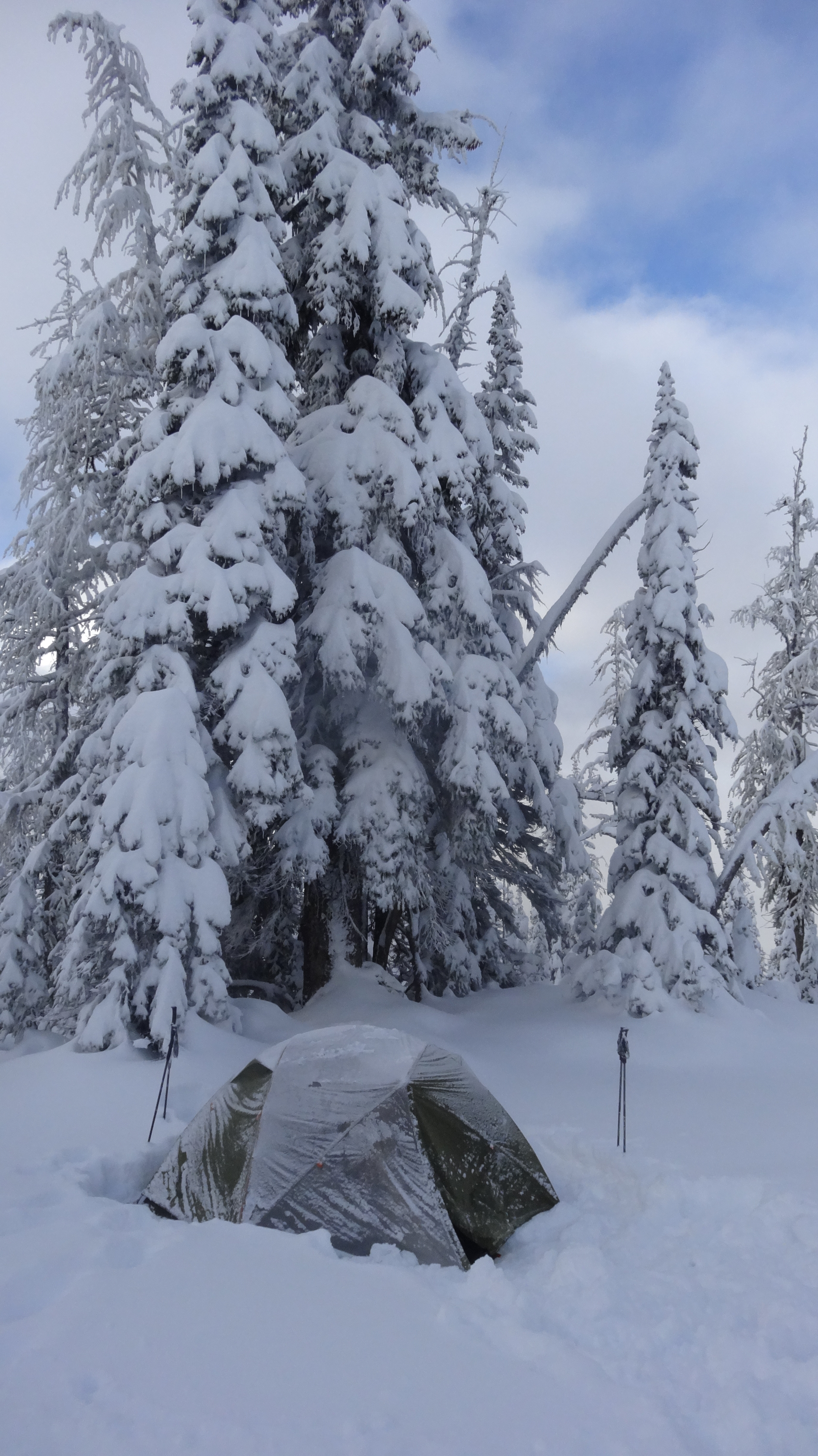
DSC03365

Winter Wonderland

DSC03366

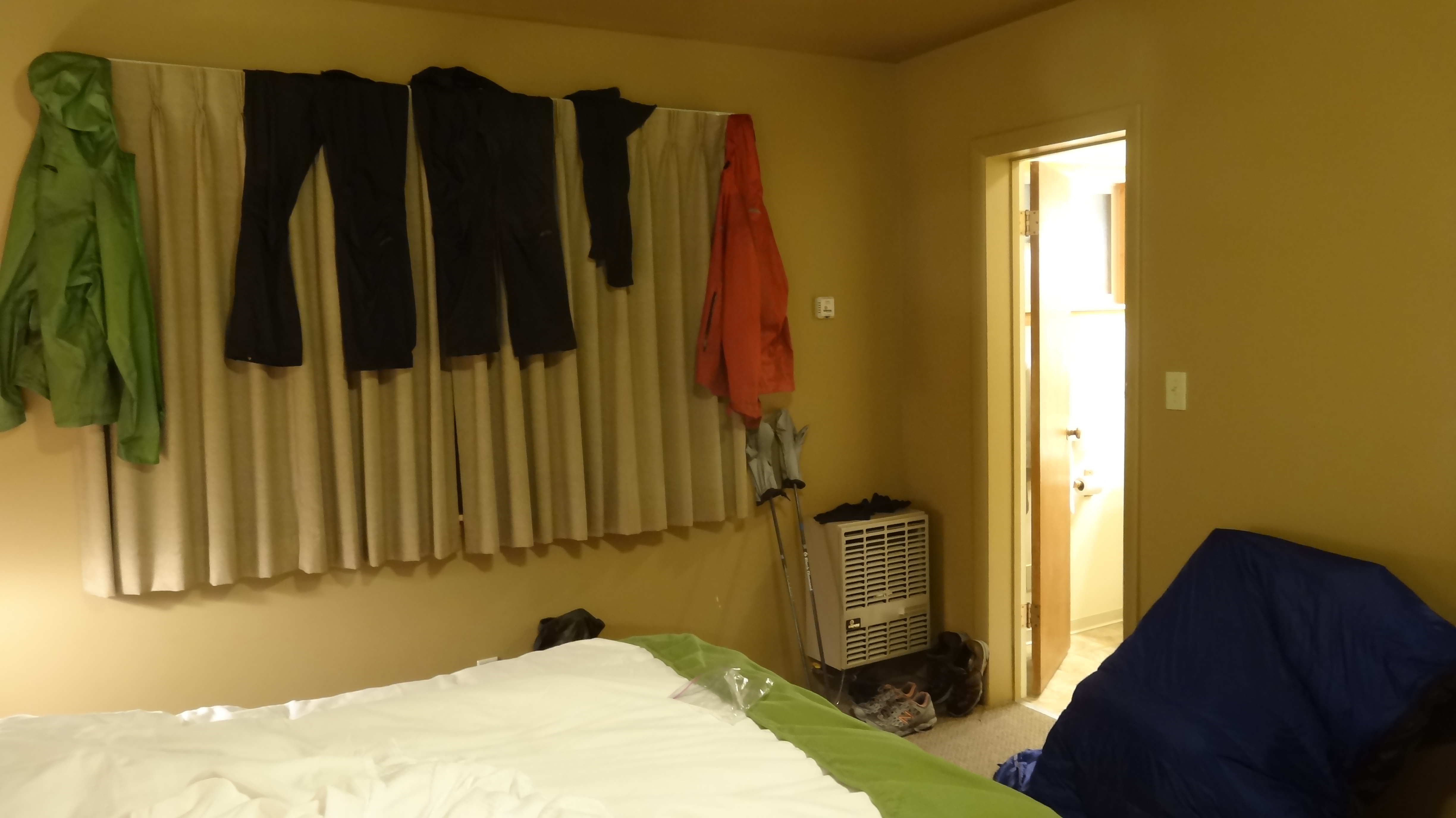
Our room in Stehekin, where every surface was covered with gear laid out to dry

DSC03369

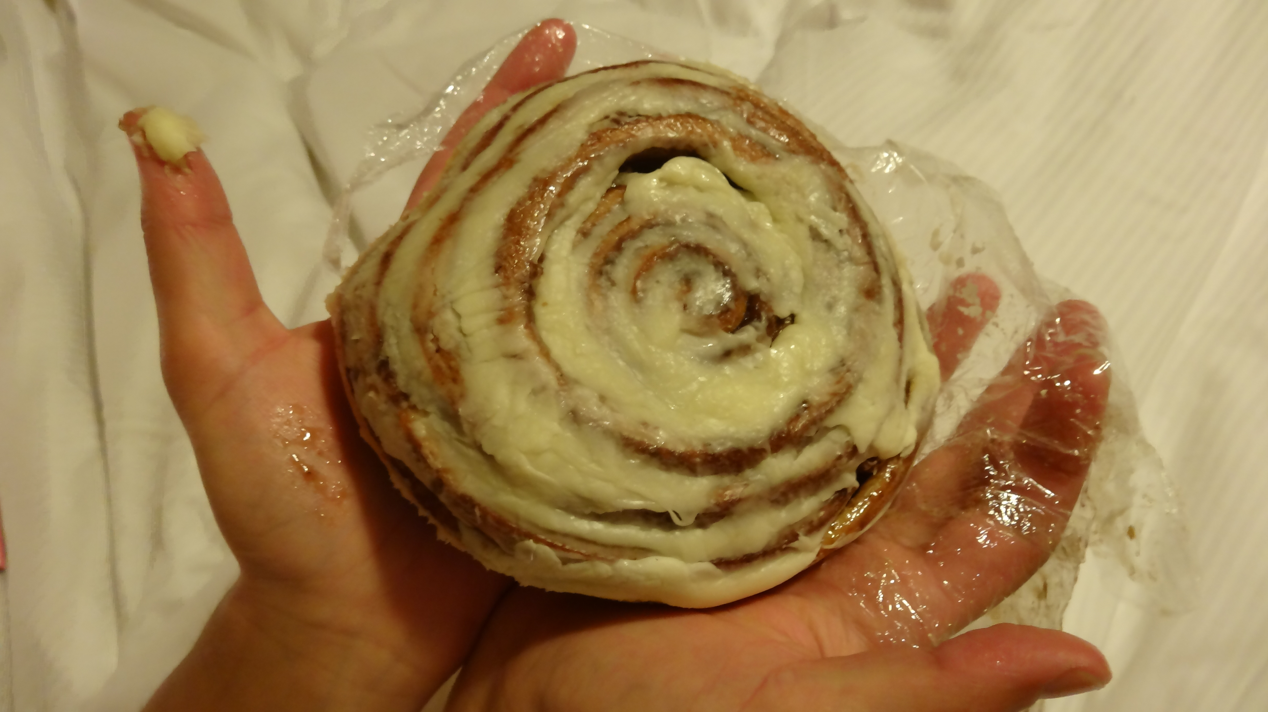
The cinnamon buns from the Stehekin Bakery were amazing. We ended up eating 5 of them between us.

DSC03373

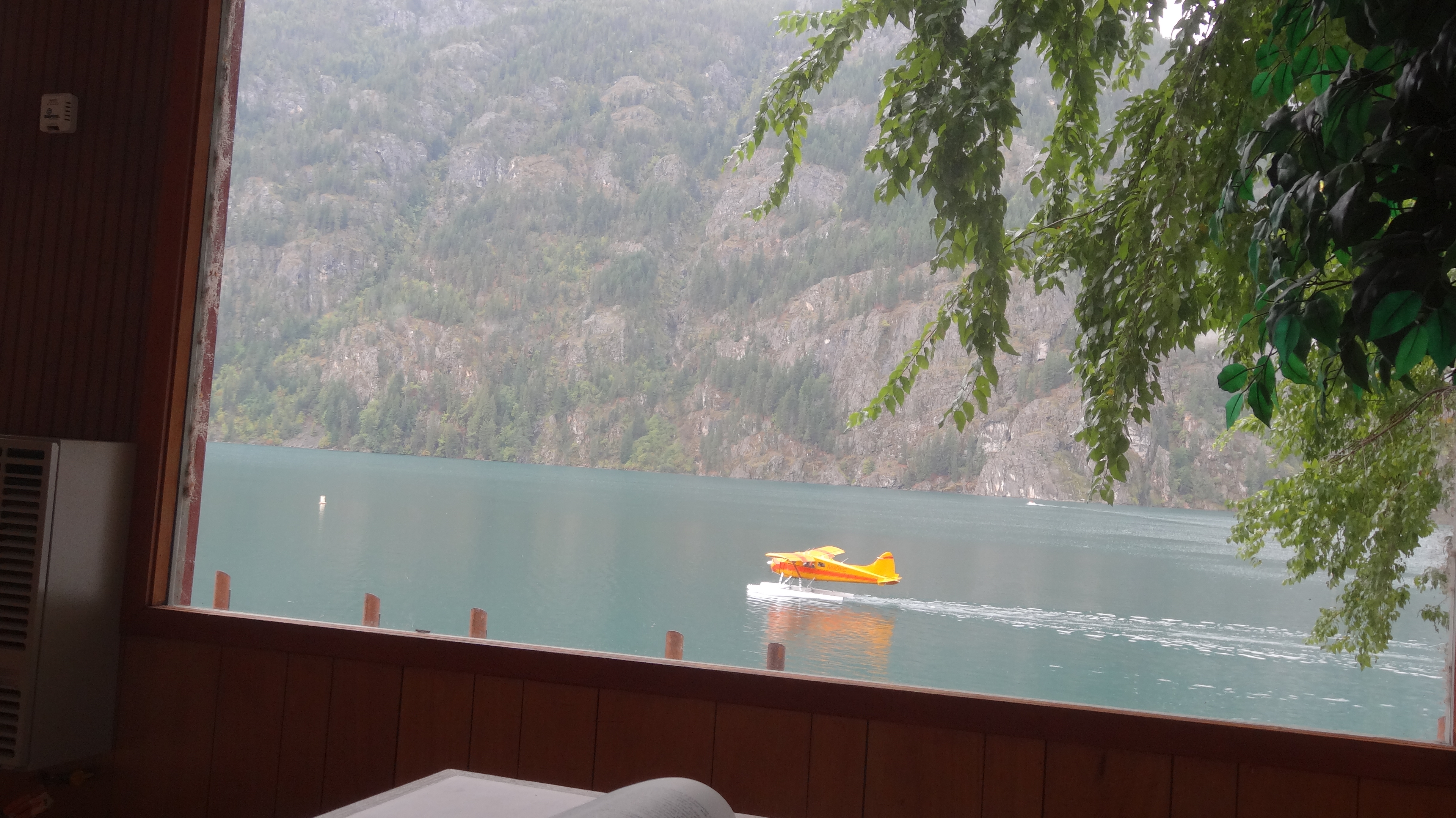
Float plane landing on Lake Chelan

DSC03375

The lodge

DSC03378

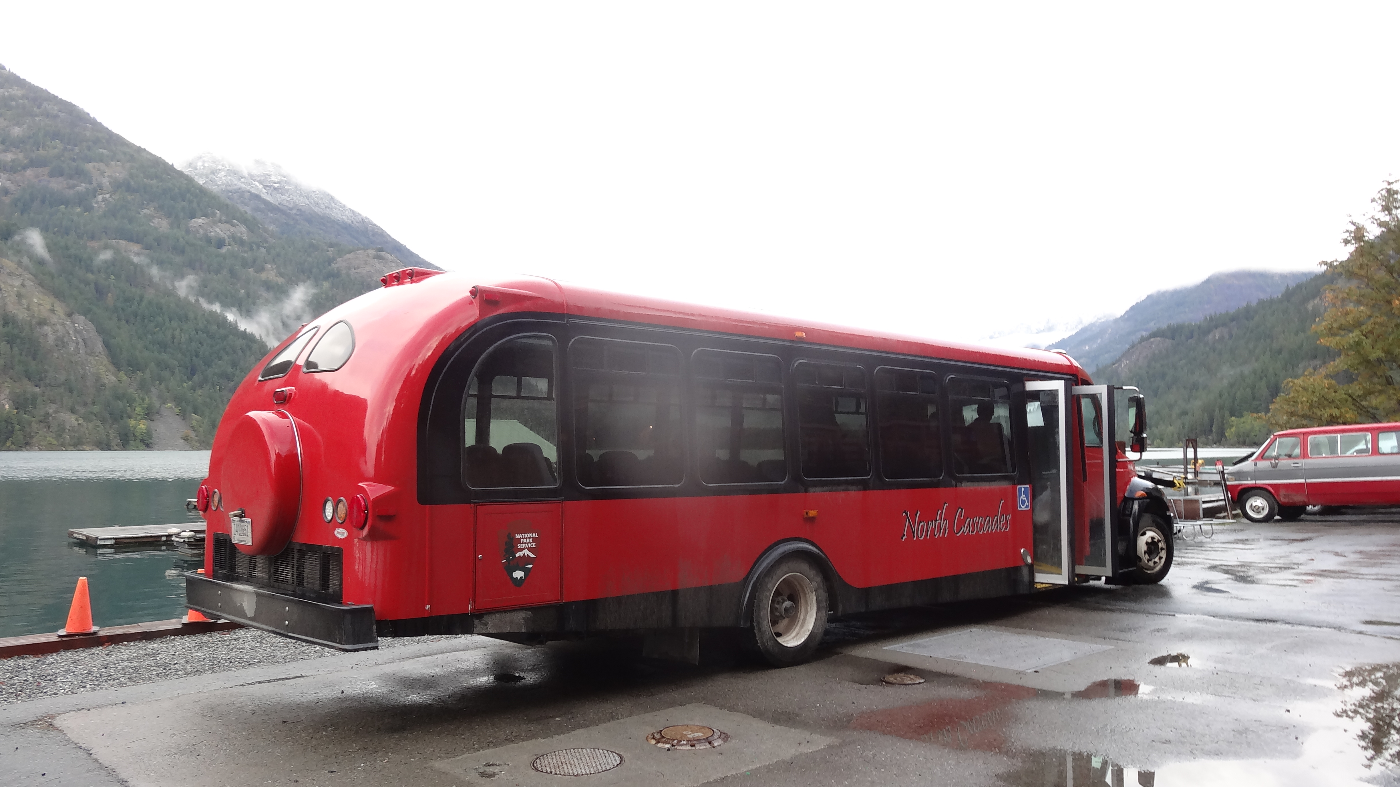
The Stehekin Shuttle run by the NPS. It’s currently not running due to the government shutdown (thanks, Obamacare).

When we left Stehekin, the very tops of the hills and mountains surrounding Lake Chelan were topped with fresh snow and the air was cold and crisp, but we were ready to get on with our hike – only 80 miles from the border. We slowly climbed away from Stehekin and toward Rainy Pass. The weather was fine until about 3 miles south of the pass, when a light snow started to fall. The light snow soon turned into heavy, wet snow as we approached the pass, and by the time we had hiked the 19 miles, we were chilled to the bone but happy to think we’d be in a bed again that night. Looking fairly pathetic, we easily caught a ride down to Winthrop with a nice guy who was on his way to Pullman. As we traveled to the east side of the mountains, the sun started shinning through and we completely forgot that we were being snowed on only half an hour prior. We checked into another motel and started to contact some of the hikers who we knew were in town.

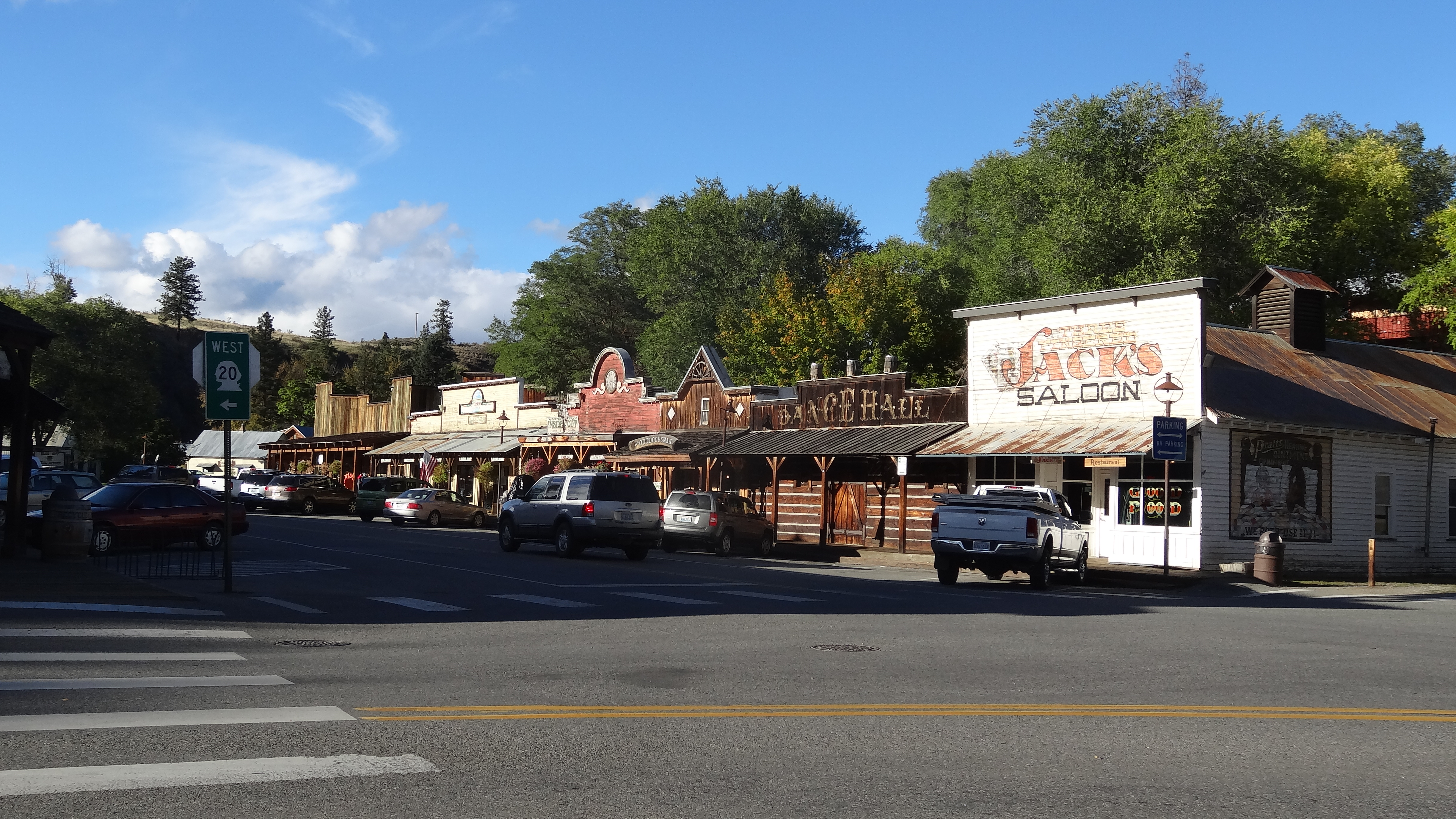
Winthrop is a western-themed town with old western facades and business names like “The Emporium” and “Jack’s Saloon.” It was kind of a fun place to plan for our last push to the border. We met up with some hikers, many of whom we hadn’t seen in hundreds of miles, and started planning. A large group of our friends were leaving the next day to brave the snow out of Rainy Pass. We decided to wait another day for more weather to pass before we made our push. This also meant that the large group in front of us would navigate and break the trail for us (cut tracks in the snow). That night, we said goodbye to our friends and wished them luck.

The next day, we finished gearing up for our wintery trek with additional wool layers, extra socks, a thermos, snow gaiters, and micro spikes (which attach to your shoes for extra traction on ice or slick surfaces). We thought about getting waterproof boots but didn’t want to spend the money on them for just 60 miles of hiking (I would later regret this decision). We spent the rest of the day just poking around town, talking with some of the hikers we were planning to head out with the next day. But around 5 o’clock, we received word that the hikers who had left that morning had been forced to turn back. It was devastating news. We met them at the Saloon to hear their story.

They had made it 6 miles from Rainy Pass to an area just past Cutthroat Pass, at around 7000 feet. They had encountered waist-deep snow and white-out conditions. Showing us pictures and videos of them struggling through the snow, they described the trail as “impassable.” We were crushed. There were maybe 12 hikers in the bar, all exchanging strategies for an alternate route at lower elevation, telling stories from their attempt, and crying as they grappled with the fact that they would not be able to finish the trail. We were trying our best to come to terms with the fact that we might not make it to the border via the PCT. It was a tough pill to swallow. Tears came to my eyes as I thought of giving up after all this time and effort, and Ashleigh was sobbing.

Then, a hiker who we had only met once, briefly in Bend, walked into the bar. He had gone up with a different group of hikers the same day and was turned back as well. Ashleigh immediately began talking to him. His name was Sneaks, and he was the first and only hiker to tell us that he thought the trail was doable, just extremely slow going. That was all we needed to hear. We had to at least try to make it on the PCT. So we began to plan our own push up into the snow with him. We learned that there was another group of hikers camped out at Rainy Pass who were also going to try the PCT early the next morning. In addition, there were 4 others in Winthrop and a group in Mazama nearby that were planning to try, plus us and Sneaks. We figured it would be a good group of hikers, and that many would be breaking trail ahead of us.

The next morning, we caught a ride to Rainy Pass with our friend Dishcloth. He dropped us off at the trailhead, and we were met there by a large group of hikers. We quickly realized, however, that virtually all of them had bailed and were planning to take an alternate route instead of the PCT. They would road walk from Rainy to Ross Lake, which sits at much lower elevation, and then take a trail along the east bank of Ross Lake up to the Canadian border. Suddenly, the big team of hikers we’d expected to hike out with had shrunk to a team of 8.

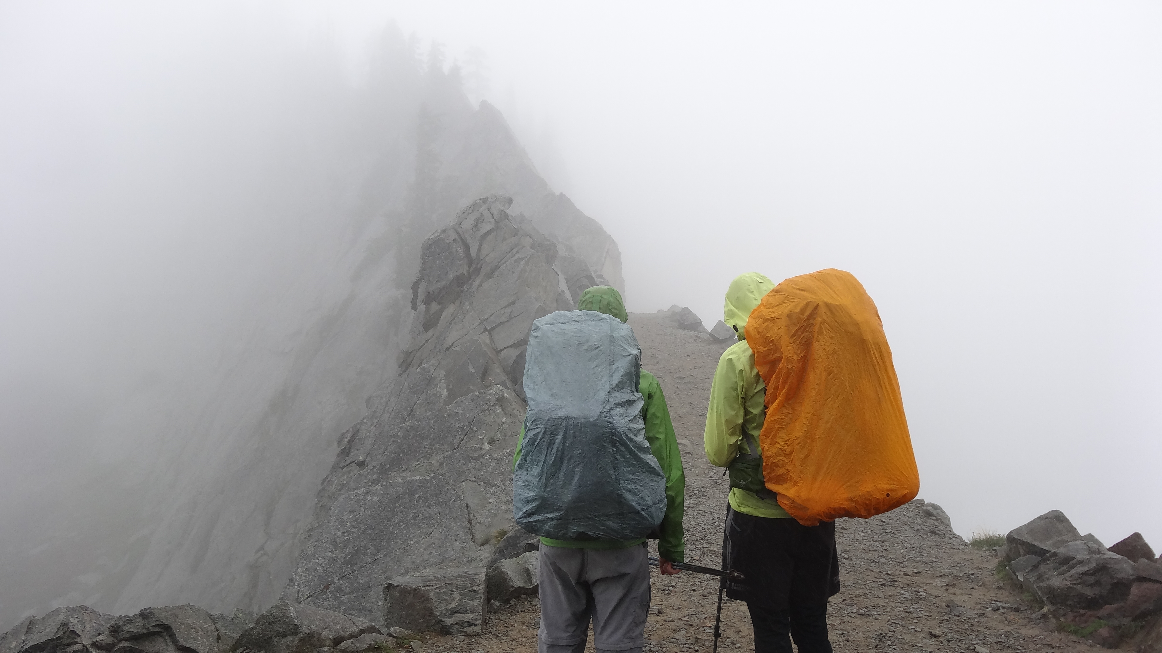
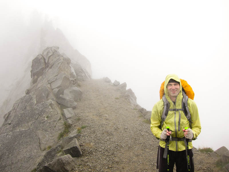
Undeterred, we climbed out of Rainy Pass and soon hit the snow. It gradually became deeper as we went, but we were following the tracks of the groups who turned back the previous day, as well as those of Sneaks and Acid Glasses who had hiked out just ahead of us, so we were moving at a relatively good pace. We ascended to just under 7000 feet at Cutthroat Pass and found ourselves in snow 3 feet deep, with more snowing falling. We slowly made our way about a mile further before running into Acid Glasses and Sneaks. Glasses had decided to turn back, and Sneaks didn’t want to go on alone. We were not prepared to be defeated just yet and decided to push on with Sneaks.

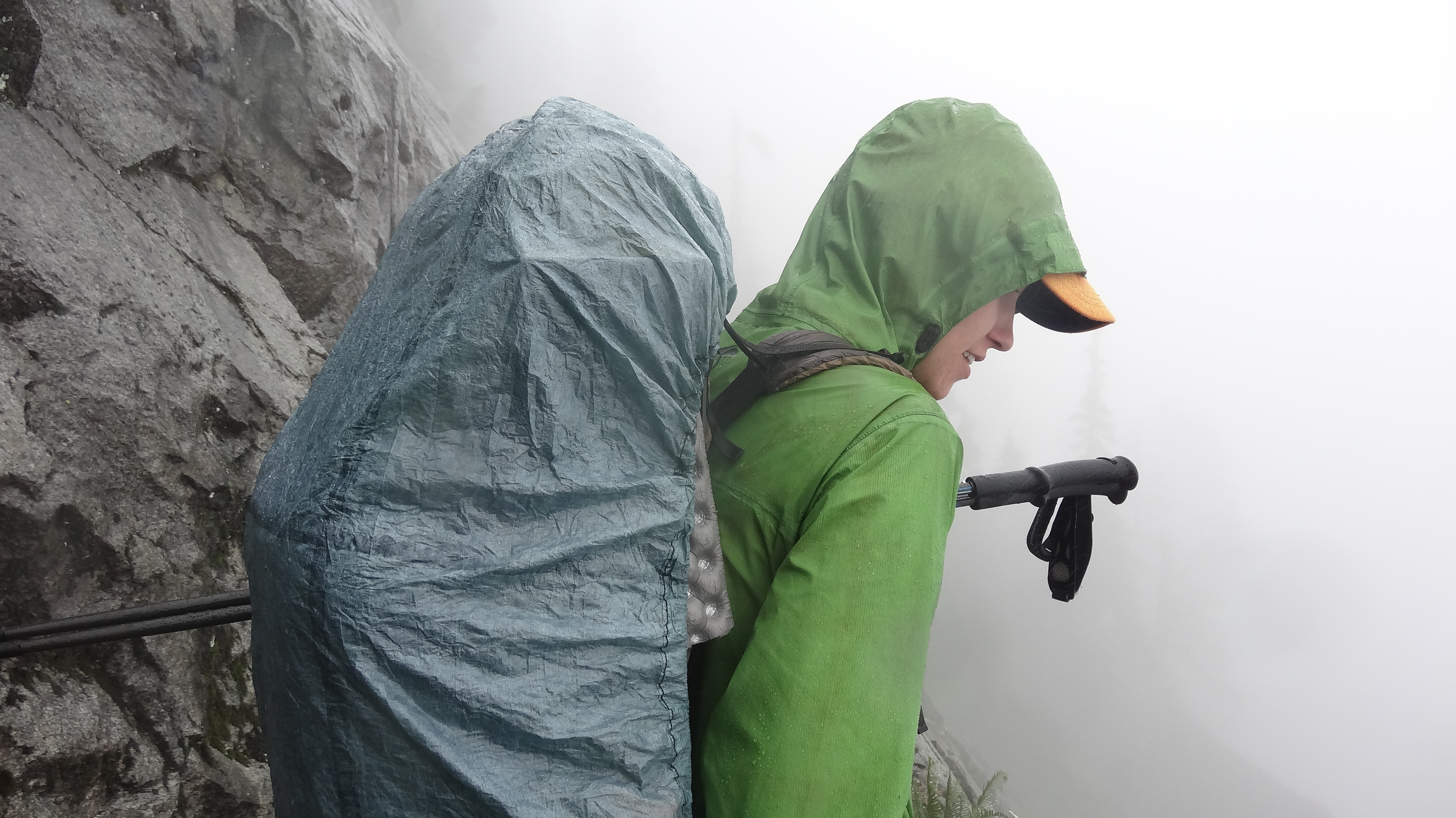
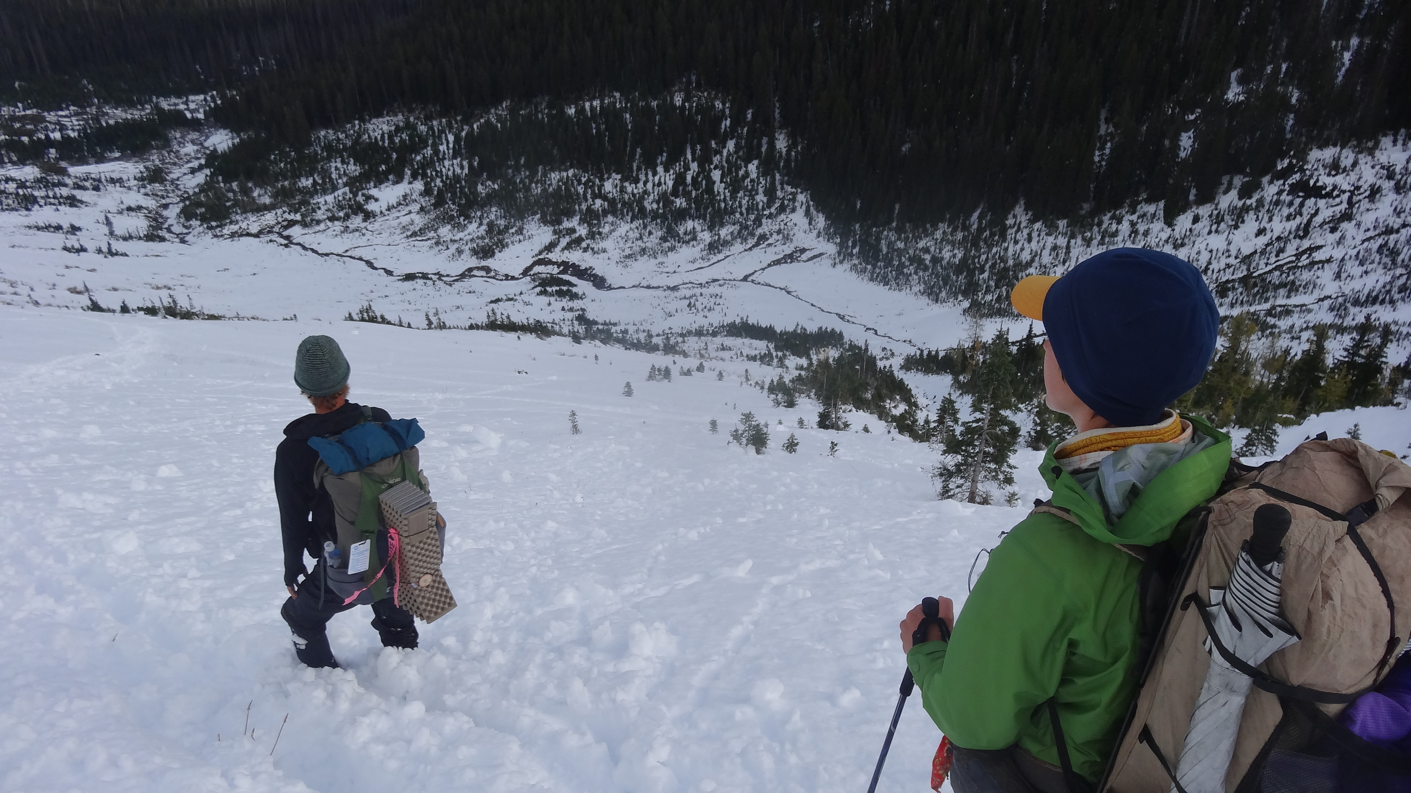
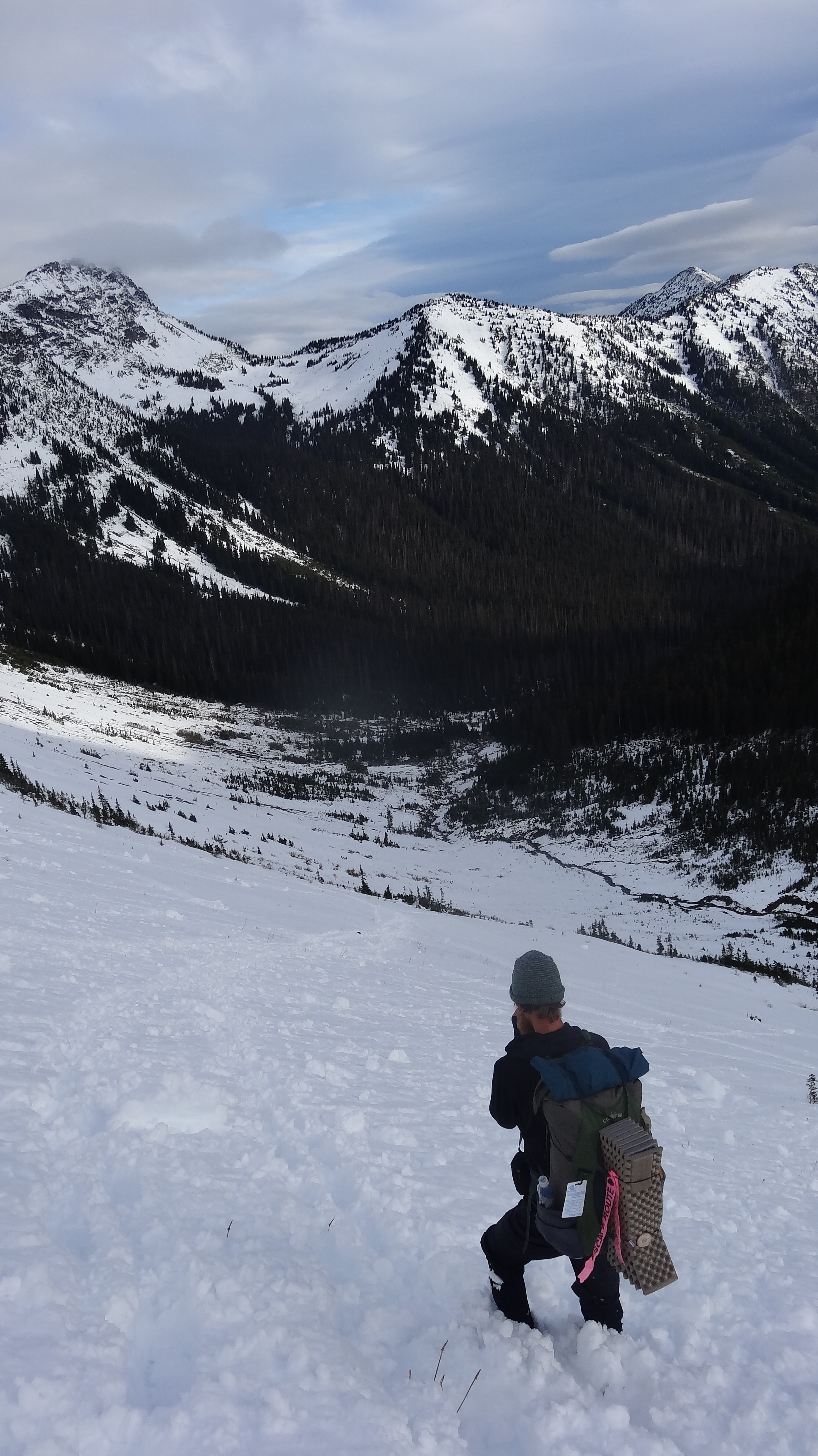
By now, we were at the point where everyone had turned around the previous day. We now had to break our own trail through the snow, just the 3 of us. Only about a hundred yards later, we reached a point where there were cliffs in front and to the right of us and only the sheer mountain to the left. We knew there were some switchbacks descending from the ridge but had no idea where they were. We wandered around for about 10 minutes trying to get our bearings, but the snow was falling hard, and we couldn’t see anything beyond a hundred feet. We couldn’t find the trail, and the drop offs were too steep in all directions for us to gamble on the route. Then, just as we were preparing to throw in the towel, John, Maggie, Hannah, and Hops showed up. John and Maggie quickly decided that they were done and turned back. Hops and Hannah wanted to push on, and Hops had a fairly accurate GPS on his phone. So we slogged on, now a team of 5. He would point in the general direction of the trail, and we would wade through the snow to get there; then we would stop and check again.

It was incredibly slow going. We were post holing with every step, which means we would sink into the snow thigh deep. We were only covering about half a mile an hour, if that. I was starting to get cold and had sharp pains in my toes and fingertips. As long as we were moving at a decent pace, we could keep our blood pumping and stay warm enough, but we were now moving way too slow. I would look up and see nothing but white everywhere, and there we were in waist-deep snow, not sure which direction we should go. I didn’t know if this was brave or stupid, or some combination of both. I came close many times to just saying, “This is insane. We need to turn around.” Soon, we were all too cold and tired to go on. We had only gone 7.7 miles, but we needed to set up camp and get warm. So we packed down some snow, set up our tents, and crawled into our sleeping bags. It was only 3:30pm, but we would remain in our tents for the rest of the afternoon, thawing our feet. It was Ashleigh’s 28th birthday.

About an hour later, we started hearing voices. We stuck our heads out of our tents and saw a group of 6 thru hikers with snowshoes on, all in good spirits (Nightcrawler, Pimplimp, Hurculeas, Rafiki, Krusteaz, and K-Pax). We had completely forgotten about the group of hikers leaving behind us with snowshoes! It was so wonderful to see them. They had been following our tracks and decided to push on past us, which meant that in the morning, we could follow them. We wouldn’t have to navigate or break the trail!

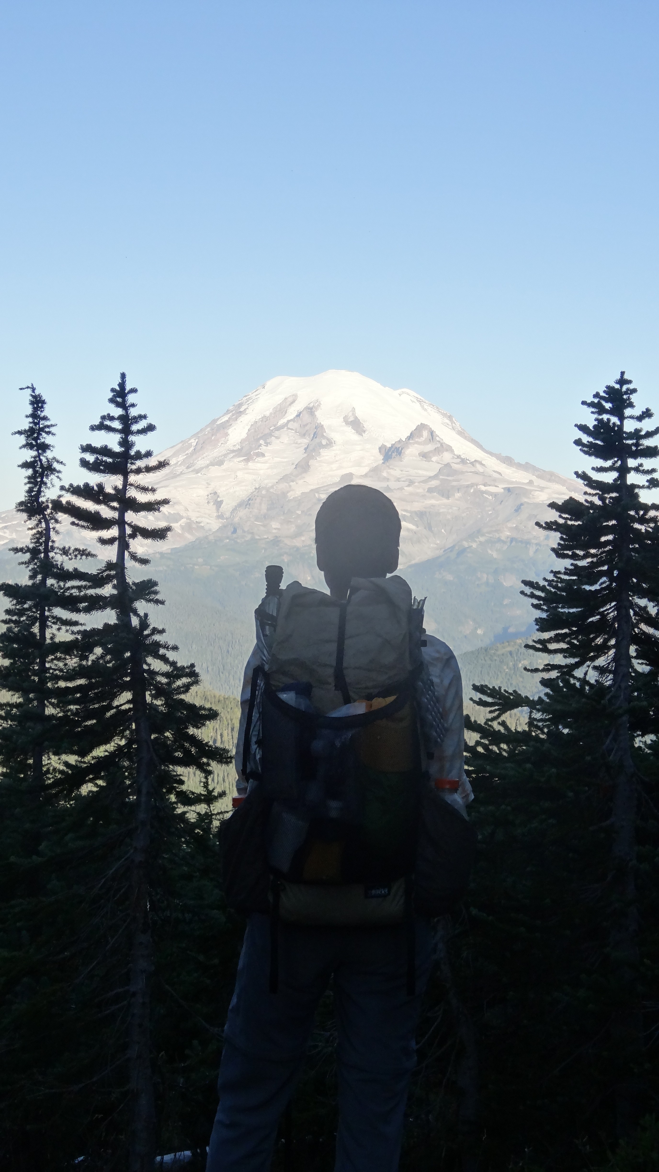
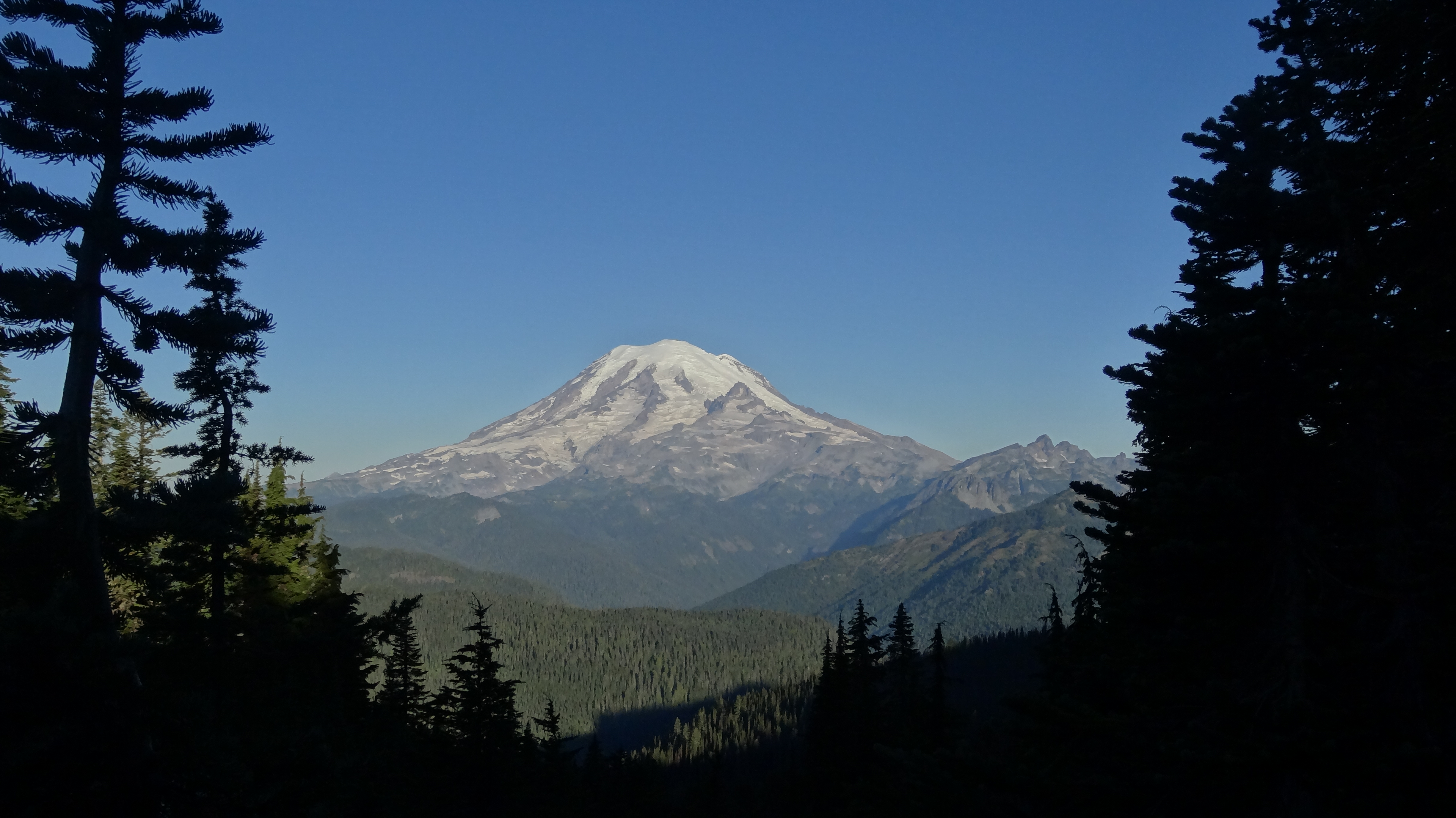
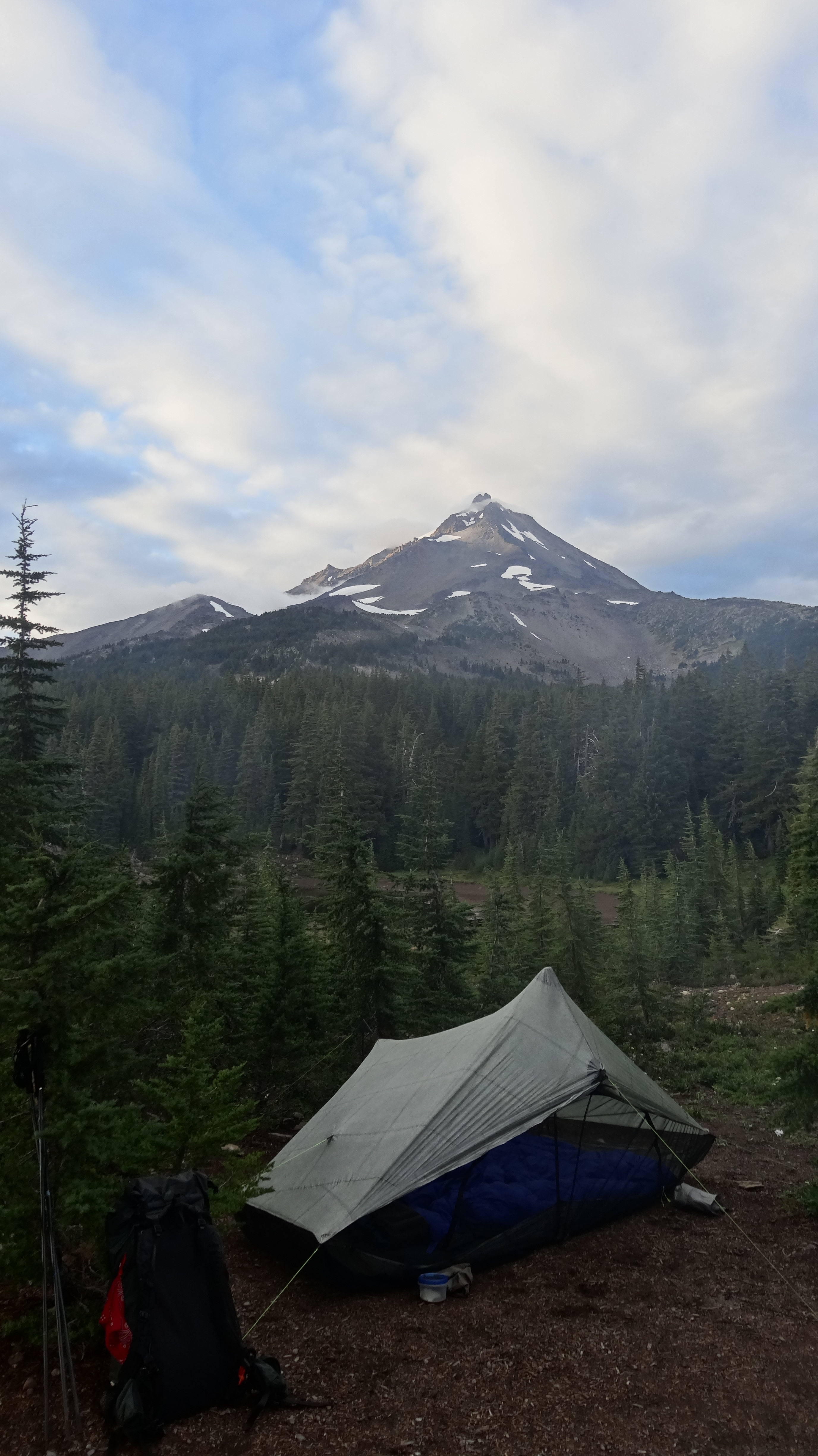
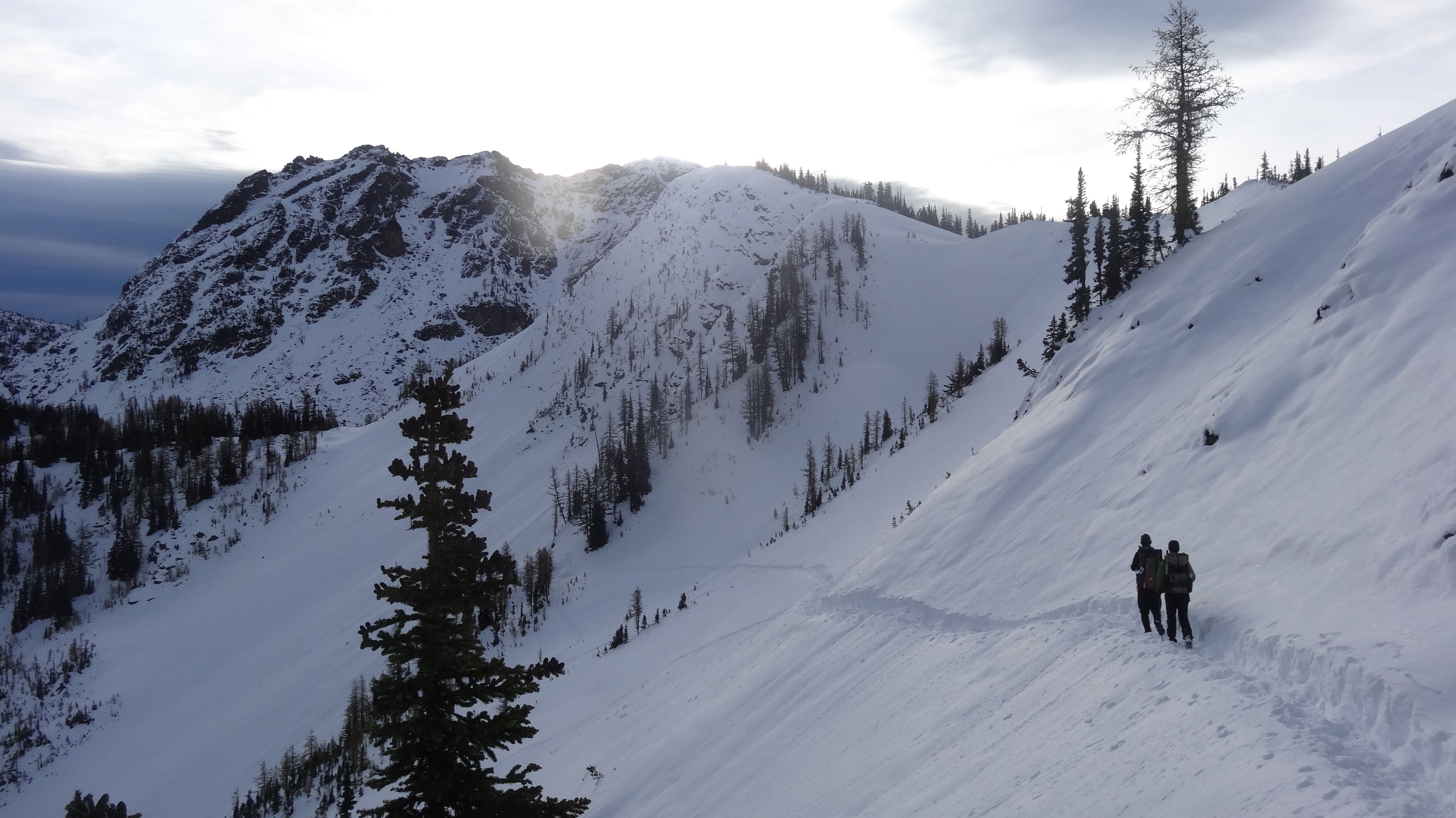
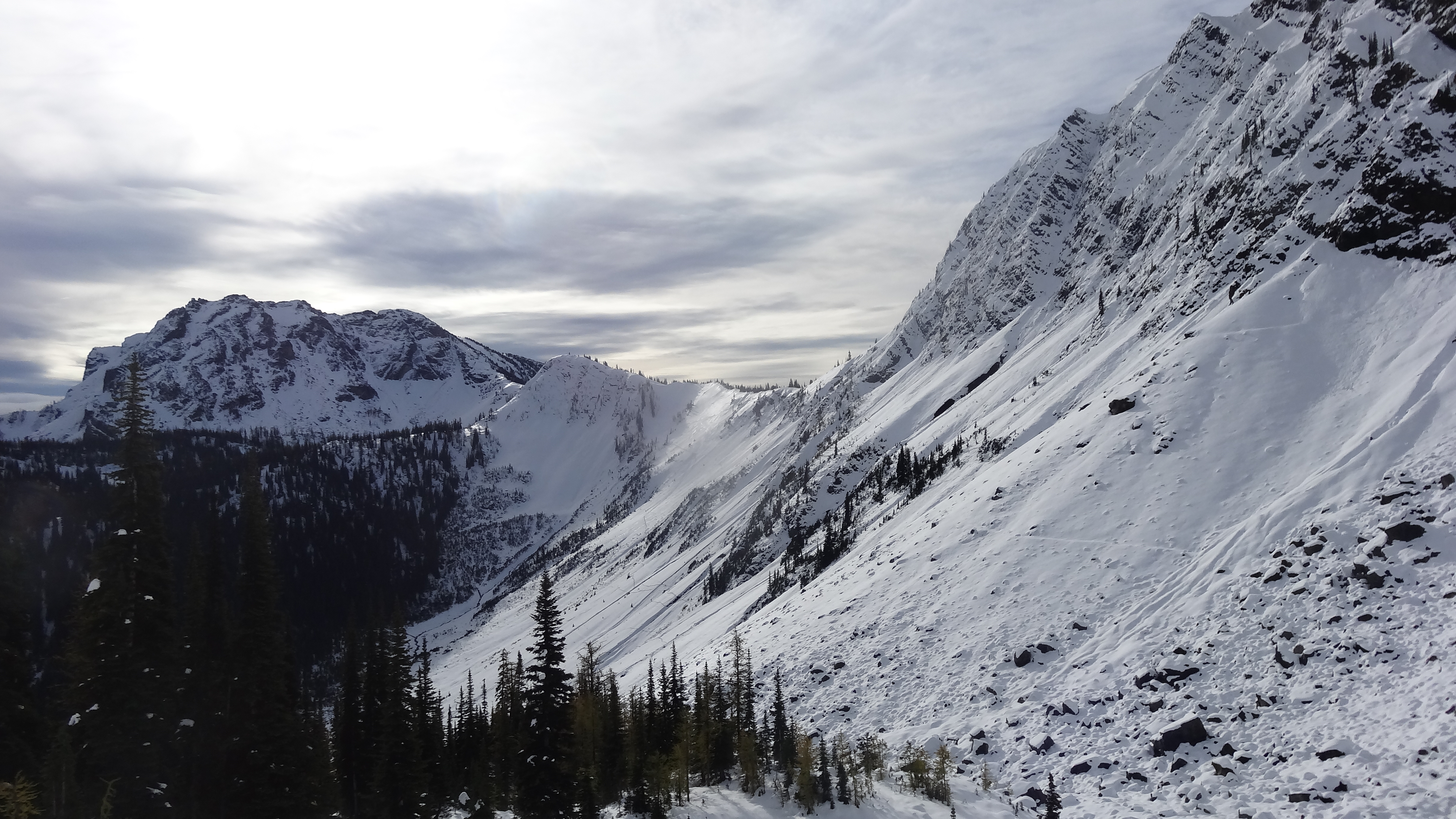
The next day, we quickly caught up to the snowshoers, who had camped just 2 miles past. We were still post holing in their tracks, but it wasn’t as deep or as often, and we no longer had to navigate, which saved a lot of time. We all decided to stick together and hike to Harts Pass that day, as 2 of the snowshoers had their parents meeting them there with trail magic. Harts Pass is the only place with road access between Rainy Pass and the border, and we knew we could bail to town from there if conditions were unsafe. So we hiked on with them, across steep, snow-covered faces and along ridges at 7000 feet. It was sunny that day, and for the first time, we could see the beautiful snowy Cascades.

As the day stretched on, we were making steady progress but not moving very fast. Everyone was adamant about making it to Harts Pass that day, so we slogged on into the evening and then into the night. It was dark, and we were hiking closely together with our headlamps, which made us look like a little train moving in the darkness. We were passing over some high-elevation ridges and steep mountain faces. It seemed more than a little crazy to be doing these things at night, and for the first time on the trail, I was longing for an ice axe. It was so cold that I had to punch a hole in the ice that formed over my water bottle when I wanted a drink. At 10:45pm, we finally rolled into Harts, after hiking for 14 hours and covering 23 miles in the snow. It was one of the most physically exhausting days I ever had on the PCT.

We were met by Hurculeas’ and Pimplimp’s parents, who greeted us with cold pizza and cookies. All I could do was shove 2 slices in my face, then wander off to set up camp. My toes were in a lot of pain, and I started thinking I might have mild frostbite. After setting up our tent, I quickly got in, exchanged my soaking wet socks for 3 pairs of dry ones, and shoved a pair of hand warmers into them. But my feet and toes continued to have sharp pain for another 30 minutes or so. It was excruciating, but eventually they warmed up, and we were able to sleep a little.

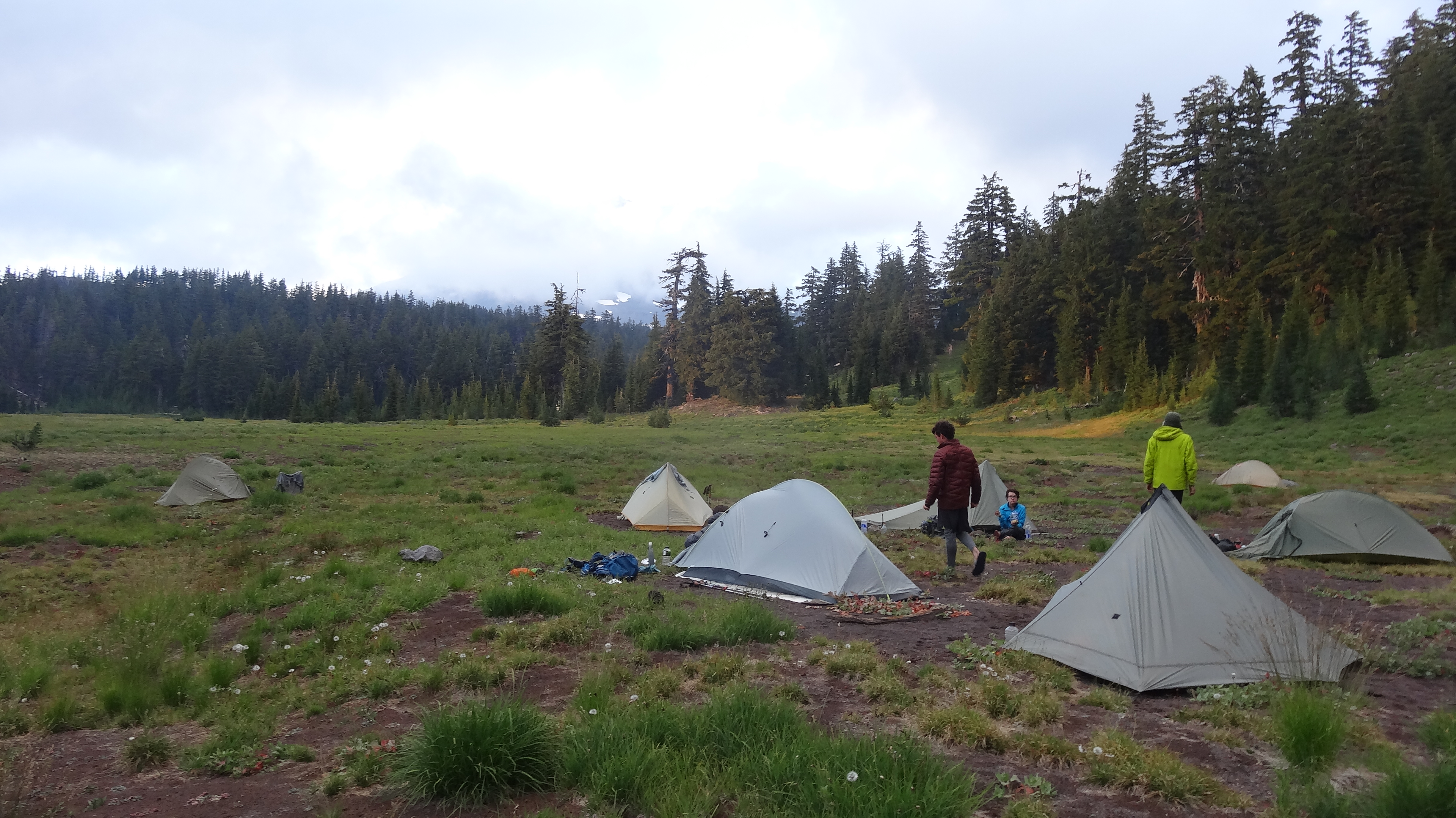
We left late the next morning, around 11am, and said thank you and goodbye to Hurculeas’ and Pimplimp’s parents. There were only 30 miles to go, and we were excited to get going, even though we were physically done. The weather was great and the hiking easier. We covered maybe 10 miles in little-to-shallow snow, and we were able to put in 16 miles that day. We camped alone with Sneaks that night; 4 hikers were ahead of us and 3 behind (Rafiki had been forced to get off at Harts in order to meet a travel deadline). We were able to find a bunch of dry wood and made a great campfire. We had decided to go for the border the next day. It would be our last night on the trail.

Around 10pm, we were tucked into our sleeping bags when we started to hear voices and saw lights shining into our tents. We poked our heads out to see Midnight Rider with her brother Cameron, along with Rustic, hiking south with Valentino (Midnight Rider’s horse). They had spent the entire afternoon (some 6 hours) on the side of a steep face just a mile ahead of where we were camped, trying to get Valentino moving. Midnight Rider has been riding Valentino since Mexico – she actually started the same day as us. She’s done every foot of the trail except for the last 60 miles but has struggled to get Valentino accustomed to the snow. Midnight Rider, Cameron, and Rustic were constantly hiking out ahead of the horse to pack down the snow so that he wouldn’t sink in, but this would leave Valentino standing in the snow for long periods of time. And that afternoon on the side of that mountain, Valentino just lost it. He was rearing up and running around on the steep face, sometimes dragging Midnight Rider behind on a rope. The group’s gear tumbled down the side of the mountain, and Cameron had to go retrieve as much of it as he could but was too exhausted to climb back up. They were so exasperated that we couldn’t fully understand everything that had gone wrong, but we do know they had activated the SOS signal on their emergency beacon. They would later cancel it. By the time they had backtracked to our camp, they were exhausted and shaken, and Cameron repeatedly said that they and Valentino almost died.

The next morning, we woke early and said goodbye to the horse crew, as they were planning to hike south back to Harts Pass that day. We hiked over the ridge and onto the face that had given Midnight Rider and her team so much trouble. We saw tracks in the snow zigzagging all over the place from their crisis but eventually caught the trail and moved on. After scrambling over a few huge washouts, we caught up with the 4 snowshoers in front of us.

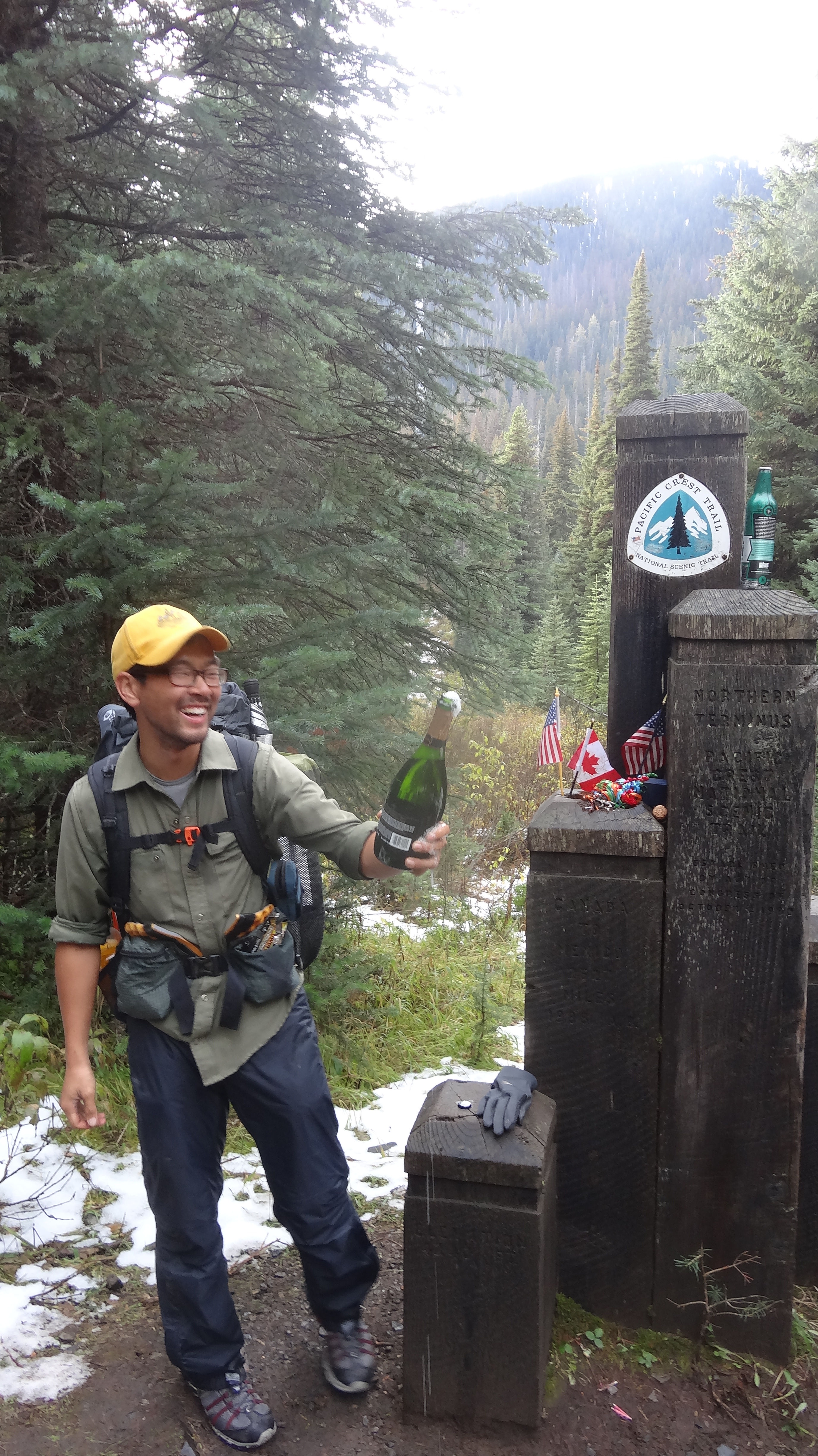
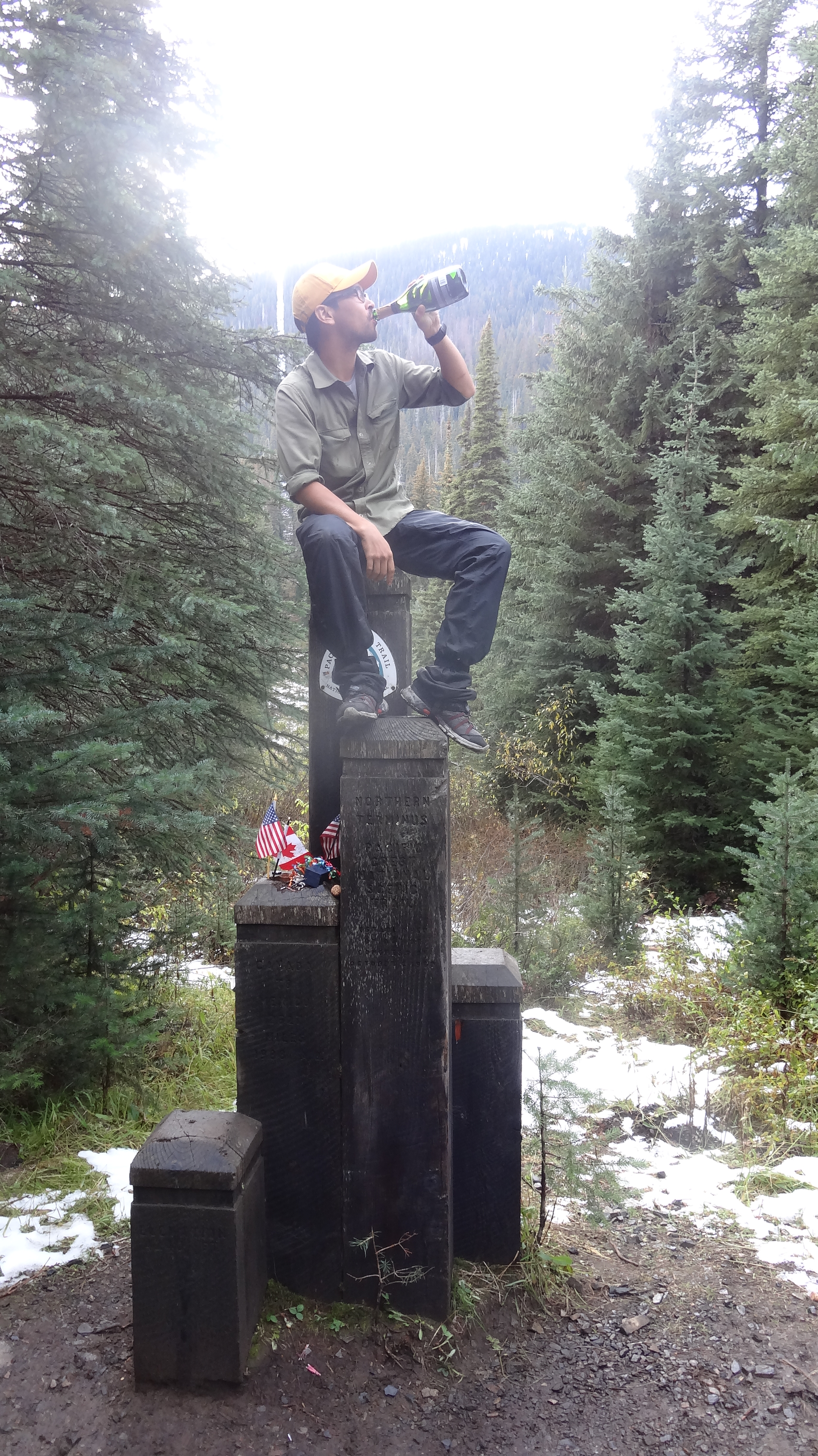
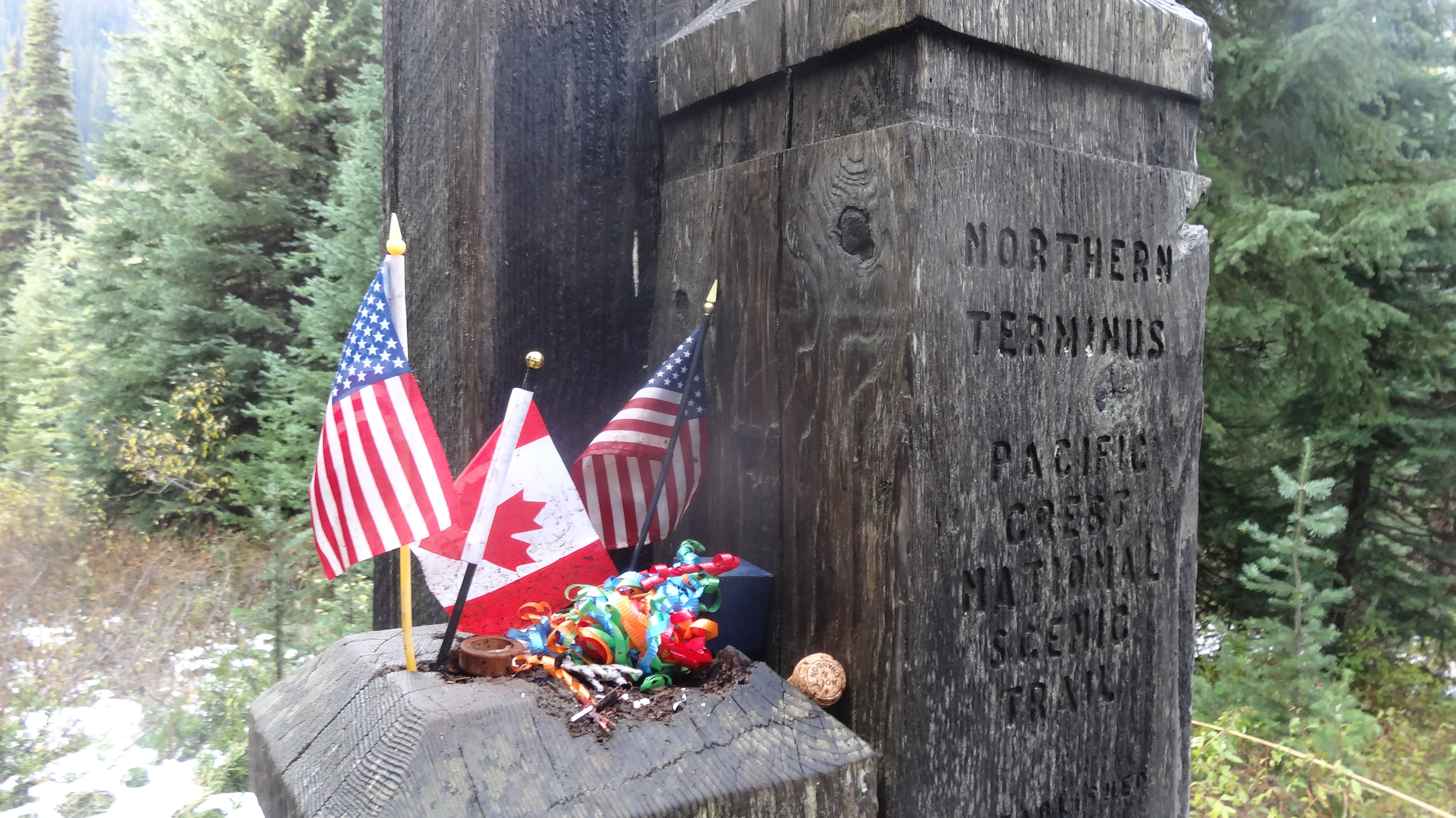
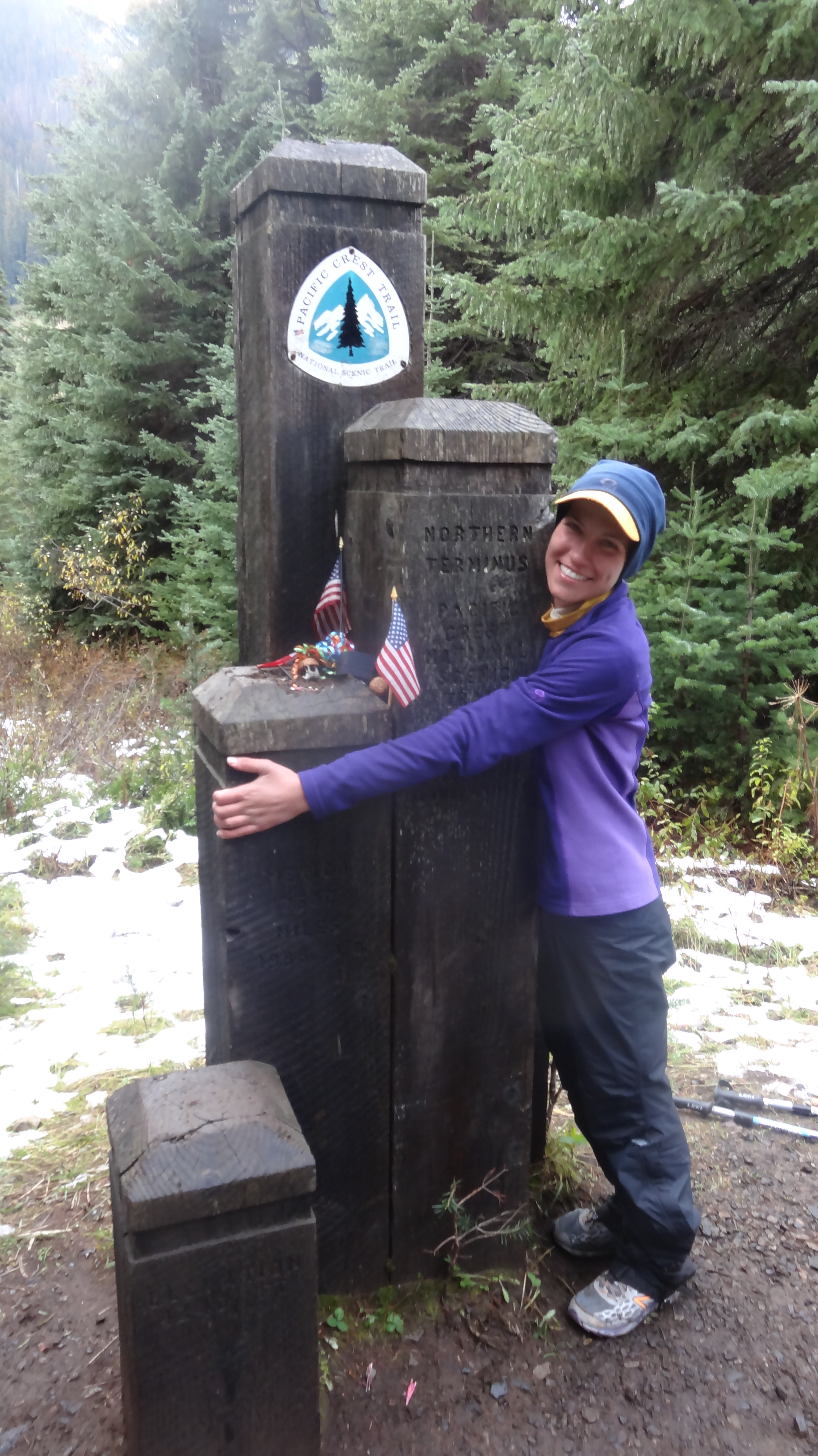
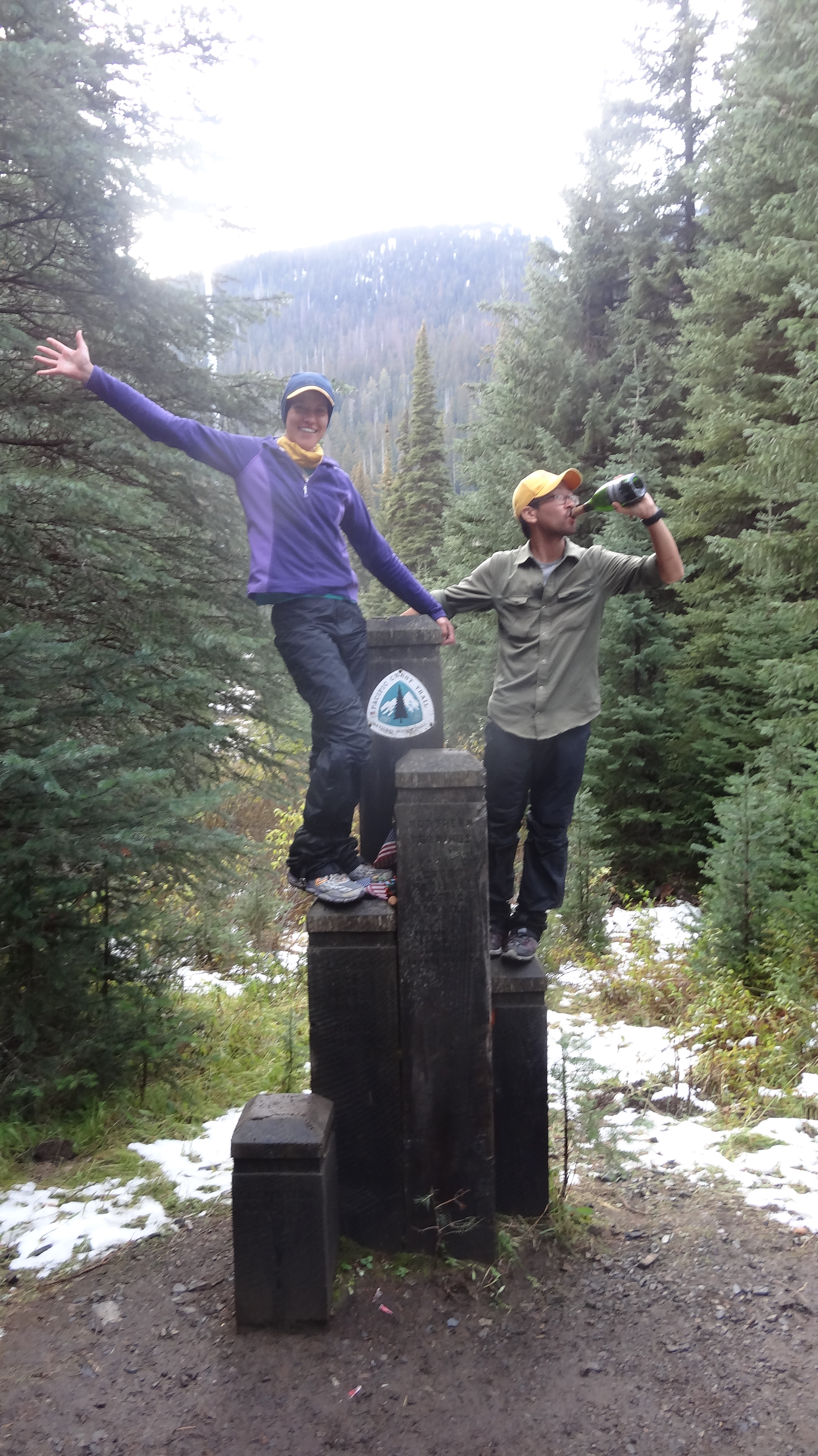
We hiked along in deep snow and hit 7000 feet a couple more times but soon began a long descent toward the border. After we descended below 5500 feet, the snow got lighter and we were able to cruise toward our finish line. As we hiked, I could feel the miles melting away, and with every step, I felt like I was making substantial progress toward the end. My adrenaline started to kick in, and the anticipation was growing; I felt like I was going to burst. Finally we reached a point where we could actually see the clear cut that is the Canadian border! We hiked quickly down one more switchback away from the border (of course), and emerged next to Monument 78 (the Northern Terminus of the PCT)! We had made it!

I can’t describe the waves of emotions that overtook me when we reached the border. It was a mixture of joy, sadness, relief, happiness, and many more. It was one of the most surreal moments of my life – almost like an out-of-body experience. We had been dreaming of this moment for 2 and a half years. To finally reach our goal, especially considering what the last week had been like, was overwhelming. I popped open a bottle of champagne that we had carried all the way from Stehekin and passed it around. We all signed the register, took our victory photos, and sat around and took in the scene. In all, I think we stayed about an hour at the monument, but it was beginning to get dark, and so we had to move on.

Cruelly, after you reach the monument, you still have to hike almost 9 miles out to Manning Park, where you can get transportation back to civilization. We basically ran those last miles, most of them in the dark, but eventually made it to the lodge. There, we ran into Chozen One, who (in an incredible feat of courage and determination) had hiked the section from Harts Pass to Manning Park by himself, breaking trail alone about a day in front of us. Manchurian and Rafiki were also there.

They informed us that most of the hikers who had taken the road walk had made it to the Ross Lake junction but no further. At the Ross Lake trailhead, they were turned away by rangers and forbidden to go any further, as their intended alternate trail was located in a National Recreation Area and had been closed due to the government shutdown. (Five hikers slipped through before the rangers showed up, including Manchurian, who saw the rangers and literally ran down the trail before they could stop him.) It was heartbreaking news – after having their hikes derailed by snow, these hikers had made their peace with the fact that they would have to take an alternate route to Canada, only to have their 2660-mile journey come to a crashing halt 30 miles from the border as a result of Washington politics. Talk about salt in the wound. It was awful to hear, and we could have easily been with them.

We were particularly bummed, as we had expected most of the Ross Lake hikers to be celebrating at Manning Park that night and were looking forward to seeing them and having a chance to say goodbye. Instead, there were only a few of us there. We sat and talked with them and their families about the trail and how it felt to finish. It was a bittersweet moment; everyone knew it was the end of a great adventure. Though we didn’t want the day to end, we were soon too tired to keep our eyes open and checked into a room at the lodge. Unfortunately, the restaurant had closed long before we arrived and we were too tired to cook any food, so our victory meal that night was a bag of Cheetos, some donuts leftover from breakfast, and a multi-vitamin in bed. The Wizard of Oz was on television, and we watched until we fell asleep.

DSC03381

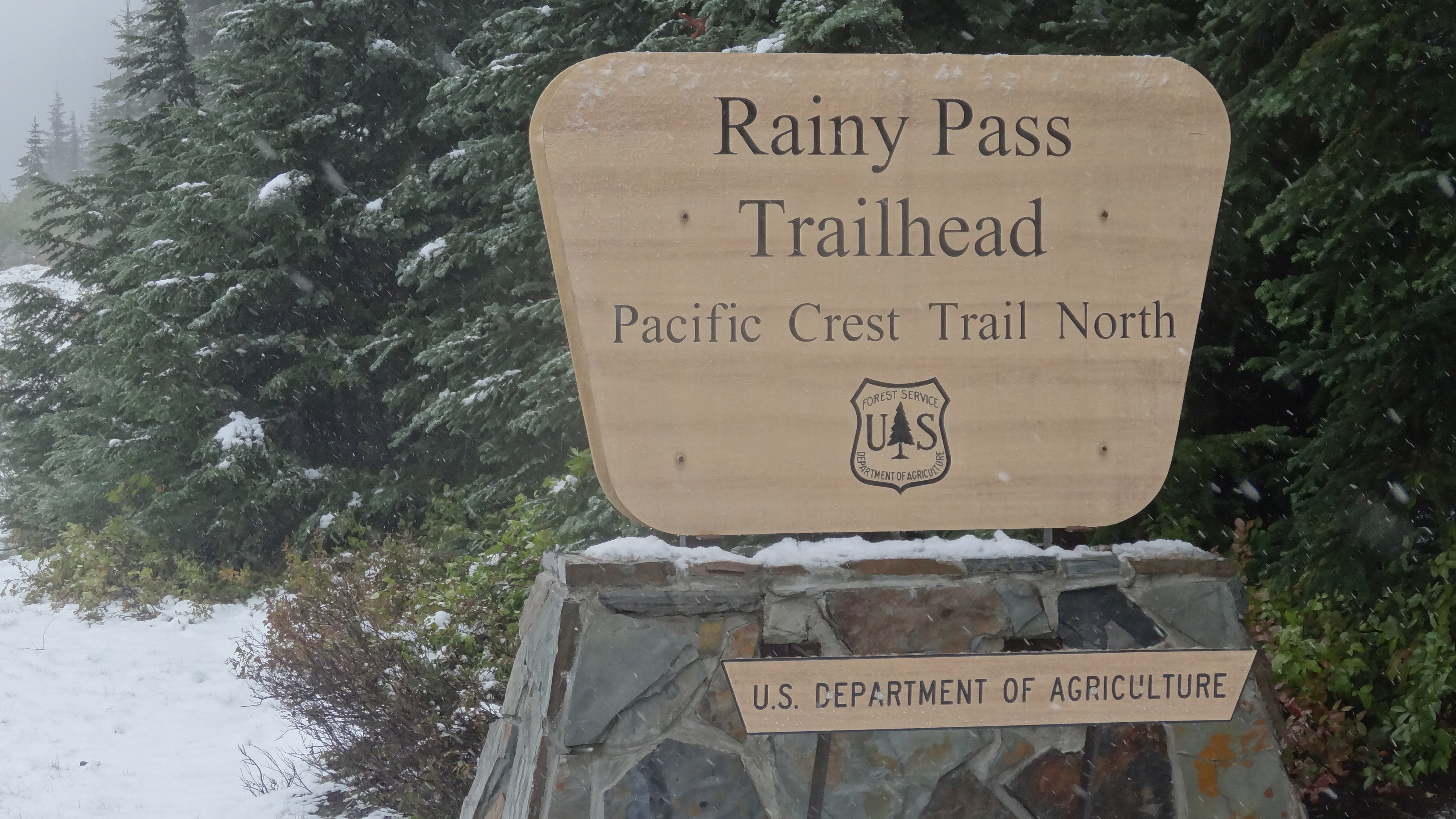
Rainy Pass was snowy.

DSC03389

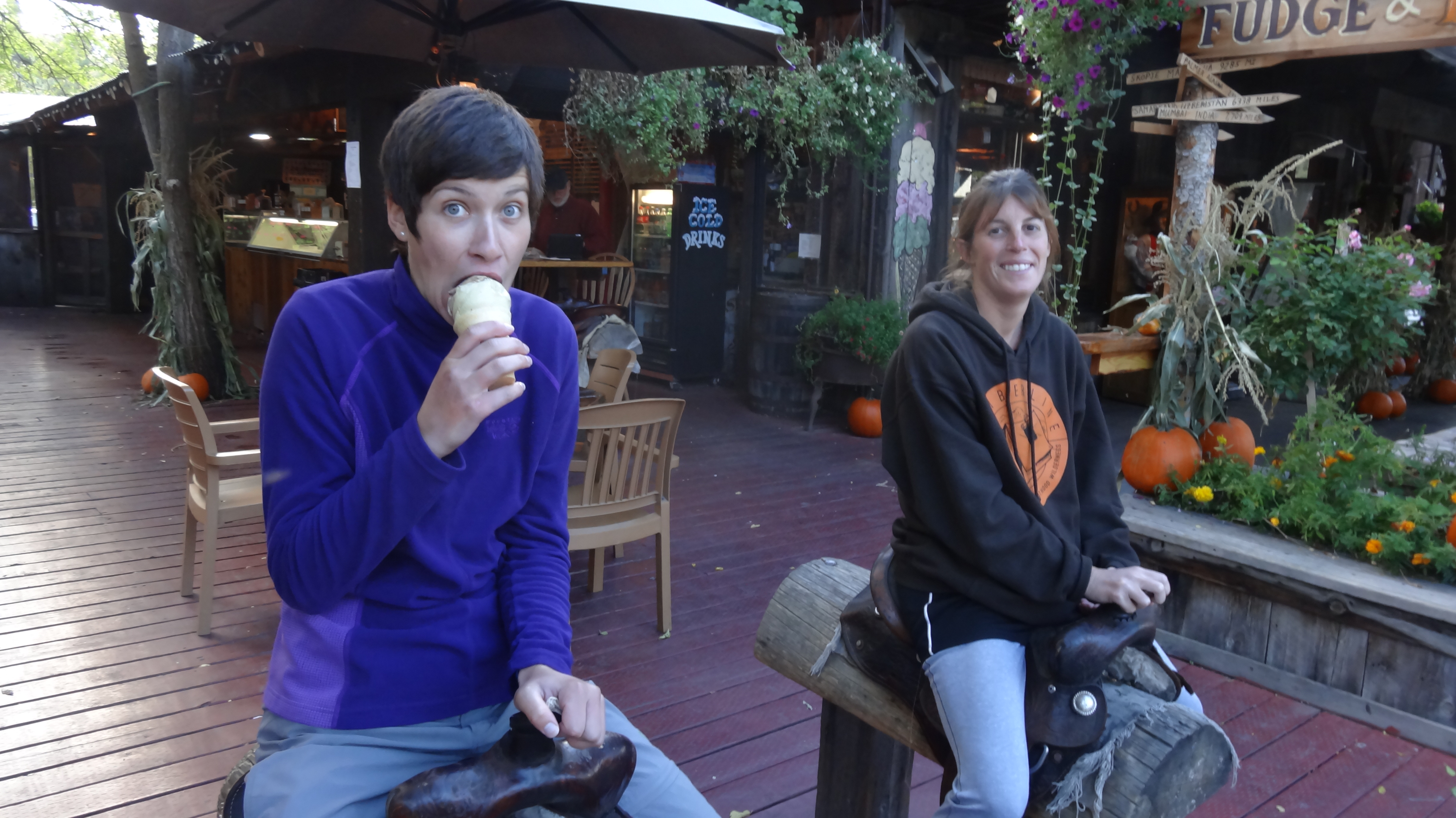
We passed some time with Peter Pan eating ice cream in Winthrop.

DSC03390

The adorable tourist trap that is Winthrop

DSC03398

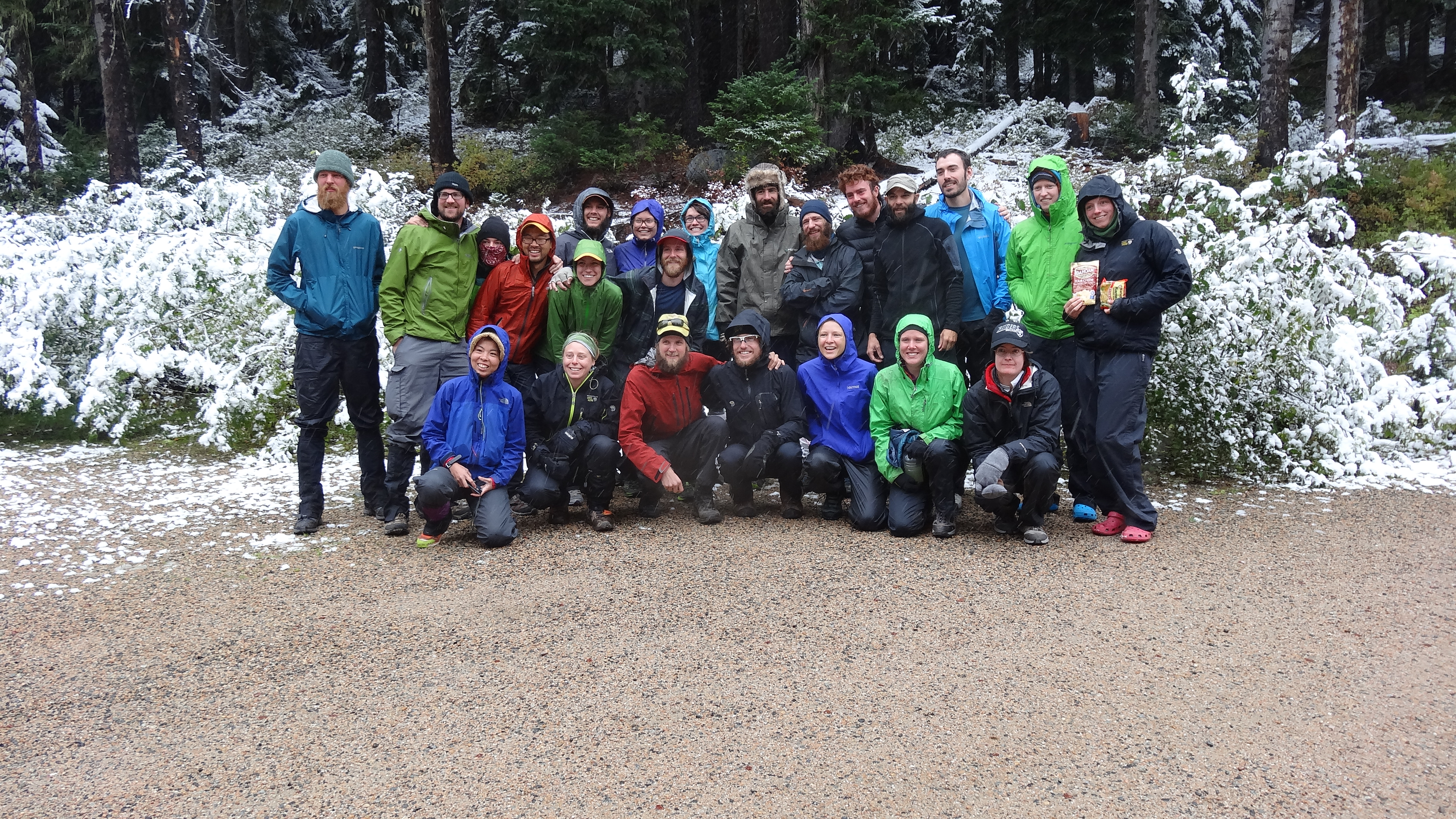
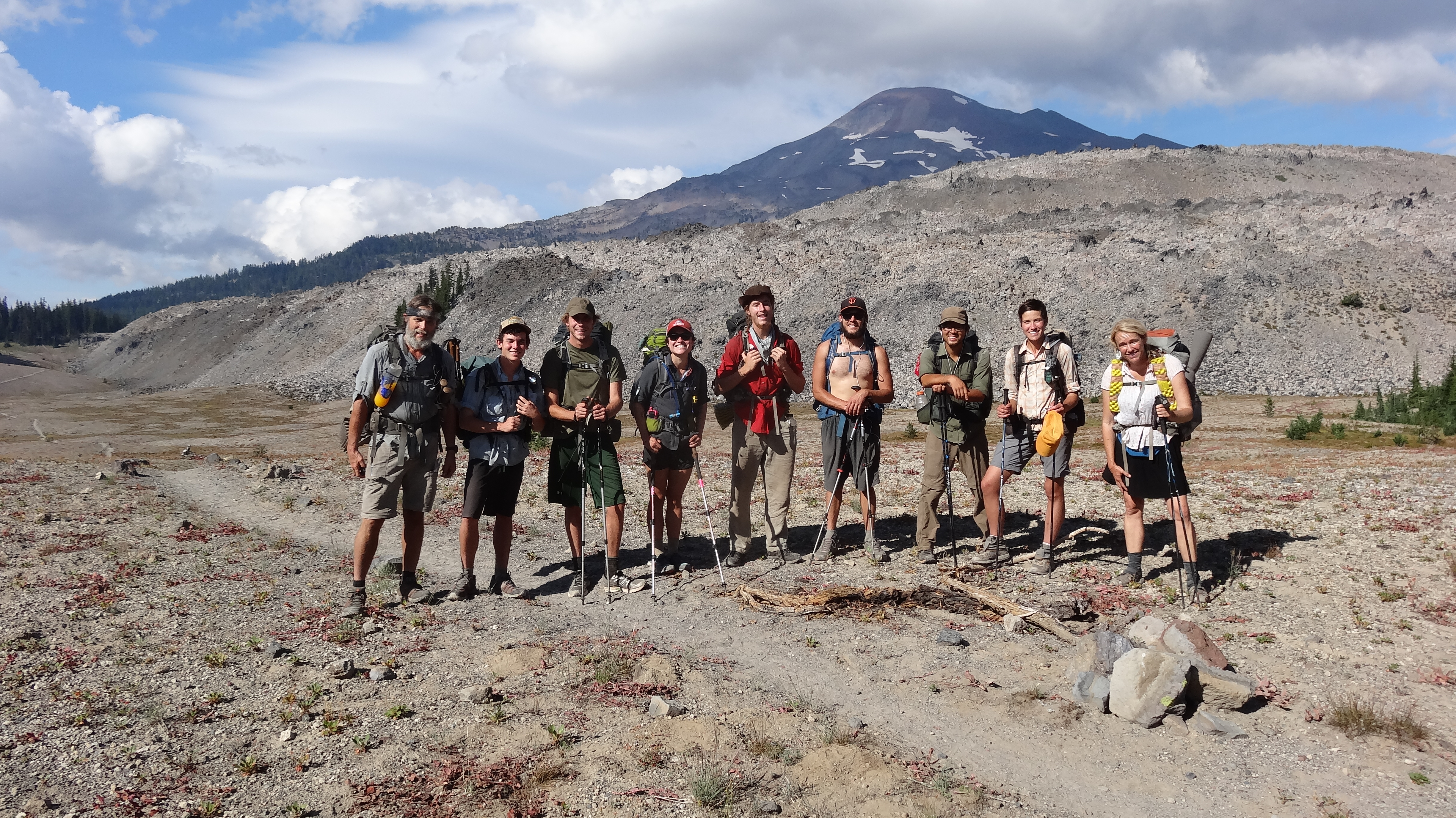
The crew that left from Rainy Pass on Oct. 2. Many left on the road walk to Ross Lake, some turned back from the PCT, and only 3 would end up camping with us that night.

DSC03403

The birthday girl, up near Cutthroat Pass

DSC03404

The sign at Cutthroat Pass

DSC03405

This is where Sneaks, Goldie, and I lost the trail. There were steep cliffs on two sides and the mountain on one. We had no idea where we were going. Goldilocks stares over a cliff and ponders the way down.

DSC03407

Waking up on day two

DSC03412

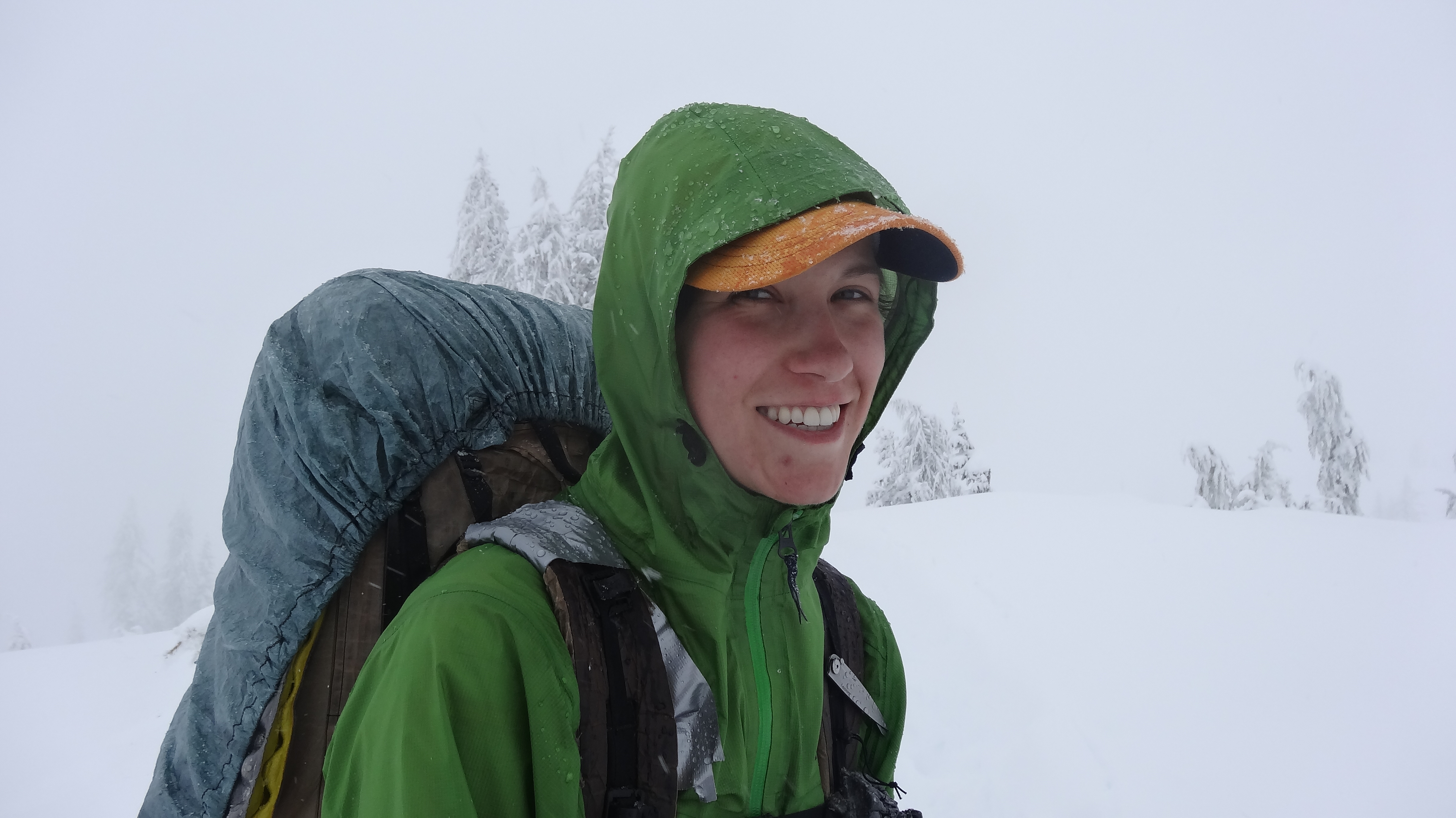
It was a beautiful day to hike!

DSC03415

Hiking with Sneaks along the slopes of the North Cascades

DSC03418

Trying to figure out where to go

DSC03419

Sneaks led the way and opted for straight down.

DSC03423

The side of one of the mountains we traversed. If you look closely, you can see the trail.

DSC03429

Getting close!!!

DSC03434

Success!!! We had carried this bottle of champagne 80 miles from Stehekin.

DSC03450

It was delicious.

DSC03437

The monument!

DSC03483

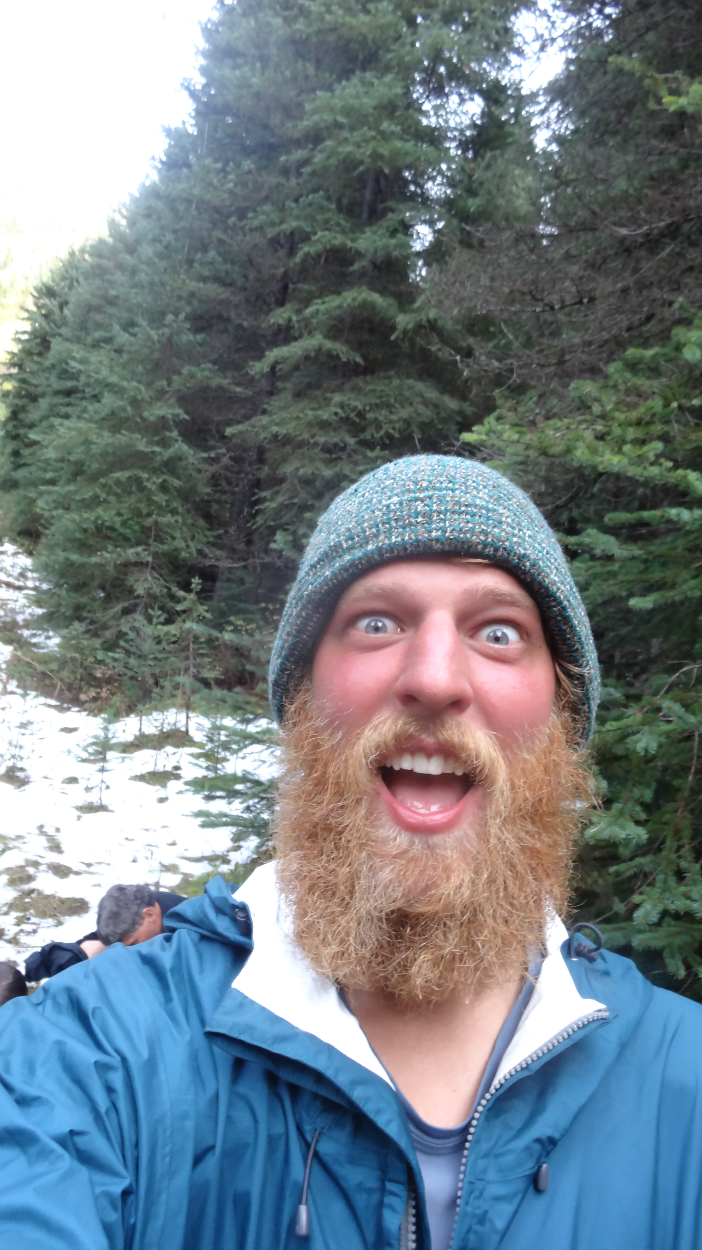
The face of happiness

DSC03460

Goldilocks and Frosty!

DSC03461

Sneaks! The man who saved our hike.

DSC03468

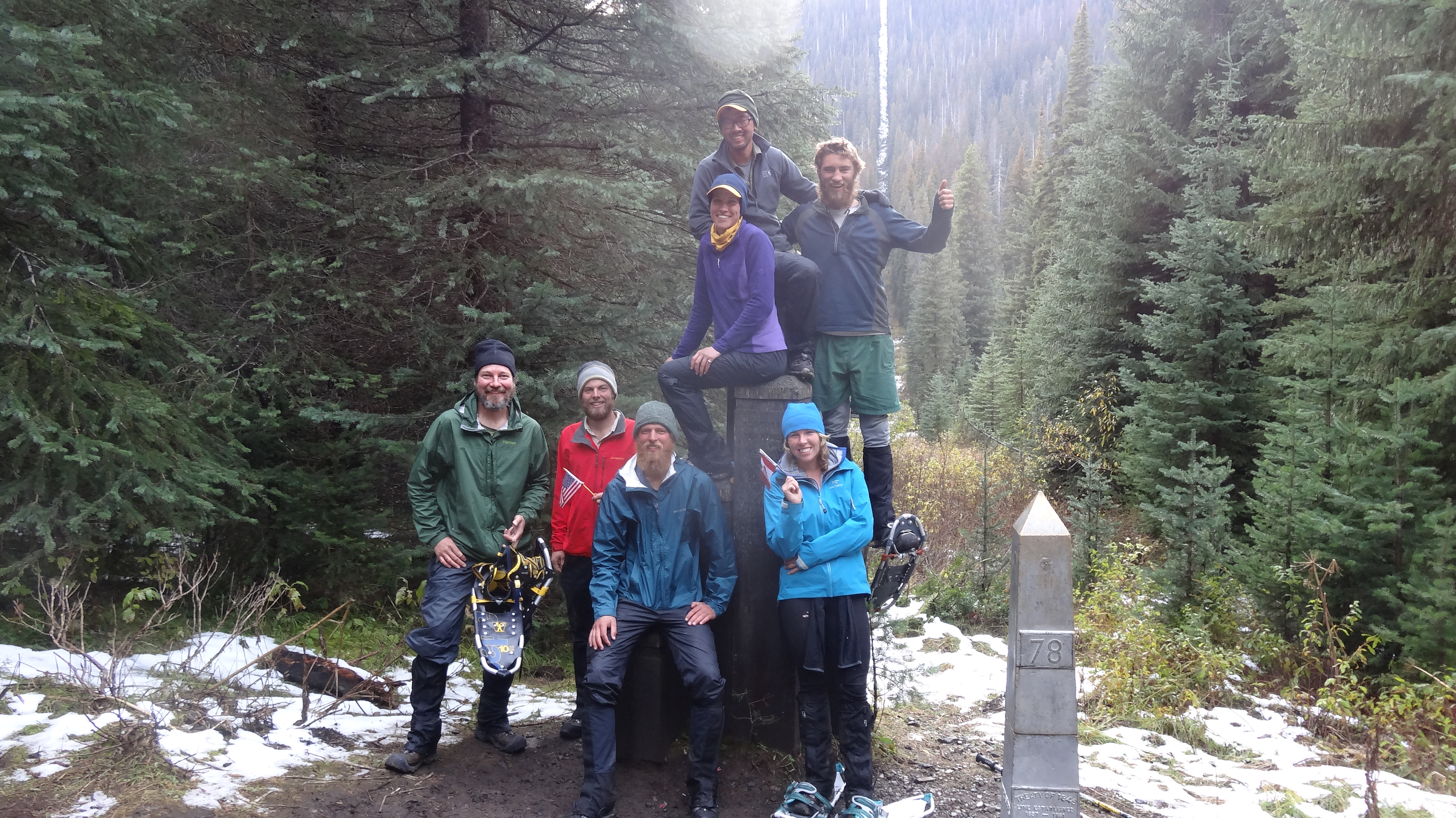
The amazing, determined crew we finished with. Left to right: K-pax, Krusteaz, Sneaks, Goldilocks, Frosty, Nightcrawler, and Hurculeas. Thank you guys so much. We couldn’t have done it without you.

Soggy Update

I don’t really know what day number it is or what mile we are at. But I can tell you that the section between Skykomish and Stehekin was one of the most challenging of the trail. It’s been raining and it’s been cold, and the forecast is for more rain and lots of snow at higher elevations. We hiked through in misery, including a 25-mile day climbing 8000 ft. in elevation, dropping 8500 ft. and finally missing our campsite in the dark by half a mile.

We are something like 80 miles from the border. We intend to hike on but are unsure of what exactly the plan is going to be. We might hitch into a larger town for winter gear, we might push through the snow, we might take a lower route. Hopefully the next post will include pictures of us at the Northern Terminus. Stay tuned and wish us luck.

Day 152, Mile 2476.0 – The Stormy Northwest

On our first zero in Snoqualmie, we headed to Tacoma to attend a wedding of two of our college friends (congratulations, Jess and Ryan!). It was great to see old friends all in the same place again, but it was hard to keep up with them – we were pretty exhausted, and our metabolisms are so out of wack these days that it’s difficult for us to drink more than one or two cocktails. The next two zeros were spent attempting to relax, and doing our regular town chores: laundry, blogging, resupply, etc. We also helped Jonathan, Ashleigh’s brother, gear up to hike with us on the next section from Snoqualmie Pass to Stevens Pass.

On Tuesday, we were dropped off by Jonathan’s wife Lindsey and hit the trail. The weather forecast indicated the possibility of rain over the next few days, but we were anxious to get going. It soon began to sprinkle on us lightly, but we paid it little mind and kept on hiking. But the sprinkle soon turned to a drizzle, and then to rain. We stopped about 8 miles in and decided to pitch our tents and hunker down, as the wind was blowing and it was getting very cold. We spent that cold, soggy afternoon side by side in our tents, tucked into our sleeping bags. We cooked dinner under the vestibules of our tents and tried to sleep as the rain pattered on our tent and the temperature dropped into the 30s.

The next morning, there was a break in the rain, and over breakfast, we decided on a plan. It had rained all night, and we were feeling pretty miserable and cold. Unfortunately, Jonathan was forced to turn back and hike home – the sleeping bag he’d brought wasn’t warm enough, and he’d had a a horrible sleepless night. We were extremely tempted to go with him, but it is harder to hike south than it is to face the rain. So we said goodbye and hiked into the drizzle of the Great Northwest.

It was a miserable hike for the first half of the day. My gloves were soaking wet from the day before, so my hands were freezing. It rained on as we hiked through the Alpine Lakes Wilderness, a section that is supposedly one of the most scenic on the trail. We couldn’t see anything; the low clouds obscured everything except the occasional silhouettes of trees in the distance. But after a cold soggy lunch, we started noticing small holes of blue sky, and soon the patches of blue expanded, and then… SUNSHINE! It wasn’t exactly warm, but at least it wasn’t raining.

The rest of the section was mostly sunny, but the nights were freezing, and we shivered as we set up and broke down camp each day. The sun is setting earlier and earlier these days, and rising later and later. In the evening, it’s getting increasingly difficult to cram in the miles before it gets dark, and getting out of our sleeping bag while it’s dark out in the morning is extremely hard as well.

On Friday, we made it to Stevens Pass and hitched a ride into the nearby town of Skykomish. The forecast was calling for rain again that night, so we booked a room at the local motel with Shedder and ate a big, satisfying meal at the cafe. The restaurant was filled with anxious hikers, all talking about the weather. We stared at the forecast on my cell phone and quickly got discouraged. It was calling for rain for the next five days. Further north, the forecast was even more ominous, with snow levels dropping to 5,500 feet (an elevation that the PCT is frequently above). It’s the first storm of the fall, bringing wind, rain, snow, and temperatures in the 20s and 30s. It feels much too soon for this type of weather. We were planning to finish by October 1st or 2nd in order to beat the weather, but it looks like we are going to face it now. Our greatest fear is being snowed out a few dozen miles from the border, and unable to finish the hike. We have just under 200 miles to go – mileage we could typically cover in less than 10 days – but suddenly it seems like an incredible distance.

Our plan is to wait out the storm for a couple of days, and then hike into it, in hopes that it will break partway through the next section (i.e., we’re hoping to be miserable for only two or three days, instead of five). Luckily, Jonathan was able to come fetch us at Stevens Pass and bring us back to Snoqualmie, where we can rest and make a run to REI to pick up some winter gear. Only one resupply point lies between us and Canada (the small town of Stehekin), but it looks like the 104 miles between here and there may be our most difficult yet.

We are way too close to even consider quitting. So wish us luck. And maybe make a sacrifice to the sun gods.

DSC03234

At the Snoqualmie Pass trailhead with Jonathan

DSC03237

Ashe and Jonathan checking out Kendall Katwalk – a section of trail that was created by blowing out the side of a cliff with dynamite. Supposedly there are some great views here, but unfortunately we couldn’t see anything.

IMG_3237

Jonathan at the Katwalk

DSC03242

Ashe checking out the scene

Looking over the edge of the Katwalk.

Looking over the edge of the Katwalk – a 1,200 foot drop

IMG_3247

On day two, our rain mitts made their first appearance of the trip.

IMG_3251

A rainy morning at camp – not quite the experience we’d hoped for Jonathan

image

An example of our amazing views over the first two days

image

Slowly, the clouds started to dissipate.

image

We started to get some nice views.

image

We’re still seeing tons of awesome looking mushrooms. These are our favorite.

image

Sunshine!

DSC03246

Hiking in the sunshine

DSC03253

Alpine Lakes Wilderness

DSC03264

Looking down at beautiful Trap Lake

The Misery Movie

We recently ran into an old friend from down the trail named Manchurian who we hadn’t seen in more than 1000 miles. It was wonderful to catch up with him, and when we asked how the trail had been going, he said, “I can only describe it as an adventure.” Adventure. This is probably the single best way to describe the trail. Using the word “adventure” invokes not only the good, triumphant, and beautiful times, but the bad, uncertain, and miserable times as well. He described to us an idea he had for a short movie compilation about the trail, which I wish we could have thought up back in Southern California: the misery movie.

When you look at online trail journals or YouTube videos about the PCT, you mostly find accounts of the glorious times during someone’s hike… photos and videos of them standing on top of Mt. Whitney, wandering in hushed awe through beautiful lush woods, smiling faces as they cross sunny meadows, swimming in hot springs and clear blue alpine lakes, hiking at sunset with stunning white snowy peaks in the background, the elation of coming across trail magic, triumphantly drinking beers in town, peaceful encounters with bears, elk, birds, etc., etc… And don’t get me wrong, there’s lots of that. If the trail weren’t glorious, we wouldn’t be out here. But this portrayal of the PCT omits a pretty huge aspect of thru hiking: misery.

For every wonderful thing that happens on the trail, there is an equally demoralizing thing that happens, kind of like the trail’s version of Newton’s Third Law of Motion. Manchurian’s idea was to make a compilation video of all the bad things that happen. The constant hobbling from wretchedly sore muscles that makes us all look like 90-year-olds (commonly called “the hiker hobble”), the most insane blisters you’ve ever seen, lying awake at night because your body aches too much to get comfortable, or your air mattress has partially deflated, or your tent is dripping condensation on your face, cuts, bruises, rashes, and frequently stubbed toes, stomach problems (due to funky water, a diet based on freeze dried and dehydrated foods, or perhaps just sheer exhaustion – who can tell?), and what it means to have stomach problems when you have to dig your toilet in the ground and ration your toilet paper, exhaustion, heat, cold, wind, rain, hunger, exhaustion, mental breakdowns, putting on cold wet clothes in the morning, trips and falls, bee stings, mosquito bites, biting ants, spiderwebs in the face, food-stealing rodents that chew holes through your pack to get at your trail mix, exhaustion, anxiety about bears, mountain lions, and snakes, deadlines, exhaustion, boredom, monotony, gear failures at inopportune moments, gear repair, resupply boxes that don’t arrive in time or get sent to the wrong place, a never-ending list of errands to do in town, constantly feeling sweaty, filthy, and disgusting, exhaustion, etc. If we could only capture our comrades at their lowest points and compile the videos, it would probably make for an entertaining movie, not to mention educational material for future hikers.

This may seem like a downer of a post, but it’s not meant to be that way. Without all these low points, the highs of the trail wouldn’t feel nearly as high (as cliché as that might sound). I am reminded of our hike around Hat Creek Rim. We hiked the 27-mile waterless stretch mostly in the middle of the day, in 100+ degree weather, drinking hot water, breathing in the dust on the trail, sweating, and feeling disgusting and horrible. By the time we hit the highway and attempted to hitch into the town of Burney, it was getting dark, an hour went by without a single car giving us a glance, and we had just about given up hope. We were going to have to camp next to the highway without water. It was one of our lowest moments on the trail. But just then, a wonderful women pulled over to pick us up. She gave us homemade cookies and a ride to a motel, where we immediately showered and ordered pizza and salad for delivery. We gleefully ate pizza in bed and watched whatever garbage was on TV. It was amazing, and there is no way that eating pizza and watching crummy television would have felt as wonderful in any other context.

Day 145, Mile 2402.0 – The Wonderful Mt. Rainier

The morning after we arrived at White Pass, my mother picked us up at the inn and drove us to the nearby town of Packwood for breakfast, where my sister Kristin, her boyfriend Thomas, and Bob (a family friend) were waiting for us. It was great to see some friendly faces and eat a hot breakfast. But all too soon, we had to get back on the trail. Canada’s call is getting stronger and stronger.

We were planning to hike the 99-mile section to Snoqualmie in four days but only managed to do 16 miles on day one, after spending the morning with my family. We camped by a wonderful lake just off trail. Before setting up camp, I dropped my pack and ran up trail to check for any better campsites. I was jogging slowly when I was stopped by a large female elk in the middle of the trail. She glanced at me with an annoyed look, then jumped down into the bushes off trail. Shortly after that, I came across a meadow with four other elk milling around, including a beautiful male with a large rack of antlers. That night by the lake, we were continuously woken by the heavy steps of elk around our campsite and the sound of them splashing around in the nearby lake and creek. In the morning, as we packed up, we saw two more elk just next to our campsite. They didn’t seem to mind us too much, but unfortunately, they ran off before we could snap any photos.

The next day, we passed into Mt. Rainier National Park. There were stunning views of the mountain all day. The weather was much different from our last section. Almost every day passed without a cloud in the sky. And it got hot, sometimes too hot. Ashe even jumped in a couple of lakes, clothes and all, to cool off.

We’ve been really cruising since leaving the Oregon border, as we had a deadline to meet in Snoqualmie. Two good friends of ours are getting married on the 14th, so we had to arrive here on the 13th. For awhile, we thought about hiking in on the 14th and driving down to the wedding the same day. But we thought better of it, deciding that it might be a little too jarring, and instead pushed hard to arrive on the 13th. As a result, we ended up doing 250 miles in 10 days, and we’re pretty exhausted. We are planning to enjoy three much-needed zeros in Snoqualmie before Jonathan, Ashleigh’s brother, joins us on the trail from here to Steven’s Pass.

Ashe in front of Mt. Rainier

Ashe in front of Mt. Rainier

DSC03218

Mt. Rainier!!

DSC03223

Lush Washington

DSC03224

Yay!

DSC03226

Mt. Rainier

DSC03227

Huckleberries were growing everywhere along the trail. They were delicious treats as we hiked.

DSC03232

Early morning hiking

DSC03167

Bonus picture: I forgot to post this one in our last entry. This is a view from on top of Old Snowy, with Mt. Adams on the left and Mt. Rainier on the right.

Day 141, Mile 2303.0 – The Two Sides of Washington

There are two things hikers discuss when talking about Washington: the weather and the beauty. We got to experience both in a very clear way during this past section. In six days, we hiked nearly 150 miles from Cascade Locks to White Pass, and we were very thankful that there was a bed and shower at the end of it all.

We spent two not so relaxing but still wonderful zeros in Vancouver, running around doing errands, fixing gear, and eating. Ashleigh’s dad offered to support a slack-pack for our first day out of Cascade Locks. We happily accepted, as Cascade Locks is the lowest point on the trail and there is a considerable climb coming out. So after three wonderful nights in a bed, we woke at 5:30am and left for the trail. We managed to do 30 miles that day, starting at the Bridge of the Gods and the Washington/Oregon border. Ashleigh’s dad was waiting for us at Trout Creek with his friend Tom, along with all our gear and beer and brats for dinner!

The next couple days were spent hiking up and down in the “green tunnel” (heavily forested area). Not many views, and where there were lookouts, all you could see was a grey fog. “It’s like hiking in a cloud,” as one hiker described it. These low hanging clouds made the air moist. We were waking up every morning with our tent and sleeping bag dripping with condensation. Finally, as we rolled into a campsite on Thursday evening, it began to rain – just a light drizzle at first. Thankfully, there was an extremely friendly couple trail angeling at the site. They immediately offered us hot food and had an amazing bonfire going. More than a dozen hikers crowded around to dry off. Then the heavy rain came in. We retreated to our tent and tried to sleep.

In the morning, we woke to the sound of rain still falling on our tent. We laid in our bag and pretended that if we slept a little more, the rain was bound to stop. It didn’t. We reluctantly packed up in the rain, everything soggy and water logged. Other hikers who stayed at the site were equally wet and were hitching rides with the trail angels, hitching some other way, or road walking to Trout Lake, a small nearby town, for relief from the rain. We decided to hike on down the trail through the rain. Forecasts said it should clear up by that afternoon anyway. But as we slogged northward, the rain kept falling. The trail was covered in puddles, some unavoidable, and in some places the trail just turned into an ankle-deep stream of water. We were planning on doing a high 30-mile day that day but only managed 21 before camping. Wet and miserable, we slept, hoping the next day would be dry.

When I poked my head out of the tent the next morning, there wasn’t a cloud in the sky. Thankful, we hiked for a few hours before finding a sunny meadow, where we laid out all our year to dry. It felt great to finally have everything dry. Eagerly, we hiked on toward the Goat Rocks Wilderness, an area known to be as beautiful as the High Sierra.

Goat Rocks lived up to its reputation. It was stunningly beautiful. After we passed over Cispus Pass, the terrain opened up to a huge valley with amazing waterfalls and a gorgeous sunset. We camped on the side of the valley and took in the views. The next morning we hiked up Old Snowy and caught stunning views of Mt. Adams and Mt. Rainier. It was bright and sunny as we hiked, and it felt wonderful.

We ended up going slower than expected, due to the difficult terrain and frequent photo ops, and had to hurry down to White Pass to pick up our resupply box before the local store closed. We tried to take a “shortcut” down a ski slope, as recommended by our guide book, but it ended up being a nightmare… we had to scramble down steep rocky slopes and bushwack through thigh-high huckleberry bushes before finally emerging at the highway. It took just as long as the standard route would have. Eventually we made it to the store, picked up our resupply box (along with a couple pizzas) and checked into the local inn.

image

On the Bridge of the Gods

image

Hello Washington!!

image

This is an example of our views the first few days in Washington.

image

Hiking in the cloud

image

Our muddy trail

image

The morning after the rain – sunlight!!!

image

Drying our gear out in “Dry Meadow.” Seriously, that was the actual name of the meadow.

image

Fording Mt. Adams Creek was a bit tricky.

image

Mt. Adams

image

There have been mushrooms of all shapes and sizes along the trail.

image

Mt. Rainier

image

Goat Rocks Wilderness

image

Goat Rocks

image

Mt. Rainier

image

Rainier again

image

The top of Old Snowy

image

Hiking along the Knife’s Edge, a ridge with steep dropoffs to glaciers on either side, with Old Snowy in the background

image

Stunning views in Goat Rocks

image

Hiking friend Stumblin’ Beef atop a peak on the Knife’s Edge

image

Looking back on the trail

Day 133, Mile 2155.0 – Good Bye Oregon… HELLOOOO Washington!

Oregon has a reputation on the trail as being flat (relative to the rest of the PCT). With terrain that allows you to put in big miles every day, you can fly in Oregon. And it’s true. You can. But no one ever mentions how amazingly beautiful Oregon is, or how nice Oregonians are. We have basically fallen in love with Oregon, even with the record rain fall this past month. It has been epically gorgeous and filled with amazing people.

We left Elk Lake Resort after a rainy night sleeping on their porch, and headed north. We wanted to put in a few days of hiking in the Sisters Wilderness before hitching out to Bend, Oregon for an unscheduled break. The Sisters Wilderness was gorgeous, with the Three Sisters (three volcanic peaks in a row) looming over us as we hiked. We had it all planned out. On our second day out from Elk Lake, we would push for a 35-mile day to Santiam Pass, where we would hitch to Bend. We were only 15 miles into the long day and had stopped for a short lunch when suddenly, our old friend Cuddles stumbled out of the woods to join us. We hadn’t seen him for more than 1000 miles!!! He told us he intended to hitch into Bend from McKenzie Pass, which was only 2 miles away (as opposed to 20). We were easily persuaded to go along with him…

Bend is mainly known for one thing among hikers: beer. Lots of beer. There are some 20 breweries in Bend. We managed to hit a few in the two days we were there but not nearly as many as we would have liked. Town days for hikers can be extremely stressful. There are so many errands to run: laundry, blog, resupply, email, bank, fix gear, clean gear, let gear dry, call family, call gear companies, organize mailings of other resupplies or new shoes, and a lot of other random things that need to be done while you have cell service and access to civilization. But all hikers really want to do is eat and relax. I can’t describe how exhausted we are all the time, mentally and physically. It’s hard to get everything done, and sometimes you don’t even feel like you’ve had a break at all. That said, we had a pretty great time in Bend that involved lots of beer, the most insane nachos I’ve ever had, and an amazing night of karaoke.

Leaving Bend, we passed the 2000 mile mark (which felt pretty anti-climatic) and continued our trek across Oregon, passing peak after peak… seeing them grow in the distance, standing next to them, then watching them recede into the horizon. Oregon really has a way of making you feel the distance you’re covering. We passed by the South Sister, Middle Sister, and North Sister, moved on past Broken Top, Mt. Washington, and Three Fingered Jack, then past the amazing Mt. Jefferson, and finally to Mt. Hood.

The section following Mt. Jefferson offered particularly mild terrain, and we decided to try for a 40-mile day – partly to make up for our unscheduled stop in Bend, but mostly just to see if we could. We were on the trail by 5am, had hiked 20 miles by lunch at 11:30am, and sure enough, had banged out 40 miles by 7:30pm. Had there been more daylight remaining, we might have tried for 50! Six months ago, I would have considered it insane to hike 40 miles in one day, but now it doesn’t seem all that difficult. It’s remarkable what your body can adapt to.

Following our big day, we were left with an easy 15-mile hike to Timberline Lodge at Mt. Hood, where we stopped to pick up a resupply box and to gorge ourselves on their famous lunch buffet. It was pretty surreal to reach Mt. Hood. It holds a special place in Ashleigh’s heart, as she spent a lot of time there as a child, skiing in the winter. Hiking north from Mt. Hood, we also caught our first sight of the mountains in Washington that we’ll soon pass: Mt. St. Helens, Mt. Adams, and Mt. Rainier, the latter holding a special place in my heart as the peak that loomed over my hometown of Olympia. It feels like we are home.

On our final push through Oregon, we took the highly popular Eagle Creek Trail as an alternate to the PCT. Almost all thru hikers take this trail, as it passes a series of amazing waterfalls. This included Ramona Falls, Punch Bowl Falls, and the incredible Tunnel Falls, which the trail actually passes behind. From there, it was a short hike until we caught our first glimpse of the Columbia River, which separates Oregon from Washington. We hiked along it until we arrived in Cascade Locks below the Bridge of the Gods, where Ashleigh’s father met us with sandwich fixings and beer. We drove back to Vancouver, Washington (where Ashleigh grew up) for some much-needed down time. When we return to the trail, there will be only one more state to walk through, only 505 miles to go.

DSC02780

The morning we left Elk Lake, hikers crowded around a small fire to dry their wet gear and clothing.

DSC02790

Senor Verde hikes ahead of us toward the North Sister.

DSC02794

Left to Right: Bird-Dog, Leaky, Verde, Horny Toad, Moonshine, Shedder, Frosty, Goldilocks, and Weeds. The North Sister behind us.

DSC02799

Tent City! You can’t see it in this shot, but the Middle Sister framed our campsite.

DSC02803

Huge chunks of Obsidian were deposited all around a small section of the trail.

DSC02809

Obsidian in the rocks

DSC02811

Climbing the volcanic rocks toward McKenzie Pass

DSC02824

Our first look at Mt. Hood in the distance behind Mt. Jefferson

DSC02837

Shedder and his sign, hitching a ride to Bend

DSC02838

10 Barrel Brewery in Bend. Happiness.

DSC02845

Mile 2000!

DSC02843

Ashleigh sits and contemplates the gravity of our accomplishment.

DSC02852

Rhymenocerous at Three Fingered Jack

DSC02899

Camping under Mt. Jefferson

DSC02918

Hiking away from Mt. Jefferson and having lunch

DSC02924

Cuddles, Shedder, Goldilocks and Frosty!

DSC02933

The view of Mt. Jefferson from the wonderful Olallie Lake, where the staff were incredibly nice to us, and even made us cheeseburgers for dinner.

DSC02937

Ashe was pretty excited when we entered the Mt. Hood Forest.

DSC02952

Approaching Mt. Hood

DSC02962

Mt. Hood

DSC02983

Breakfast at Ramona Falls

DSC02986

Ramona Falls

DSC02990

Carefully crossing Muddy Creek

DSC03008

You can’t really see them, but behind me were Mt. St. Helens, Mt. Adams, and our first look at Mt. Rainier.

DSC03034

Ashe on the other side of the AMAZING Tunnel Falls

DSC03024

Tunnel Falls

DSC03026

Tunnel Falls…I need to shave.

DSC03051

Made it to Cascade Locks and the Washington border!! That’s the Bridge of the Gods behind us.


Trail Names: A Belated Story

We probably should have written this post 1000 miles ago, but better late than never, I suppose. Trail names are one of the most beloved traditions on long trails. Basically, every hiker receives a nickname early on in the hike. The names can be based on almost anything: a funny quirk about the person, something unique that they carry, a hiking style, a fashion style, something they eat, a funny event that happend to them, a physical attribute, a resemblance to a famous person or character, etc.

There are a few rules when it comes to receiving a trail name. Traditionally, the name must be bestowed upon you; you can not give yourself a name (although there are a few exceptions). You can reject some of the suggested names if they are unreasonable. A trail name is generally not considered official until you sign a trail register with it. And you shouldn’t try to change your name after a few hundred miles of going by that name. Some people never take a trail name for whatever reason, but it is all up to the person. As they say on the trail: hike your own hike.

Here is a short (but far from exhaustive) list of folks we have hiked with: Cuddles, Fun Size, Fuller, Uni-Croc and Scat Tracker, Peter Pan, Blur, Goodall, #2, Mr. Green, Manchurian, Hoop Dreams, Dish Cloth, Senor Verde, Shedder and Roo, Robin Hood, Shotput, Mudd and Dingo, Drop Bizkit, Acid Glasses, Nightcrawler, Toots McGoots and Tears for Beers, Pepper Flake, Wagon Wheel, Noah the Prophet, Hermes and Lotus, Grumpy, Stumbling Beef, Leaky, Sagi, Moonshine, Wakka Wakka and Giddy-Up, 2 Bad Dogs, Can Can and Square Peg, One Pint, K-Pax, Red Bearfield, Horny Toad, Sexy Legs, Bird-Dog, The Chosen One, Johnny Reb, Shorts, Whispers, Rhymenocerous, and many many more that I can’t think of right now.

I received my trail name back at the Paradise Valley Cafe, around mile 150. It was bestowed upon me by Fun Size. The full name is Frosty the Salt Man. It was inspired by the amount of salt that is left on my shirt after my sweat evaporates (which is a lot). It looks like I’m frosted over with salt. Fun Size began singing “Frosty the salt man…” And that’s how I got my name.

Ashe’s name came 550 miles later, at Kennedy Meadows. She had received many poor suggestions, which were roundly rejected by all, but she was determined to pick one up before leaving Kennedy Meadows. One afternoon, as we chatted with friends about our experiences in Southern California, Cuddles suggested the name Goldilocks, due to the fact that she had seen three bears in the desert, which is very rare for a hiker. It quickly evolved with a few iterations, including Glocks and G-Lox. And, just as our Seattle buddies often call us Mashleigh as a couple, we’ve come to be known as Frostylocks by some friends on the trail.

Trail names are a fun tradition, but they can also be really odd at times. You can hike with someone every day for hundreds of miles and suddenly realize that you don’t even know their real name! Many of the friends we’ve made this summer don’t know us as Mark and Ashleigh. Instead, in their memories, we will forever be Frosty and Goldilocks.

Day 123, Mile 1959.1 – Lake-a-palooza

When we left the campground at Crater Lake, we hadn’t actually seen the lake yet. We had to resupply, shower, do laundry, and eat at the restaurant (three times) before we could hike the 5 miles up to the rim. After breakfast, we plodded up the steep trail to the Rim Village. There, we chugged a couple liters of water each, as there would be no on-trail water for 27 miles, which also meant carrying 4+ liters of heavy water with us down the trail. When we finally stepped out toward the rim of the crater, we were stunned by the beauty of the lake.

Crater Lake was a huge volcano that erupted around 7,700 years ago. It left a huge crater that eventually filled with snow melt and rain water, creating an amazing lake. There stands a gorgeous island near the west side of the lake called (awesomely) Wizard Island, which was created by volcanic activity after the volcano blew its top. The water in the lake is some of the bluest I have ever seen. It is ridiculously gorgeous, like something out of a fantasy.

It took us longer to hike the rim than expected, due to our need to stop every 50 yards to take photos and gape at the beauty. Eventually we left the rim with reluctance and hiked until dark in an effort to make up some miles.

On the third day out from Crater Lake, we left the official PCT and took the Oregon Skyline Trail alternate. We heard the OST was more scenic, had more water, less elevation gain, and was slightly shorter. We are not “purists,” meaning that we are okay with not walking every single step on the official PCT; we just want to walk a continuous footpath from Mexico to Canada (no skipping), which we have succeeded in doing so far. We stopped and swam in the beautiful Crescent Lake, then camped at the equally lovely Diamond View Lake, where we had a wonderful view of the sun setting over the Diamond Peaks. In the morning, we hiked to Shelter Cove Resort and had a pizza for breakfast before joining back up with the PCT.

We decided to do a lazy 19-mile day out of Shelter Cove and planned to make up for it with big miles the next day. From our campsite that night, it was 36.5 miles to Elk Lake Resort, our next resupply. Before bed, Shedder, Ashe, and I decided it was crazy to try for Elk Lake; we would sleep in a bit instead and just get close to the resort. But the next morning, we went back and forth trying to decide if we wanted to go for it. After 18 miles, we decided to do it. At mile 30, we learned that the restaurant at the resort would close at 7pm (not 8pm, as thought), so we pushed hard for the last 6.5 miles to arrive at 6:40pm. We had done 36.5 miles in 12 hours, the last 5.5 hours without a break through thunder storms. We ate up a burger and salad joyfully and exhausted. In an amazing act of kindness, the resort staff offered to let a dozen of us sleep out on the back porch so that we wouldn’t have to set up camp in the rain.

We’ve made it to Central Oregon and are heading into Bend soon for a quick break. Then we are off to Timberline Lodge and Mt. Hood. It feels like Oregon is flying by.

image

Our First view of the amazing Crater Lake.

image

Crater Lake. Wizard Island is on the left.

image

Shedder and I checking out the scene.

image

Ashe was impressed.

image

Wizard Island.

image

Shedder, Goldilocks, and Frosty!

image

Taking in our last views of the lake.

image

We really didn’t want to leave.

image

Thanks for the warning!

image

Mt. Thielsen.

image

The back side of Thielsen.

image

Won’t go any higher than this for the rest of the trip!

image

Old Man’s Beard Moss.

image

Diamond View Lake. One of our best campsites on the trail.

image

We were treated to an amazing sunset.

image

Ashe checking it out.

image

It was pretty amazing.

image

The fire pit at Shelter Cove.

image

Shelter Cove.

image

There is always time for a swim.

Day 117, Mile 1829.3 – The Laziest Oregon Days

We ended up taking two full zeros in Ashland. It was wonderful seeing my parents and sister. We spent the days wandering the town and eating… and eating… and eating. The town had a lot of charm and it was difficult to leave, but we eventually peeled ourselves away from the comforts of town life and hit the trail.

We weren’t particularly motivated after being spoiled by my family and only made it 16 miles up the trail before taking an unscheduled stop at Green Springs Inn about 2 miles off trail. The people there were ridiculously friendly. We sat down for dinner and enjoyed a free beer (on the house for PCT hikers). There happened to be a live band playing that night outside on the porch. It was wonderful – we stuffed ourselves with burgers, wound up with free slices of pie, and settled in for a night of free camping on their property.

Again, the next day, we were’t feeling super motivated. We got sucked into the Inn’s vortex while waiting for a hitch back to the trail and ended up staying ’till 10am to eat breakfast. We stopped at a lake mid-day and swam, hiked on, and felt like we were making good progress, but at the end of the day we had only made it 19 miles.

We managed to get an earlier start the next day but made yet another unscheduled stop at Fish Lake Resort, where again, the people were ridiculously nice to us. We stuffed ourselves with more food and reluctantly waddled on to avoid getting sucked into staying the night. We were determined to do some serious hiking that day and ended up going some 25 miles, the last 10 being furiously quick.

The hiking so far in Oregon has been incredibly nice. We had to hike over some volcanic rocks just north of Ashland, but over all, it’s been soft dirt and easy climbs and descents (if you can even call them that). Large pine and cedar woods have been shading us most of the way with cooler temperatures.

We’ve made it to Crater Lake and are eager to get up on the rim for some views. We promise our next post will have some pictures of the lake. Our next stop will be Bend, one of the beer capitals of the country… so apologies in advance if our next post is less coherent…

image

image

image

image

image

image

image

image

image

image

image

image

image

image